
February 11 , 2020 .
La Réunion , Piton de la Fournaise :
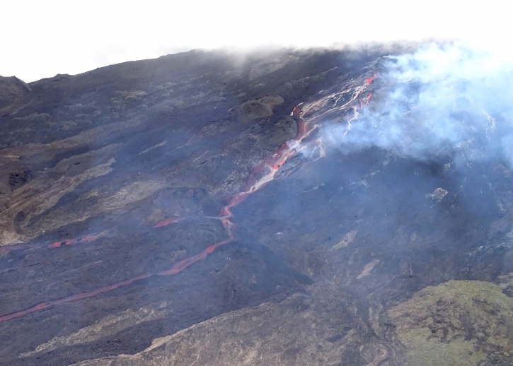
The show is largely played behind closed doors on the big slopes of Piton de la Fournaise. The volcano erupted on Monday, February 10 at 10:50 a.m. The activity, moderate, is maintained. The terminal cone and the main cracks are located at an altitude of 2,000 meters.
The sky is cloudy and rainy, this Tuesday, February 11, 2020, on the peak of La Fournaise. Difficult to see the eruption, for now, and if the weather forecast is confirmed, it will remain invisible all day.
While waiting for the sky to clear, let’s take our trouble patiently.
The good news comes from the eruptive tremor. Despite a drop in the intensity of the spasms, the volcano still emits its magma.
Sources : Fabrice Floch / la1ere.francetvinfo.fr .
Photo : OVPF.
Peru , Sabancaya :
Analysis period: February 3 to 9, 2020. Arequipa, February 10, 2020.
The Peruvian Geophysical Institute (IGP) reports that the eruptive activity of the Sabancaya volcano has been maintained at moderate levels; that is to say with the continuous recording of moderate explosions and consequent emissions of ash and gas. Consequently, for the following days, no significant change in activity is expected.
During the period from February 3 to 9, 2020, the IGP recorded and analyzed the occurrence of approximately 978 earthquakes of volcanic origin, associated with the circulation of fluids (magma, gas, etc.) that occur inside the volcano. During this period, there were on average 8 explosions per day of medium to low intensity.
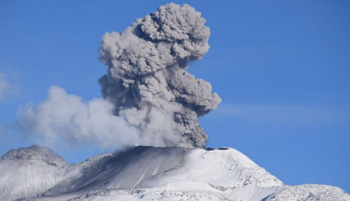
The monitoring of the deformation of the volcanic structure, using GNSS data (processed with fast orbits), does not record any significant anomalies. Visual surveillance, using surveillance cameras, allowed us to identify the presence of columns of gas and ash up to 3 km above the summit of the volcano, which were scattered in the southern sectors -West, West and North-West of Sabancaya. Satellite surveillance has identified the presence of 3 thermal anomalies with values up to 1 MW, associated with the presence of a lava dome of approximately 280 m in diameter in the crater of the volcano. It should be noted that the number of anomalies has been reduced due to the high cloudiness in the region.
RECOMMENDATIONS
Maintains the orange volcanic alert level.
Source : IGP.
Photo : Ingemmet.
Indonesia , Anak Krakatau :
Level of activity at level II (Waspada), since March 25, 2019. The Anak Krakatau (157 m above sea level) has experienced an increase in its volcanic activity since June 18, 2018 which was followed by a series eruptions in the period from September 2018 to February 2019.
The volcano is clearly visible until it is covered with fog. The smoke from the crater is black, of intense intensity with a height of about 1000 meters above the summit. The weather is sunny to cloudy, the winds are weak to strong, oriented to the east. The temperature is around 24.7-29.6 ° C.
According to the seismographs of February 10, 2020, it was recorded:
8 emission / eruption earthquakes
5 earthquakes of explosions.
1 distant tectonic earthquake
Continuous tremor, amplitude 0.5 to 32 mm (dominant value of 2 mm)
Recommendation: People / tourists are not allowed to approach the crater within a radius of 2 km.
VOLCANO OBSERVATORY NOTICE FOR AVIATION – VONA.
Issued: February 11 , 2020
Volcano: Anak Krakatau (262000)
Current Aviation Colour Code: ORANGE
Previous Aviation Colour Code: orange
Source: Anak Krakatau Volcano Observatory
Notice Number: 2020KRA09
Volcano Location: S 06 deg 06 min 07 sec E 105 deg 25 min 23 sec
Area: Lampung, Indonesia
Summit Elevation: 502 FT (157 M)
Volcanic Activity Summary:
Eruption with ash clouds at 02h45 UTC (09h45 local time). The eruption lasted for 75 seconds.
Volcanic Cloud Height:
Ash-cloud is not visible
Other Volcanic Cloud Information:
Anak Krakatau volcano is not clear.
Remarks:
Eruption recorded on seismogram with maximum amplitude 36 mm and duration 75 second
Source : PVMBG , Magma Indonésie .
Photo : S Chermette / 80 Jours Voyages .
Philippines , Taal / Mayon :
TAAL VOLCANO BULLETIN 11 February 2020 8:00 A.M.
Activity in the Main Crater in the past 24 hours has been characterized by weak emission of steam-laden plumes rising 50 to 100m high before drifting southwest. Sulfur dioxide (SO2) emission was measured at an average of 105 tonnes/day on February 10, 2020. The Taal Volcano Network recorded eighty-seven (87) volcanic earthquakes including one (1) low frequency event and two (2) harmonic tremors having durations of one (1) to three (3) minutes. These earthquakes signify magmatic activity beneath the Taal edifice that could lead to eruptive activity at the Main Crater.
MAYON VOLCANO BULLETIN 11 February 2020 08:00 A.M
Mayon Volcano’s seismic monitoring network recorded four (4) volcanic earthquakes during the 24-hour observation period. Recent electronic tilt data showed inflation of the northern sector of the volcanic edifice that began in the last quarter of 2019. This follows an inflationary trend that began in February 2019 as recorded by continuous GPS monitoring.
Source : Phivolcs.
Photo : Julien Monteillet
United States , California Volcanoes :
CALIFORNIA VOLCANO OBSERVATORY MONTHLY UPDATE
U.S. Geological Survey
Current Volcano Alert Level: all NORMAL
Current Aviation Color Code: all GREEN
Activity Update:
All volcanoes monitored by CalVO using telemetered, real-time sensor networks exhibit normal levels of background seismicity and deformation. Volcanoes monitored include Mount Shasta, Medicine Lake Volcano, Clear Lake Volcanic Field, Lassen Volcanic Center, Long Valley Volcanic Region, Coso Volcanic Field, Ubehebe Craters, and Salton Buttes.
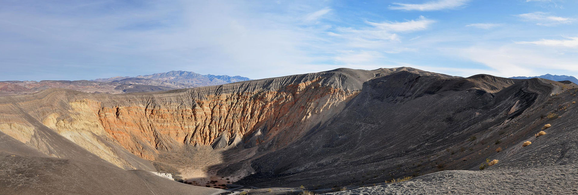
Ubehebe craters .
Observations for January 1, 2020 (0000h PST) through January 31, 2020 (2359h PST):
Clear Lake Volcanic Field: No earthquakes at or above M1.0 were detected. [Note: The typical high level of seismicity was observed under the Geysers steam field located at the western margin of CLVF. The largest event was M2.82].
Lassen Volcanic Center: Three earthquakes at or above M1.0 were detected, the largest of which was a M1.54.
Long Valley Volcanic Region: In Long Valley Caldera, 31 earthquakes of M1.0 or greater were detected, with the largest registering M2.79. One earthquake at or above M1.0 was detected in the Mono Craters region (M2.15). Ten earthquakes at or above M1.0 were detected under Mammoth Mountain, the largest of which registered M2.06. [Note: The typical high level of seismicity was observed south of the caldera in the Sierra Nevada range, with the largest registering M2.61.]
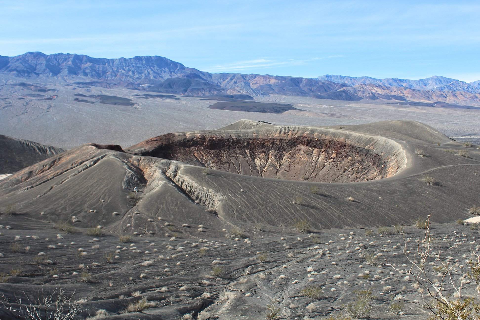
Photo of Little Hebe Crater, a 330-foot-wide tuff cone that was built within the cluster of maar craters that make up the Ubehebe Craters in the Mojave Desert. The craters were formed during a series of explosions about 2,100 years ago that were triggered by magma interaction with groundwater. Photo by Judy Fierstein, USGS, 2018.
Mount Shasta: Two earthquakes at or above M1.0 were detected, the largest of which was a M1.82.
Medicine Lake: No earthquakes at or above M1.0 were detected.
Salton Buttes: Fourteen earthquakes at or above M1.0 were detected, with the largest registering M1.70.
Coso Volcanic Field: 128 earthquakes at or above M1.0 were detected, the largest of which was a M2.82.
Ubehebe Craters: No earthquakes at or above M1.0 were detected.
The U.S. Geological Survey will continue to monitor these volcanoes closely and will issue additional updates and changes in alert level as warranted.
Source : Calvo.
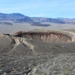
Photos : Finetooth , Judy Fierstein .


No comment yet, add your voice below!