
December 24 , 2019.

Alaska , Shishaldin :
54°45’19 » N 163°58’16 » W,
Summit Elevation 9373 ft (2857 m)
Current Volcano Alert Level: WATCH
Current Aviation Color Code: ORANGE
The low-level eruption at Shishaldin Volcano likely continues. Seismicity remains elevated, but tremor has decreased over the past day. Elevated surface temperatures were detected at the summit in mostly cloudy satellite imagery. Web camera views were obscured by clouds and snow over the past 24 hours.
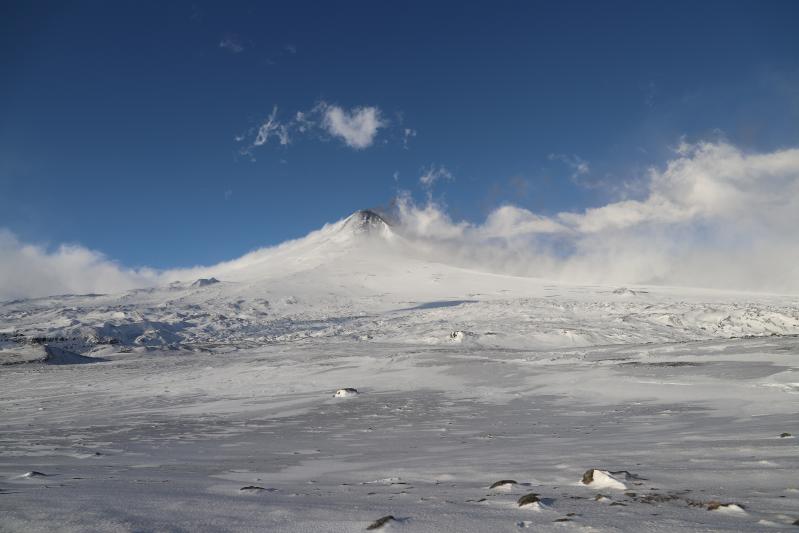
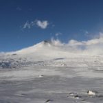
Shishaldin volcano as viewed from the SSE flank. The gray color in the foreground is sparse fine ash encased in ice from the Dec. 12 ash plume that traveled SE from the summit vent. Station 19SHJRS002.
Episodic explosions and lava flow front collapses resulting in low-level ash plumes can occur with little warning.
Shishaldin is monitored by local seismic and infrasound sensors, satellite data, web cameras, a telemetered geodetic network, and distant infrasound and lightning networks.
Source : AVO.
Photo : Schaefer, Janet , December 20, 2019 3:29 PM
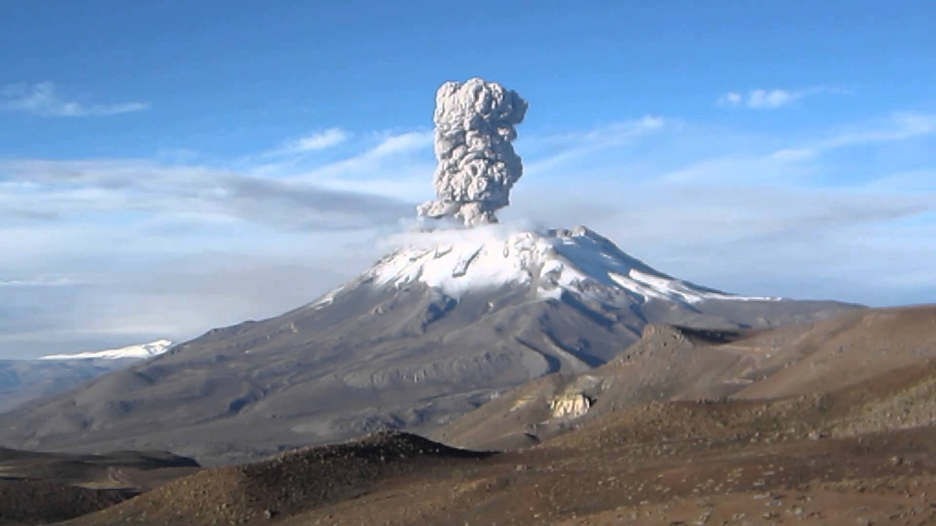
Kamchatka , Ebeko :
VOLCANO OBSERVATORY NOTICE FOR AVIATION (VONA).
Issued: December 22 , 2019 .
Volcano: Ebeko (CAVW #290380)
Current aviation colour code: ORANGE
Previous aviation colour code: orange
Source: KVERT
Notice Number: 2019-184
Volcano Location: N 50 deg 41 min E 156 deg 0 min
Area: Northern Kuriles, Russia
Summit Elevation: 3791.68 ft (1156 m)

Explosive eruption of Ebeko volcano on 26 December, 2016.
Volcanic Activity Summary:
A moderate eruptive activity of the volcano continues. According to visual data by volcanologists from Severo-Kurilsk, explosion sent ash up to 1.9 km a.s.l., an ash cloud is drifting to the north-east from the volcano.
A moderate eruptive activity of the volcano continues. Ash explosions up to 19,700 ft (6 km) a.s.l. could occur at any time. Ongoing activity could affect low-flying aircraft and airport of Severo-Kurilsk.
Volcanic cloud height:
6232 ft (1900 m) AMSL Time and method of ash plume/cloud height determination: 20191222/2242Z – Visual data
Other volcanic cloud information:
Distance of ash plume/cloud of the volcano: 3 mi (5 km)
Direction of drift of ash plume/cloud of the volcano: NE
Source : Kvert .
Photo : L. Kotenko, IVS FEB RAS , 26/12/2016 .
Peru , Sabancaya :
Analysis period: December 16-22, 2019. Arequipa, December 23, 2019
Alert level: ORANGE
The Geophysical Institute of Peru (IGP) reports that the eruptive activity of the Sabancaya volcano has been maintained at moderate levels; that is, with the continuous recording of moderate explosions and resulting ash emissions. Consequently, for the following days, no significant change in their activity is expected.
During the period from 16 to 22 December, the IGP recorded and analyzed the occurrence of approximately 926 earthquakes of volcanic origin, the highest percentage of which is associated with the circulation of fluids (magma, gas, etc.) inside the volcano. During this period, there were on average 13 daily explosions of medium to low intensity.

Monitoring the deformation of the volcanic structure, using GNSS data (processed with fast orbits), does not present any significant anomalies; nevertheless, we continue to observe a slight inflation of the northern sector of the volcano, deformation observed since the beginning of the eruptive process. Visual surveillance, using surveillance cameras, allowed us to identify the presence of columns of gas and ash up to 3 km high above the summit of the volcano, which were scattered in the northern sectors -West, West and South-West of Sabancaya. Satellite surveillance has identified the presence of 7 thermal anomalies with values of 3 MW and 29 MW, associated with the presence of a lava dome in the crater of the volcano about 280 m in diameter.
Source et photo : IGP.
Peru , Ubinas :
Analysis period: December 16-22, 2019. Arequipa, December 23, 2019.
Alert level: ORANGE
The Geophysical Institute of Peru (IGP) reports that the eruptive activity of the Ubinas volcano remains at low levels. To date, the energy of earthquakes associated with the rise of magma to the surface has considerably decreased. There are low and sporadic emissions of bluish gases (of magmatic origin) and water vapor, observed by means of surveillance cameras. According to this scenario, the possibility of volcanic explosions and / or ash emissions is low.
During the period from December 16 to 22, the IGP recorded and analyzed a total of 98 seismic events associated with the eruptive process of the Ubinas volcano. Among these events, seismic signals of the Volcano-Tectonic type (VT) predominate, linked to the fracturing of the rocks inside the volcano which, on average, recorded 7 earthquakes per day, all with magnitudes below M2 .0. The seismic signals linked to the rise of magma (hybrid type) have decreased, both in number of events (3 daily earthquakes) and in energy. It should be noted that no volcanic explosion has been recorded since September 12.
Surveillance cameras did not record gas emissions due to the cloudiness at the top of the volcano. Monitoring the deformation of the volcanic structure, using GNSS data (processed with fast orbits), does not record any anomalies. MIROVA satellite surveillance also did not record thermal anomalies on the volcano.
Source : IGP.
Photo :Unknown author.
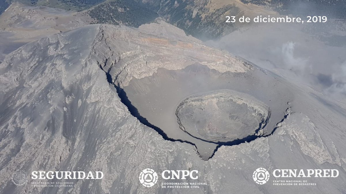
Mexico , Popocatepetl :
With the support of GN MEXICO, expert staff from UNAM MX and CENAPRED, an overflight of the Popocatépetl volcano was carried out on December 23, 2019, to check the general conditions of the crater.
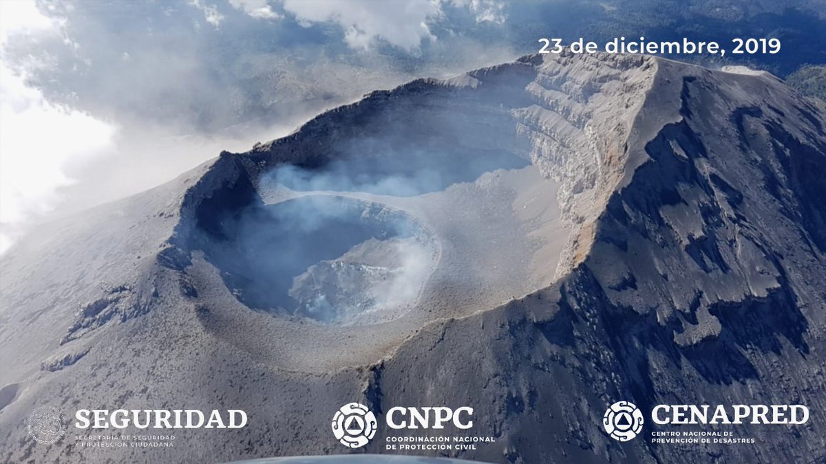
The destruction of dome 85 was corroborated because there is no longer any visible dome. The internal crater maintains a diameter of 350 m and its approximate depth is 70 to 80 meters, it is also covered with tephra.
December 23, 11:00 a.m. (December 23, 5:00 p.m. GMT)
According to the monitoring systems of the Popocatepetl volcano, only 159 low intensity exhalations have been identified. Although visibility was sometimes poor, it could be verified that they were accompanied by small quantities of water vapor and gas.
At the time of this report, the volcano has full visibility.
Source : Sécurité de la protection civile , Cenapred .


No comment yet, add your voice below!