
November 30 , 2019.
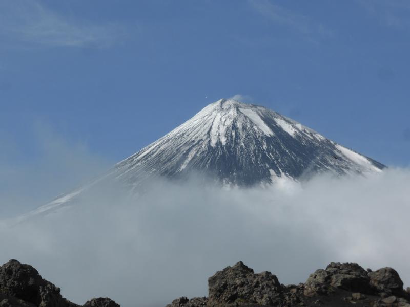
Alaska , Shishaldin :
54°45’19 » N 163°58’16 » W,
Summit Elevation 9373 ft (2857 m)
Current Volcano Alert Level: WATCH
Current Aviation Color Code: ORANGE
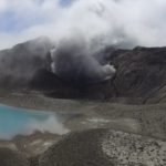
The episodic eruption of Shishaldin Volcano continues. Seismic levels were variable throughout the week, with elevated activity early in the week and over the past 36 hours. Analysis of satellite imagery indicates that a partial collapse of the summit cone occurred sometime early on November 25th. This produced a pyroclastic flow that extended up to 3 km from the summit down the northwest side of the volcano. A new lava flow was also generated during this period of activity that extended 1 km down the NW flank of the volcano. Seismicity was elevated, but variable during the middle part of the week and has increased again overnight accompanied by strongly elevated surface temperatures suggesting renewed lava effusion. Persistent clouds have obscured observations of eruptive activity in the web cameras.
Shishaldin is monitored by local seismic and infrasound sensors, satellite data, web cameras, a telemetered geodetic and tilt network, and distant infrasound and lightning networks.
Shishaldin volcano, located near the center of Unimak Island in the eastern Aleutian Islands, is a spectacular symmetric cone with a base diameter of approximately 16 km (10 mi). A 200-m-wide (660 ft) funnel-shaped summit crater typically emits a steam plume and occasional small amounts of ash. Shishaldin is one of the most active volcanoes in the Aleutian volcanic arc, with at least 54 episodes of unrest including over 24 confirmed eruptions since 1775. Most eruptions are relatively small, although the April-May 1999 event generated an ash column that reached 45,000 ft above sea level.
Source : AVO.
Photos : Calvert, Andy , Cirrus Read .
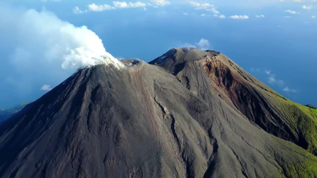
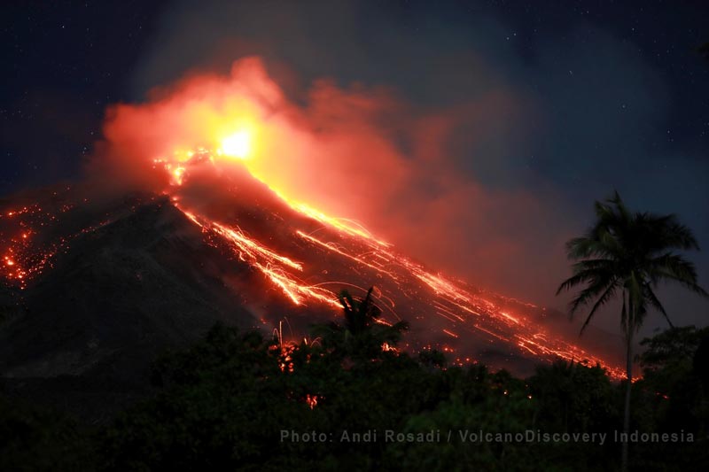
Indonesia , Karangetang :
Level of activity at level III (SIAGA). G. Karangetang (1,784 m above sea level) has entered an eruption period since November 25, 2018. The last eruption occurred on November 25, 2018, resulting in an emission column height of 500 m. The color of the column was observed gray in color.
The volcanoes are clearly visible until it is covered with fog. The smoke from the main crater is white in color with a high intensity about 100 meters above the summit. The weather is sunny to cloudy with weak winds to the southeast and west. The temperature is about 27 to 31 ° C. Projections were observed with a height of 50 m and a Strombolian eruption of the main crater with a height of 100 m. The Strombolian eruption was followed by a powerful roar. Lava flows descend from the top of the main crater to the Nanitu, Sense, Pangi rivers at 800 to 1500m, to the West Beha, Batang Rivers at 800 to 1000m, sometimes to the Batu Awang River and the Kahetang River (2000m).
Through the seismographs, on November 29, 2019, it was recorded:
1 eruption earthquake
97 avalanche earthquakes
19 earthquake explosions
1 harmonic earthquake
A deep volcanic earthquake.
8 distant tectonic tremors
Continuous tremor, amplitude 0.25 to 50 mm (dominant value of 2 mm)
The tremor continues to fall from 18:01 to 19:58 WITA.
Recommendation:
The community and visitors / tourists must not approach, climb or move through the 2.5 km danger zone around the Kawah Dua Summit (North Crater) and the main crater. (South) and in the sectoral expansion zone of Kawah Dua in the North-West-4 km to the North, as well as the main crater up to 3 km to the West.
It is recommended that communities around Karangetang prepare masks to cover their noses and mouths in order to anticipate the potential danger of breathing problems in the event of ash rain.
Communities around the rivers that rise at the top of Mount Karangetang need to be prepared for the potential threat of lahars and sudden floods that can spread to the coast.
VONA: The last yellow VONA color code was published on November 25, 2018 at 13:32 WITA, for volcanic ash emissions at an altitude of approximately 2,284 m above sea level or at approximately 500 m above sea level. above the summit, the wind blowing east.
Source : PVMBG.
Photos : hshdude. Andi Rosadi / VolcanoDiscovery Indonesia.
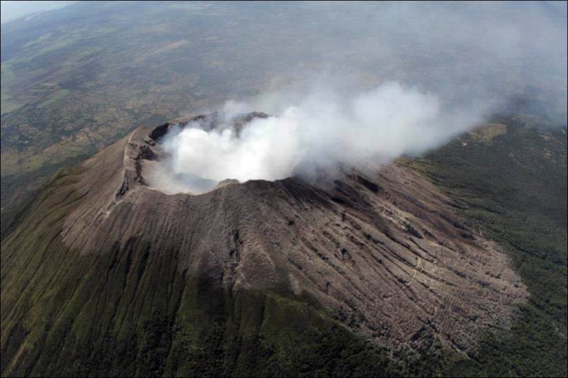
El Salvador , San Miguel ( Chaparrastique) :
Special report 4. The seismicity of the San Miguel volcano is normalizing.
Monitoring indicates that the seismicity of the San Miguel volcano has normalized, with a decrease in the number of earthquakes and frequency content. The seismicity of the volcano is related to the movement of gases and fluids in the volcano ducts.
Figure 1 shows the seismicity recorded in the VSM station over the past seven days.

Figure 1 Seismicity of the volcano recorded from November 22 to 29, 2019, associated with the circulation of gases and fluids. The number of earthquakes fluctuates between 10 and 25 earthquakes per hour, which is normal on this volcano.
Figure 2 shows the record of the number of earthquakes per hour and their respective frequency index (IF) in the last 14 days. There is a clear decrease in the number of earthquakes recorded from the 27th.
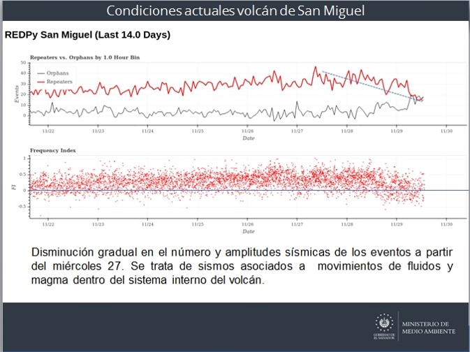
Figure 2. The dotted line indicates the downward trend in the number of earthquakes. The blue line divides the FI. The black spots above zero represent the high-frequency and below-zero earthquakes, the weak earthquakes associated with fluid movements in the volcano’s internal system.
The images captured by the volcanic surveillance camera located on the Pacayal volcano show a silent volcano, without the presence of a plume of gas. The network of local observers reported no anomaly on the volcano.
Figure 3 shows the flow of gas emitted by the volcano from September 2018 to date.

Figure 3. During the months of October and November, the sulfur dioxide flux emitted by the volcano crater remained at low values <400 tonnes / day, the threshold being 620 tonnes / day.
The Ministry of Environment and Natural Resources (MARN) continuously monitors the volcano and maintains close contact with the Directorate General of Civil Protection and local observers: We call on locals, tourists and mountaineers to stay in touch away from the crater of the volcano due to small explosions that suddenly can occur.
Interpretation:
The monitoring parameters indicate that, for the moment, the current activity of the volcano has normalized, without losing sight of the sudden changes that may occur in the equilibrium conditions of the system. These variations are continuously monitored and, if certain conditions indicate increased activity, with a potential danger for the population, the national civil protection system will make announcements later.
With this report, the series of special reports ends. In case of significant change, a preliminary special report will be published.
Source : Marn.
Photo : volcanohotspot /
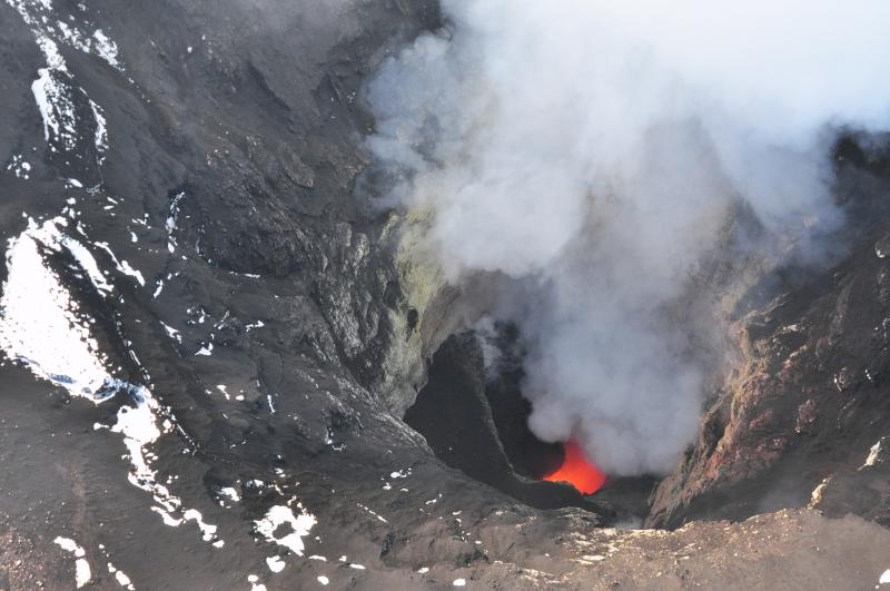
Hawaii , Mauna Loa :
19°28’30 » N 155°36’29 » W,
Summit Elevation 13681 ft (4170 m)
Current Volcano Alert Level: ADVISORY
Current Aviation Color Code: YELLOW
Activity Summary:
Mauna Loa Volcano is not erupting. Rates of deformation and seismicity have not changed significantly over the past week and remain above long-term background levels.
Observations:
During the past week, approximately 50 small-magnitude earthquakes (nearly all smaller than M2.0) were detected beneath the upper elevations of Mauna Loa. Most of the earthquakes occurred at shallow depths of less than 6 km (~4 miles) below sea level.
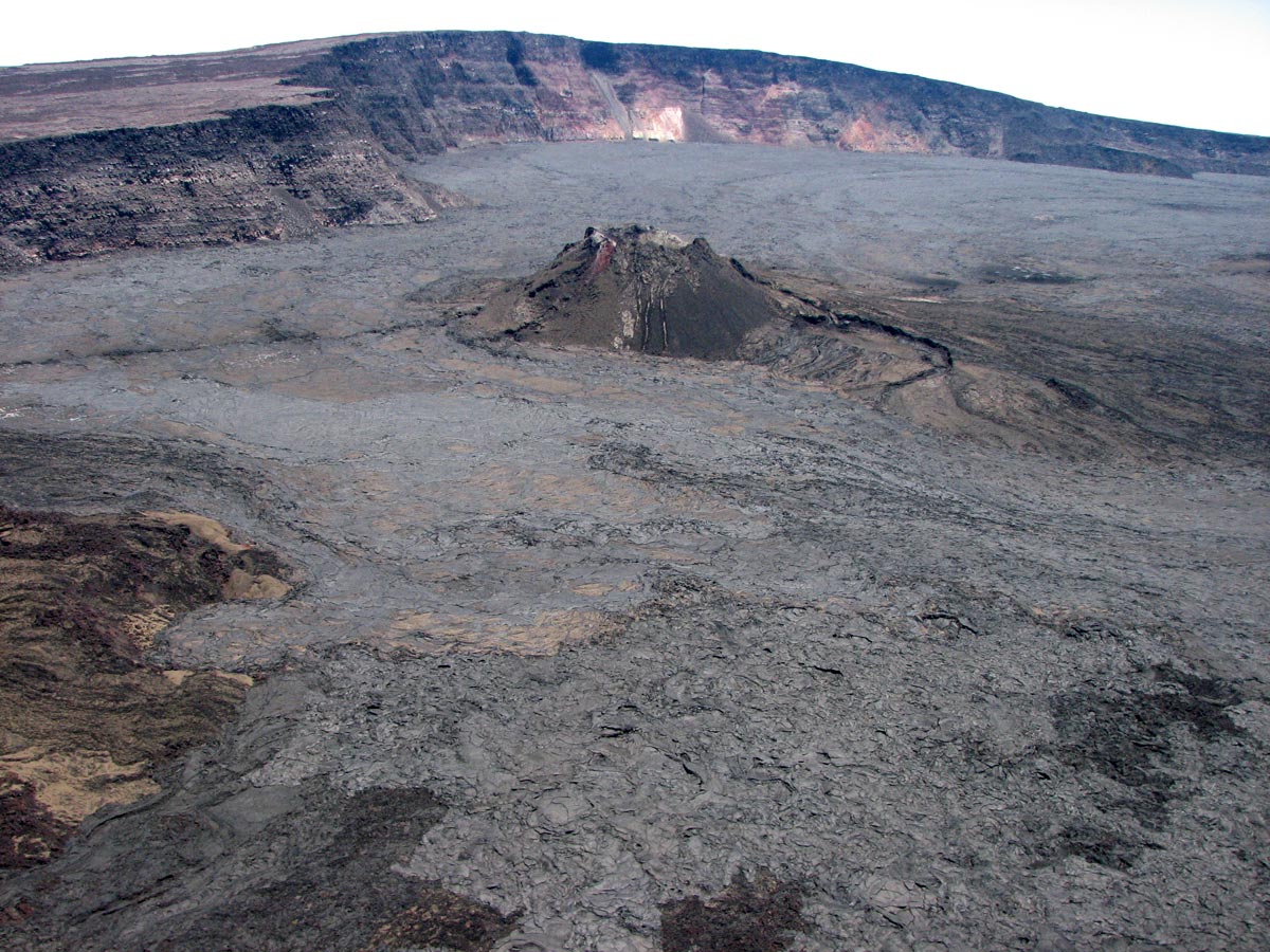
An aerial view of the 1940 ash cone on the floor of the Mauna Loa caldera. The wall of the caldera (in the background of the image) measures about 170m (560 ft).
Global Positioning System (GPS) and Interferometric Synthetic Aperture Radar (InSAR) measurements show continued summit inflation, consistent with magma supply to the volcano’s shallow storage system.
Readings of fumarole temperature and gas concentrations at the Sulphur Cone monitoring site on the Southwest Rift Zone remain stable.
Source : HVO.


No comment yet, add your voice below!