
September 30 , 2019.
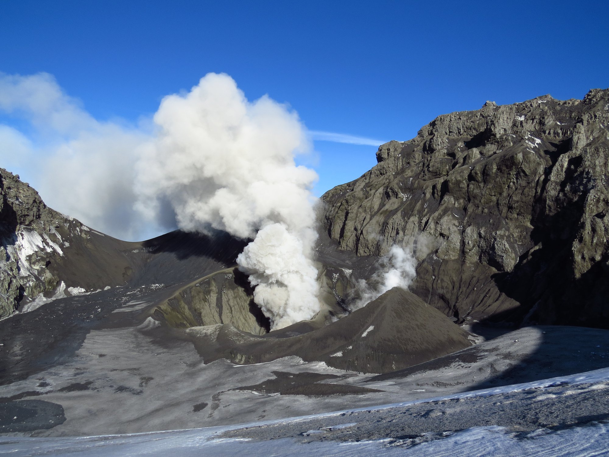
Chile , Copahue :
Special Volcanic Activity Report (REAV) Region del Bio Bio, Copahue volcano, 29 September, 2019, 14:35 Local time (Continental Chile)
The National Geological and Mining Service of Chile (Sernageomin) discloses the following PRELIMINARY information, obtained through monitoring equipment of the National Volcanic Monitoring Network (NVRN), processed and analyzed at the Volcanological Observatory of the South Andes ( OVDAS)
Yesterday, Sunday, September 29 at 13:25 local time (16:25 UTC), monitoring stations installed near the Copahue volcano recorded an earthquake associated with rock fracturing (volcano – tectonic type).
The characteristics of the earthquake are as follows:
TIME OF ORIGIN: 13h25 local time (16h25 UTC)
LATITUDE: 37,794 ° S
LONGITUDE: 71 162 ° W
DEPTH: 1.7 km
LOCAL MAGNITUDE: 3.1 ML
OBSERVATIONS:
At the time of publication of this report, 8 smaller replicas have been recorded. There is no information from the authorities or the community in general about the perception of this event in the vicinity of the volcano. Weather conditions prevent you from seeing the volcano.
Volcanic Technical Alert is maintained at Yellow level.
Sernageomin monitors online and informs in a timely manner of possible changes in volcanic activity.
Source : Sernageomin.
Photo : Sernageomin.
Indonesia , Anak Krakatau :
Information on the eruption of Anak Krakatau, September 30, 2019.
Anak Krakatau, Lampung was erupted on September 29, 2019 at 11:42 WIB, but the height of the ash column was not observed. This eruption was recorded on a seismogram of maximum amplitude of 4 mm and a duration of ± 5 seconds.
Gunung Anak Krakatau’s crater camera was clear on 29 September 2019 at 11:42; the eruption was observed with a thin column of ash gray-white, thick, reaching about 100 meters high from the bottom of the crater, but the sound of the explosion was not heard.
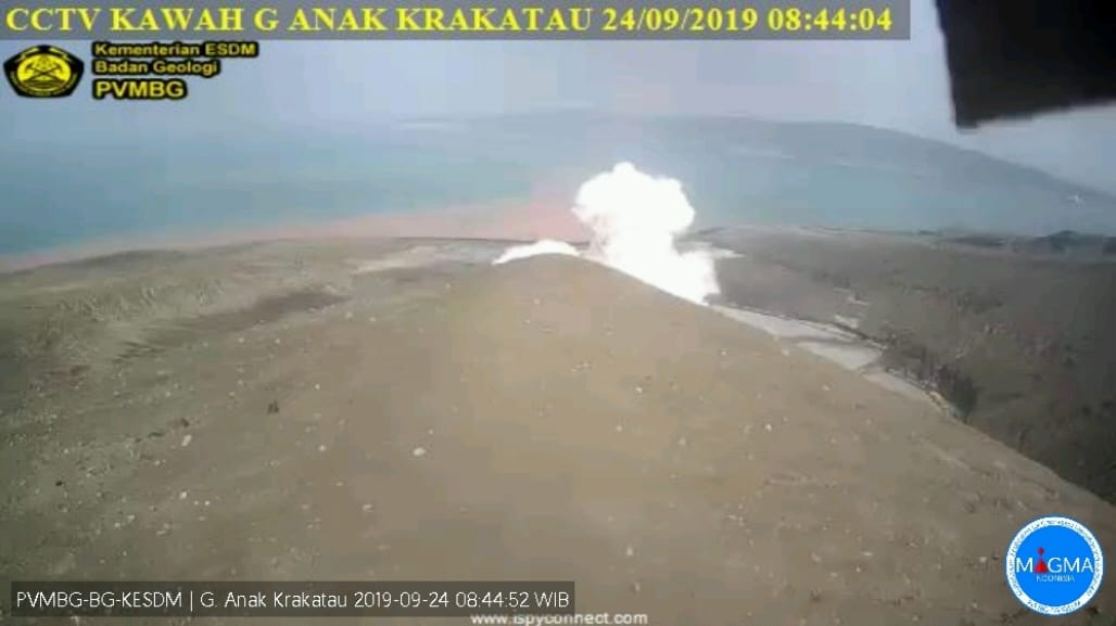
Currently, Anak Krakatau is at Level II Alert (Waspada) with these recommendations: people / tourists are not allowed to approach the crater within 2 km.
VOLCANO OBSERVATORY NOTICE FOR AVIATION – VONA .
Issued: September 29 , 2019 .
Volcano: Anak Krakatau (262000)
Current Aviation Colour Code: ORANGE
Previous Aviation Colour Code: orange
Source: Anak Krakatau Volcano Observatory
Notice Number: 2019KRA168
Volcano Location: S 06 deg 06 min 07 sec E 105 deg 25 min 23 sec
Area: Lampung, Indonesia
Summit Elevation: 502 FT (157 M)
Volcanic Activity Summary:
recorded eruption at 04:42UTC (11:42 local)
Volcanic Cloud Height:
Best estimate of ash-cloud top is around 822 FT (257 M) above sea level, may be higher than what can be observed clearly. Source of height data: ground observer.
Other Volcanic Cloud Information:
visually from cctv crater seen volcanic ash moving to north, volcanic ash white-gray thick 100 meters high from the bottom of the crater.
Remarks:
Eruption recorded on seismogram with maximum amplitude 4 mm and duration 5 second.
Source : PVMBG , Magma Indonésie .
Photos : PVMBG , Martin Hertel.
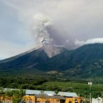
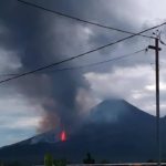
Guatemala , Fuego :
Type of activity: Vulcanian
Morphology: Composite stratovolcano
Geographical location: 14 ° 28’54˝ North Latitude; 90 ° 52’54˝ West Longitude
Height: 3763msnm
Atmospheric conditions: Cloudy
Wind: South East at 5 km / h
Precipitation: 63.7 mm.
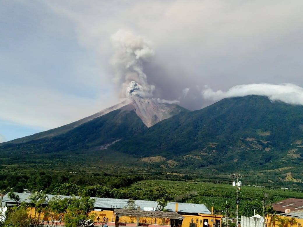
Activity:
Presence of white degassing fumarole at an altitude of 4,100 meters above sea level that disperses to the west and southwest. The activity generates 8 to 14 weak to moderate explosions per hour, emitting columns of gray ash up to 4500 and 4700 meters (14765-15420 feet), scattered 15 to 20 km to the West and South -West. At night and in the early morning, incandescent impulses were observed at an altitude of 200 to 300 m with moderate to strong avalanches on the contour of the crater, heading towards the ravines Seca, Ceniza and Las Lajas. Low to moderate rumblings are perceived, causing waves of low to moderate shock waves that vibrate the roofs of houses in communities near the volcano. The sounds are similar to those of a locomotive with a time of 3 to 7 minutes. Fine particles of ashes fall in the villages of Panimaché I, Panimache II, Morelia, Santa Sofia, El Porvenir, Finca de Palo Verde, San Pedro Yepocapa and others.
Source : Insivumeh.
Photo : Conred.
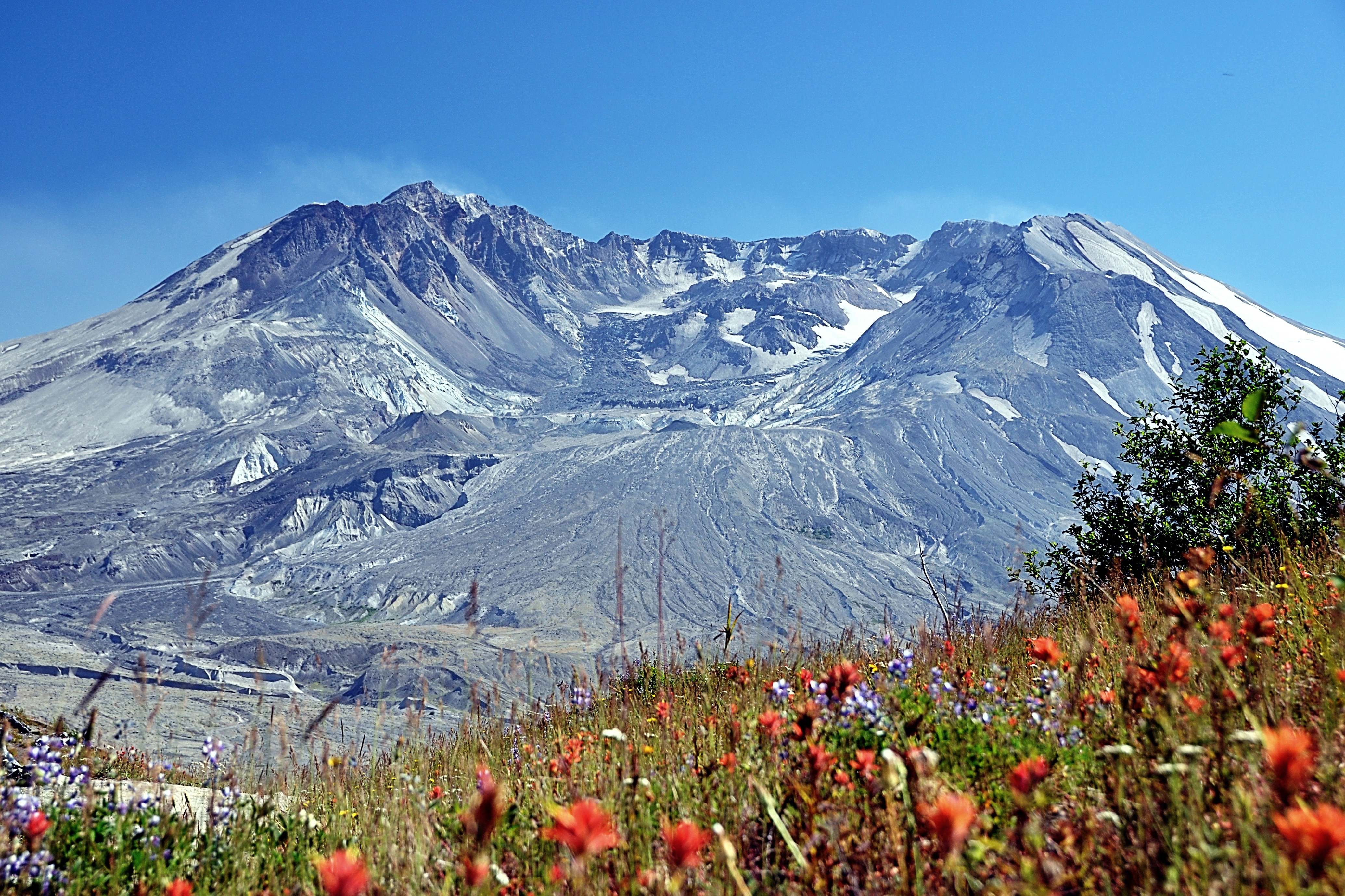
United-States , Cascade Range Volcanoes :
CASCADES VOLCANO OBSERVATORY WEEKLY UPDATE , U.S. Geological Survey , Friday, September 27, 2019, 10:20 AM PDT (Friday, September 27, 2019, 17:20 UTC)
Current Volcano Alert Level: NORMAL
Current Aviation Color Code: GREEN
Activity Update:
All volcanoes in the Cascade Range of Oregon and Washington are at normal background levels of activity. These include Mount Baker, Glacier Peak, Mount Rainier, Mount St. Helens, and Mount Adams in Washington State; and Mount Hood, Mount Jefferson, Three Sisters, Newberry, and Crater Lake in Oregon.
Recent Observations:
It was a busy week in the field with crews working on monitoring stations and infrastructure at Crater Lake, Newberry, Mount Hood, Mount St. Helens, and Mount Rainier. Late on Thursday night seismic stations at Mount Rainier detected a small debris flow in the Tahoma Creek drainage on the southwest side of the Park. The flow was subsequently confirmed by a geologist from the National Park and is smaller in size than one that occurred August 5, 2019.
The U.S. Geological Survey and Pacific Northwest Seismic Network (PNSN) continue to monitor these volcanoes closely and will issue additional updates and changes in alert level as warranted.
Source : CVO.
Photo : Mt St Helens , unknown author .


No comment yet, add your voice below!