
September 24 , 2019.
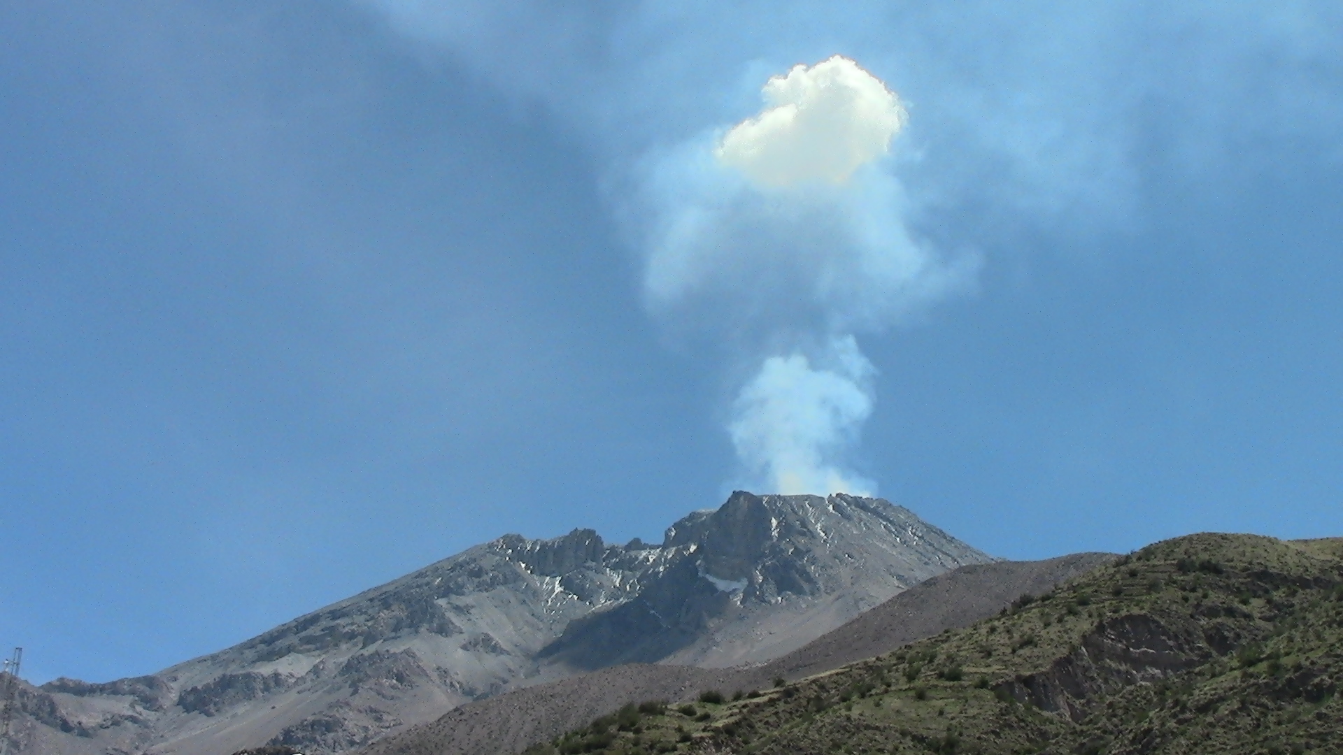
Italy , Stromboli :
Daily Bulletin of 23/09/2019
SUMMARY OF THE ACTIVITY.
In light of the surveillance data, we highlight:
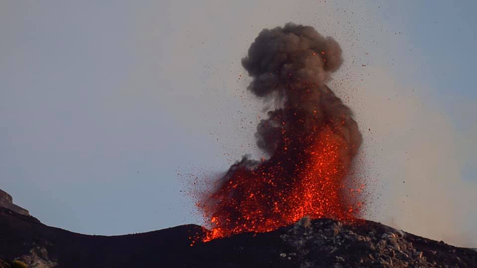
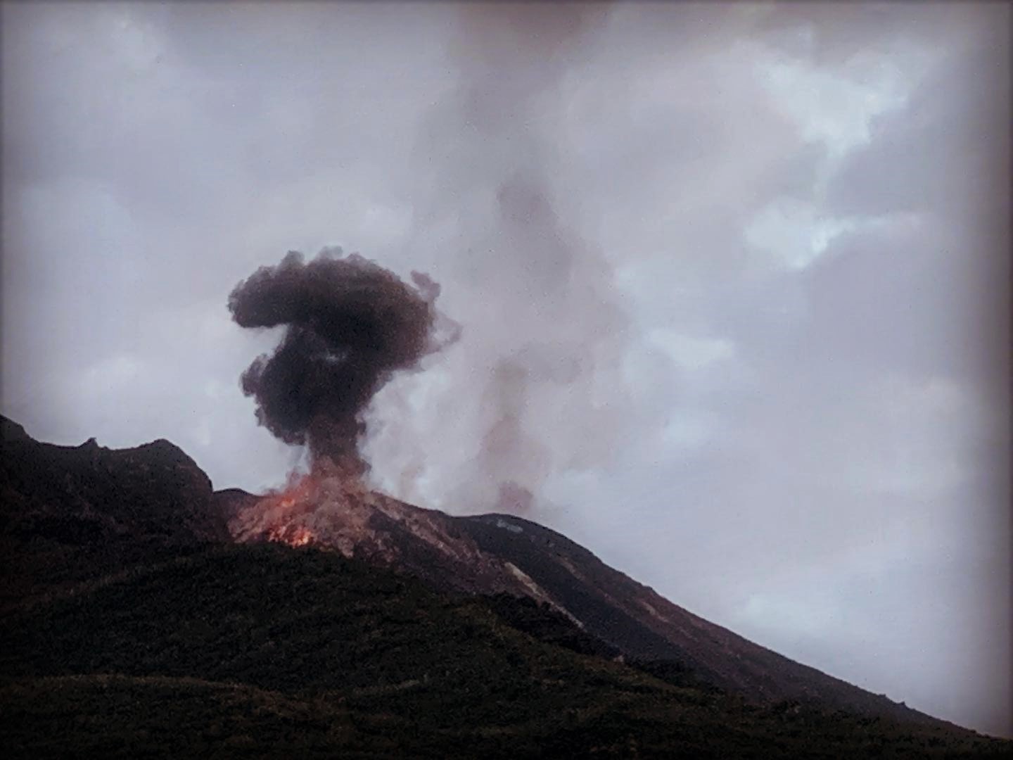
1) VOLCANOLOGICAL OBSERVATIONS: Normal explosive activity of Strombolian type accompanied by degassing activities.
2) SISMOLOGY: The seismological parameters do not show any significant changes.
3) DEFORMATIONS: The deformation monitoring networks of the island did not show any significant variation in communication during the last 24 hours.
4) GEOCHEMISTRY: the flow of SO2 is at an average level.
VOLCANOLOGICAL OBSERVATIONS
From the analysis of images from surveillance cameras at 400 m altitude and Punta dei Corvi, there is an ordinary Strombolian activity from several mouths located in the North and Center-South areas of the crater terrace. The explosions produce coarse material that often falls outside the area of the crater terrace and on the upper part of the Sciara del Fuoco, rolling down the slope towards the sea. The total number of explosive events was 19 at 20 events / h (medium-high frequency). In more detail, in the North zone, explosive activity produced 5 to 6 events / h (with peaks of 8 events / h). The explosions ranged in intensity from low (less than 80 m in height) to medium (less than 150 m in height) and produced coarse materials (lapilli and bombs) which, in some cases, covered the slopes of the cone facing the Sciara del Fuoco. The south-central zone was characterized by an average explosions frequency equal to 11 events / h with peaks of 15 events / h with fine mixed to coarse materials with low to medium-high heights (sometimes the products reached 200 m high).
SEISMOLOGY:
The bulletin is established with data acquired from a maximum of 7 stations. The seismic activity recorded over the past 24 hours has had the following characteristics: 6 small seismic signals have been recorded, associated with landslides, five of which are due to the fallout of materials after explosive events. Very long period (VLP) event counting provides an average of about 25 events / hour. The magnitude of VLP-like events remained generally low, with different events of low amplitude average. The amplitude of the explosion earthquakes remained generally low, with some events of medium to low amplitude.
The amplitude of the volcanic tremor, estimated at the STR1 station, remained generally low-average.
Source : INGV Vulcani.
Read the full article : file:///C:/Users/Utilisateur/AppData/Local/Packages/Microsoft.MicrosoftEdge_8wekyb3d8bbwe/TempState/Downloads/BollettinoGiornalieroStromboli20190923%20(1).pdf
Photos : Ruedi Thomi , Stromboli Adventures .
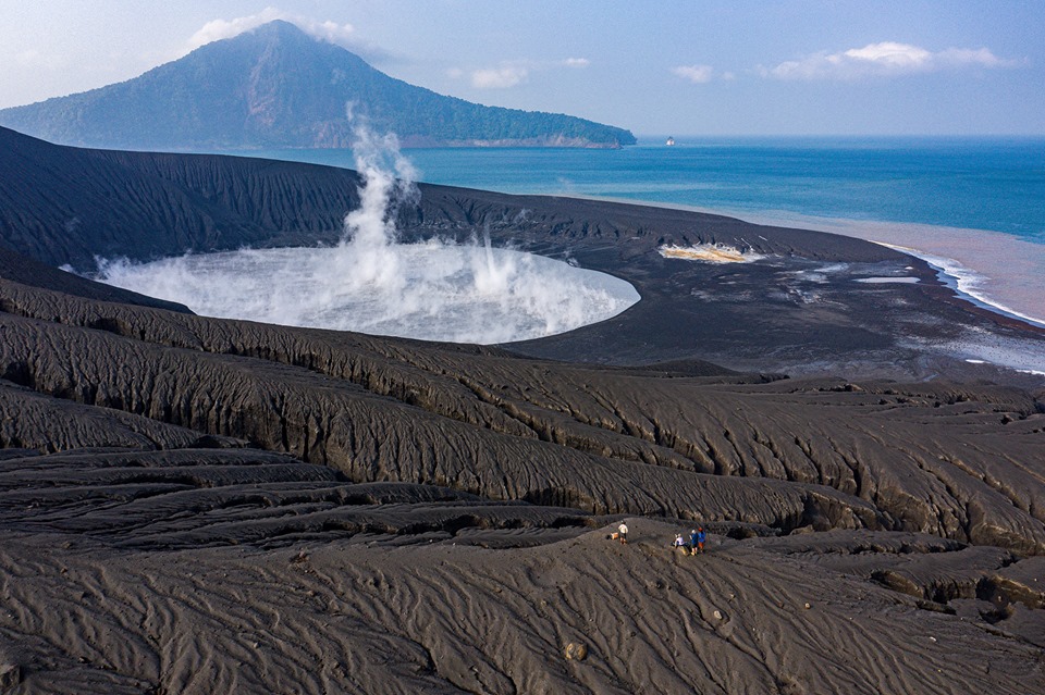
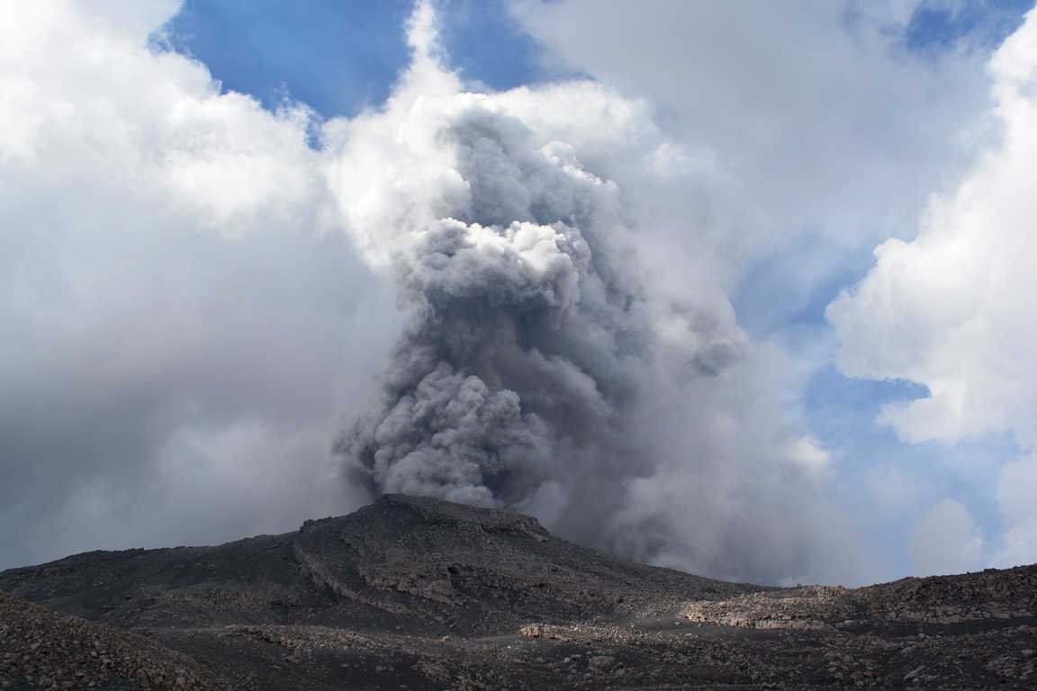
Indonesia , Anak Krakatau :
Information on the eruption of G. Anak Krakatau, September 24, 2019.
Anak Krakatau, Lampung was erupted on 24 September 2019 at 08:43 WIB. The height of the ash column was observed at ± 200 m above the summit (± 357 m above sea level). It was observed that the ash column was white / gray with a thick intensity, pointing north. This eruption was recorded on a seismogram with a maximum amplitude of 5 mm and a duration of ± 38 seconds.
No sound heard.
Currently, Anak Krakatau is at alert level II (WASPADA) with recommendations:
People / tourists are not allowed to approach the crater within 2 km of the crater.
VOLCANO OBSERVATORY NOTICE FOR AVIATION – VONA.
Issued: September 24 ,2019
Volcano: Anak Krakatau (262000)
Current Aviation Colour Code: ORANGE
Previous Aviation Colour Code: orange
Source: Anak Krakatau Volcano Observatory
Notice Number: 2019KRA163
Volcano Location: S 06 deg 06 min 07 sec E 105 deg 25 min 23 sec
Area: Lampung, Indonesia
Summit Elevation: 502 FT (157 M)
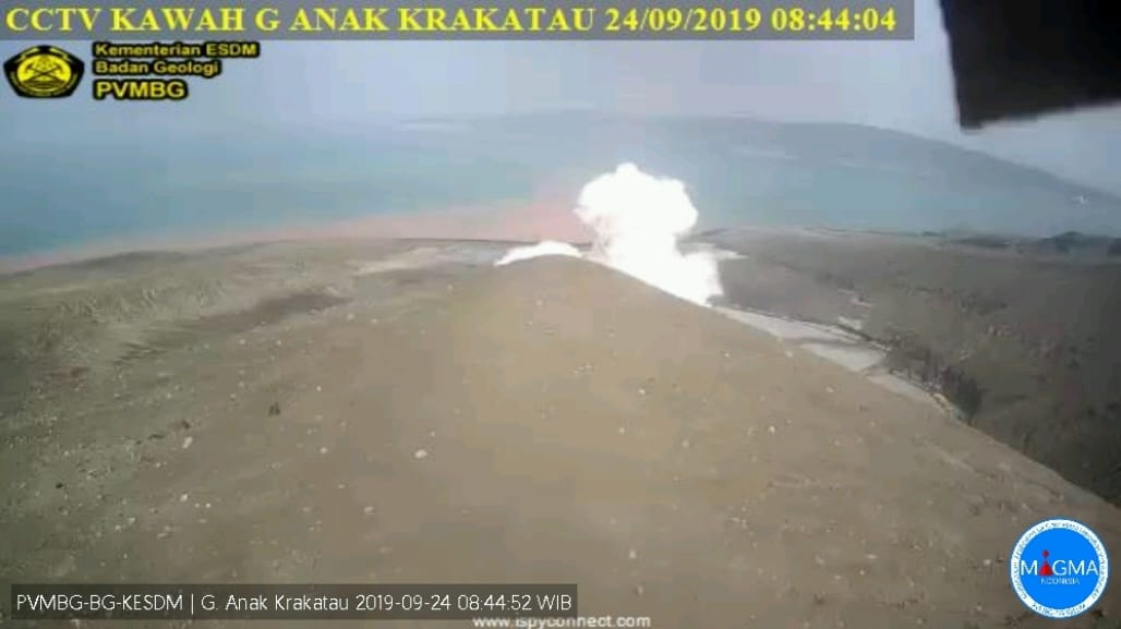
Volcanic Activity Summary:
recorded eruption at 01:43 UTC (08:43 local)
Volcanic Cloud Height:
Ash-cloud is not visible
Other Volcanic Cloud Information:
Ash-cloud moving to north, volcanic ash white-gray thick 200 meters high from the bottom of the crater.
Remarks:
Eruption recorded on seismogram with maximum amplitude 5 mm and duration 38 second.
Source : PVMBG, Magma Indonésia.
Photo : Martin Hertel
Peru , Ubinas :
Period of analysis: September 16 to 22, 2019. Arequipa, September 23, 2019.
Alert level: ORANGE.
The Geophysical Institute of Peru (IGP) reports that the Ubinas volcano continues its eruptive process. To date, there is seismic activity and thermal anomalies that would be associated with the rise and nearness of magma near the surface. Similarly, bluish gas (magmatic) and water vapor emissions observed by means of surveillance cameras are recorded. Under this scenario, one would expect moderate explosive activity and / or ash emissions during this week.
During the period 16 to 22 September, the IGP recorded and analyzed a total of 4356 seismic events associated with the eruptive process of the Ubinas volcano, with a predominant seismicity of the volcano-tectonic (VT) type, related to the fracturing of rocks in the interior of the volcano, with an average value of 567 events per day, all with magnitudes less than M2.5. Seismic signals, which are related to the rise of the magma (hybrid type), continue to be recorded at 119 events per day. During this period, no volcanic explosion was recorded.
The surveillance cameras recorded continuous emissions of bluish gas (of magmatic origin) and water vapor that was less than 1,000 meters above the summit of the volcano. The monitoring of the deformation of the volcanic structure, using GNSS data (processed with fast orbits), presents no significant anomalies. MIROVA satellite monitoring recorded 4 thermal anomalies with values ranging from 2 to 6 MW.
Source : Cenvul.
Photo : Auteur Inconnu.
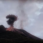
Peru , Sabancaya :
Period of analysis: 16-22 September 2019. Arequipa, September 23, 2019.
Alert level: ORANGE.
The Geophysical Institute of Peru (IGP) reports that the eruptive activity of the Sabancaya volcano has remained at moderate levels; that is, recording continuous explosions and resulting ash emissions. Therefore, for the following days, no significant change in activity is expected.
The analysis of records obtained from the seismic network of the Sabancaya volcano for the period 16 to 22 September 2019 has identified the presence of about 2282 earthquakes of volcanic origin, the highest percentage of which is associated magmatic fluid movement under the volcano During this week, there was an average of 24 medium to low intensity daily explosions.
The monitoring of the deformation of the volcanic structure, using GNSS data (processed with fast orbits), shows no significant anomaly. On the other hand, the visual surveillance, using surveillance cameras, made it possible to identify the appearance of columns of gas and ash up to 2.5 km high above the top of the volcano, which were dispersed in the South and South-East sectors of Sabancaya. Satellite monitoring identified 10 thermal anomalies with values between 3 and 59 MW, associated with the presence of a hot body near the surface of the volcano crater.
Source : Cenvul.
Photo : Auteur Inconnu.
Costa Rica , Poas :
Since 22 September 2019, the Poas volcano has been erupting continuously. Its column is 1000 meters high and 3708 meters above sea level (12162.24 ft).
The seismic activity is higher than yesterday.
At the time of this report, the winds blow from the northwest.
The volcano caused a hydrothermal eruption followed by frequent gas pulses at the time of writing this report. A peak of H2S / SO2 was observed before the eruption, and the CO2 / SO2 ratio slightly increased. There is no significant deformation.
Since the night of September 20, the Poás volcano has maintained a vigorous plume of gas and water vapor. Due to the decrease in wind and clear morning conditions, the column of water vapor was observed at different locations in the central valley. It is estimated that it has reached more than 1000 m above the level of the main crater.
In this video captured with the volcanic surveillance camera of the RSN, the activity that occurred is observed in an accelerated manner.
At some point in the video, you can see two columns, the main coming from the Boca A (where the Dome was) and the second from the fumaroles field.
Visitors to the Poás Volcano National Park are reminded that this site has protocols for eruptions. Depending on the type of activity, visits may be suspended or delayed. In the main crater view, there are four shelters to protect against eruptions. Tourists are advised to always pay attention to any change of activity and to follow the instructions of the park guards.
Source : Ovsicori , RSN/ Dr. Paulo Ruiz


No comment yet, add your voice below!