
August 23 , 2019.
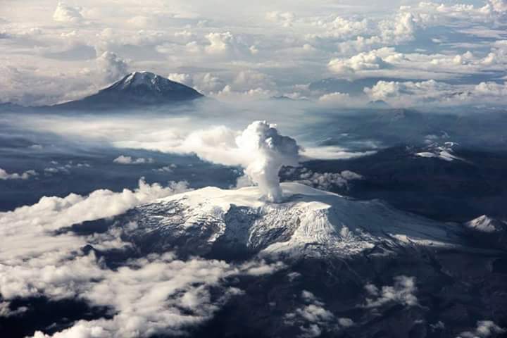
Colombia , Nevado del Ruiz :
Weekly activity bulletin of the Nevado del Ruiz volcano
The level of activity continues at: Yellow activity level or (III): changes in the behavior of volcanic activity.
With regard to monitoring the activity of the Nevado del Ruiz volcano, the COLOMBIAN GEOLOGICAL SERVICE reports that:
The Nevado del Ruiz volcano continues to display unstable behavior. During the past week, seismic activity was mainly related to fluid dynamics within volcanic canals. For the previous week, this type of seismicity showed similar levels in both number of earthquakes and energy released. The recorded earthquakes were long-period (LP), very long period (VLP), volcanic tremor pulses and episodes of continuous volcanic tremors. These earthquakes took place in the crater Arenas and its surroundings. One of these signals was associated with a small emission of gas and ash on the morning of August 18, confirmed by the cameras installed in the region of the volcano. The recording of new seismic signals of this type, which may be associated with new emissions of gas and ash, which will be dispersed according to the wind regime at the time of emission, is not excluded.
As for the seismicity caused by the fracturing of rocks in the immediate vicinity of the volcanic structure, it had similar levels both in the number of registered earthquakes and in released seismic energy, compared to the previous week. The earthquakes were mainly located in the north-east and south-east of the volcanic building, in the Arenas crater and, to a lesser extent, in the north and south-west sections of the volcano. The depths of the earthquakes ranged from 1.0 to 6.7 km. The maximum magnitude recorded during the week was 1.0 ML (local magnitude), corresponding to the earthquake recorded on August 15 at 07:05 (local time), located north of the volcano, 6.6 km deep.
Volcanic deformation measured from electronic inclinometers and GNSS (Global Navigation Satellite System) stations did not change during the week.
The volcano continues to emit water vapor and gases into the atmosphere, among which sulfur dioxide (SO2) is distinguished, as evidenced by the values obtained by the SCANDOAS stations installed in the region of the volcano. satellite image analysis. In tracking information provided by the NASA FIRMS and MIROVA portals, two low-energy thermal anomalies were recorded during this week.
The column of gas and steam reached a maximum height of 1040 m, measured at the top of the volcano on August 19. The direction of dispersion of the column was governed by the direction of the wind in the area, mainly to the northwest of the volcano.
The Nevado del Ruiz volcano continues at the level of yellow activity.
Source : SGC.
Photos :Auteurs inconnus.
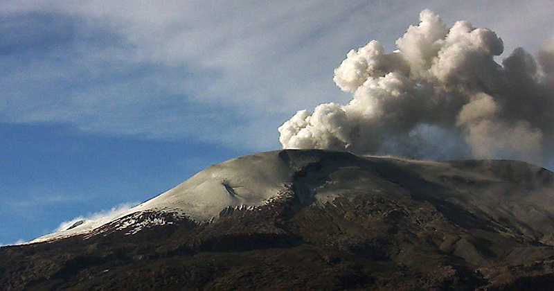
El Salvador , San Miguel ( Chaparrastique) :
Location: San Miguel Department
Altitude: 2130 meters above sea level
Type of volcano: Stratovolcano
Type of activity: Strombolian – Vulcanian.
Last major eruption: December 29, 2013.
The behavior of the seismic activity remained fluctuating. At the beginning of the month, the values remained close to 50 RSAM units. However, as of July 13, this behavior has tended to increase, until the 26th, after the 27th this increase tended to decrease. The seismic vibration remained between 51 and 99 RSAM units during the day on average. The presence of microseisms associated with the movement of fluids (gas / magma) increased compared to the previous month, with an average value of 572 events per day. Due to their low magnitude, no earthquakes were perceived by the population living in the volcano area.
For sulfur dioxide (SO2) emissions, they fluctuated between 136 and 670 tonnes per day, averaging 332 t / d, with a threshold of 620 t / d.
Source : Marn.
Photo : volcanohotspot.
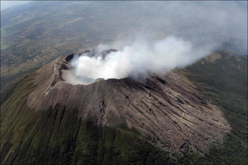
Philippines , Taal :
TAAL VOLCANO BULLETIN 23 August 2019 8:00 A.M.
Taal Volcano’s seismic monitoring network recorded thirty-two (32) volcanic earthquakes during the 24-hour observation period. One of these earthquakes, which occurred at 08:26 AM yesterday was felt at Intensity 3 with rumbling sound in Pira-piraso, Talisay, Batangas; and Intensity 1 in Brgy. Alas-as, San Nicolas, Batangas. Field measurements on 22 August 2019 at the western sector of the Main Crater Lake yielded a water temperature of 32.3°C, a water level of 0.40 meters, and an increase in acidity from a pH of 2.85 to 2.77. Ground deformation measurements through precise leveling surveys from 15 – 24 June 2019 indicated slight inflation of the edifice consistent with recent results from continuous GPS data.
Alert Level 1 remains in effect over Taal Volcano. This means that hazardous eruption is not imminent. The public, however, is reminded that the Main Crater should be strictly off-limits because sudden steam explosions may occur and high concentrations of toxic gases may accumulate. The northern portion of the Main Crater rim, in the vicinity of Daang Kastila Trail, may also become hazardous when steam emission along existing fissures suddenly increases. Furthermore, the public is also reminded that the entire Volcano Island is a Permanent Danger Zone (PDZ), and permanent settlement in the island is strongly not recommended.
Source : Phivolcs.
Photo : publicdomaine.
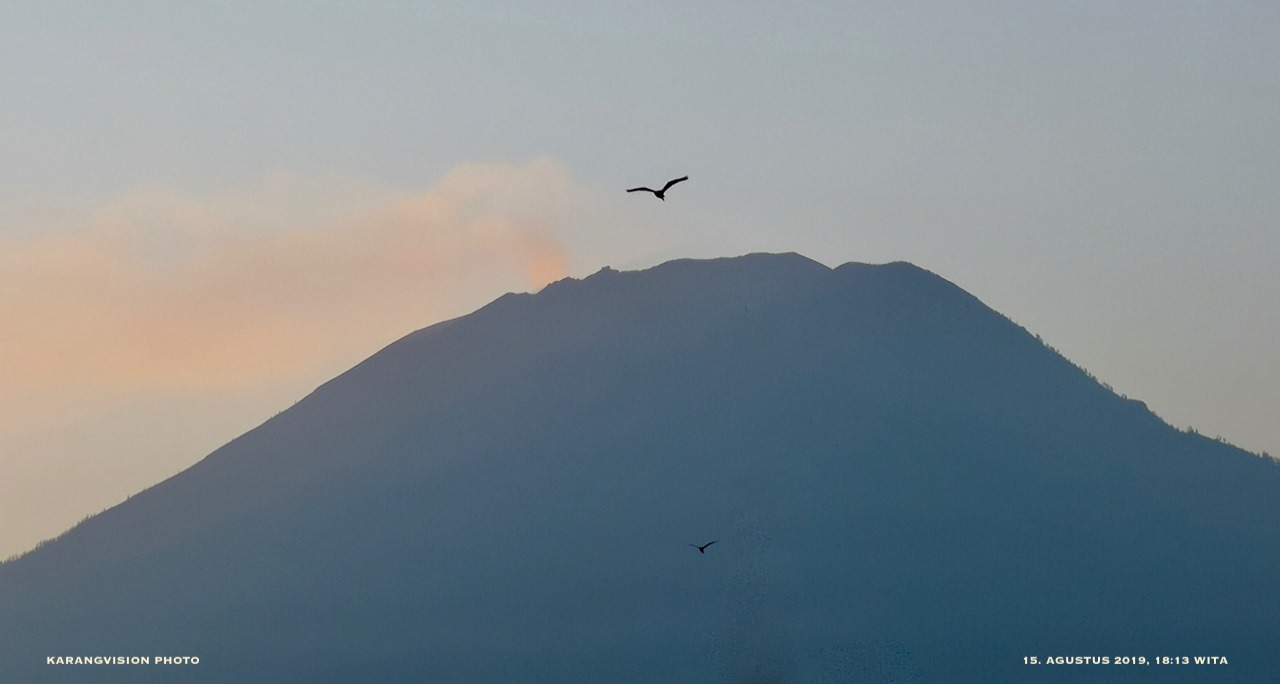
Indonesia , Agung :
The Agung volcano in Bali has begun an eruption phase from 21 November 2017 to today, after a rest of over 53 years. The current level of activity is Level III (SIAGA).
Since yesterday and until this morning, the volcano was clearly visible until it was covered by fog. The smoke from the crater is observed with a maximum height of 50 meters from the top of the peak, with a white color and low intensity.
The seismographs, on August 22, 2019, recorded:
1 low frequency earthquake
5 tectonic earthquakes
The seismographs, August 23, 2019 (from 00:00 to 06:00 WITA), recorded:
1 distant tectonic earthquake
Recommendation:
Communities around G. Agung and mountaineers / visitors / tourists should not have activities in the estimated danger zone, ie all areas within a 4 km radius of the crater.
Communities living and traveling in the river basins below Mount Agung need to be aware of the potential threat of secondary hazards in the form of lahars.
VONA:
The last VONA code sent was ORANGE, published on June 13, 2019 at 01:48, linked to the eruption of June 13, 2019 at 1:38. The column of ash was not observed. The eruption was recorded on a seismogram of maximum amplitude of 30 mm and a duration of the earthquake of 3 minutes 53 seconds.
Source : PVMBG.
Photo : Karangvision
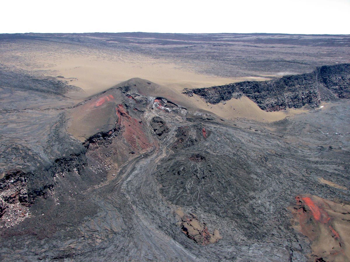
Hawaii , Mauna Loa :
19°28’30 » N 155°36’29 » W,
Summit Elevation 13681 ft (4170 m)
Current Volcano Alert Level: ADVISORY
Current Aviation Color Code: YELLOW
Activity Summary:
Mauna Loa Volcano is not erupting. Over the past week, rates of deformation and seismicity continue to remain slightly elevated.
Observations:
During the past week, approximately 40 small-magnitude earthquakes (all less than M2.3) were detected beneath the summit and upper Southwest Rift Zone. Most of the earthquakes occurred at shallow to intermediate depths of less than 10 km (~6 miles) below ground level.
Global Positioning System (GPS) and Interferometric Synthetic Aperture Radar (InSAR) measurements show continued summit inflation, suggesting recharge of the volcano’s shallow magma storage system.
No significant changes in volcanic gas release at Sulphur Cone on the Southwest Rift Zone were measured. Fumarole temperatures at Sulphur Cone and within the summit caldera remain stable.
Source : HVO.
Photo : HVO


No comment yet, add your voice below!