
August 17 , 2019.
La Réunion , Piton de la Fournaise :
Activity bulletin of Friday, August 16, 2019 at 3:15 pm (local time).
Alert level: Backup.
Since the eruption stopped on 15/08/2019 at approximately 22h local time (Figure 1), 9 volcano-tectonic earthquakes have been recorded. These earthquakes are located under the summit zone.
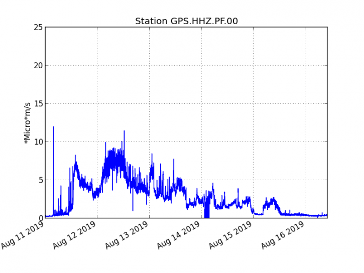
Figure 1: Evolution of the RSAM (indicator of the volcanic tremor and the intensity of the eruption) between 04:00 (00:00 UT) on August 11 and 14:30 (10:30 UTC) on August 16, 2019 on the GPS seismic station, the most close to the eruptive site (© OVPF-IPGP).
The deformations recorded by the OVPF measuring devices on the ground do not show any noticeable signals since the end of the eruption.
It should be noted that the deformation field associated with the eruption of 11-15 August 2019 did not extend outside the Enclos Fouqué (dated 15/08/2019 5h47, date of the satellite acquisition Figure 2). This shows that the dike (« feeding duct ») that fed the eruption did not spread beyond this structure.
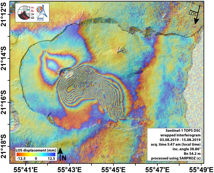
Figure 2: Interferogram representing deformations at Piton de la Fournaise associated with the eruption of August 11-15, 2019 (© OVPF-IPGP). In addition to ground measurements, the OVPF also uses a satellite technique called dInSAR to monitor building inflation / deflation cycles associated with deep magma movement. For this, the satellite « illuminates » an area of the ground with an electromagnetic wave and collects the signal reflected from the ground. The comparison of two measurements of this type of the same surface taken at different times makes it possible to image the deformations of the surface. The above interferogram shows the deformation of the surface associated with the eruption of August 11-15, 2019. Each color cycle (from red to blue) complete of the interferogram corresponds to 27.8 mm of displacement of the surface to (positive) or opposite (negative) Sentinel-1 satellite (whose direction is represented by the arrow « LOS » at the top right of the figure).
Source : OVPF.
Read the article : http://www.ipgp.fr/fr/ovpf/bulletin-dactivite-vendredi-16-aout-2019-a-15h15-heure-locale
Alaska , Veniaminof :
56°11’52 » N 159°23’35 » W,
Summit Elevation 8225 ft (2507 m)
Current Volcano Alert Level: ADVISORY
Current Aviation Color Code: YELLOW
Low-level seismicity continues with occasional low-frequency earthquakes occurring throughout the week. Elevated surface temperatures were observed in several clear satellite views over the past week.
Veniaminof volcano is monitored with a local real-time seismic network, which will typically allow AVO to detect changes in unrest that may lead to a more significant explosive eruption. AVO combines seismic, infrasound, lightning, and satellite data for rapid detection of such events.
Mount Veniaminof volcano is an andesitic stratovolcano with an ice-filled 10-km diameter summit caldera located on the Alaska Peninsula, 775 km (480 mi) southwest of Anchorage and 35 km (22 mi) north of Perryville. Veniaminof is one of the largest (~300 cubic km; 77 cubic mi) and most active volcanic centers in the Aleutian Arc and has erupted at least 13 times in the past 200 years. Recent significant eruptions of the volcano occurred in 1993-95, 2005, and 2013. These were Strombolian eruptions that produced lava fountains and minor emissions of ash and gas from the main intracaldera cone. During the 1993-95 activity, a small lava flow was extruded, and in 2013, five small lava flows effused from the intracaldera cone over about five months. Minor ash-producing explosions occurred nearly annually between 2002 and 2010. Previous historical eruptions have produced ash plumes that reached 20,000 ft above sea level (1939 and 1956) and ash fallout that blanketed areas within about 40 km (25 mi) of the volcano (1939).
Source : AVO.
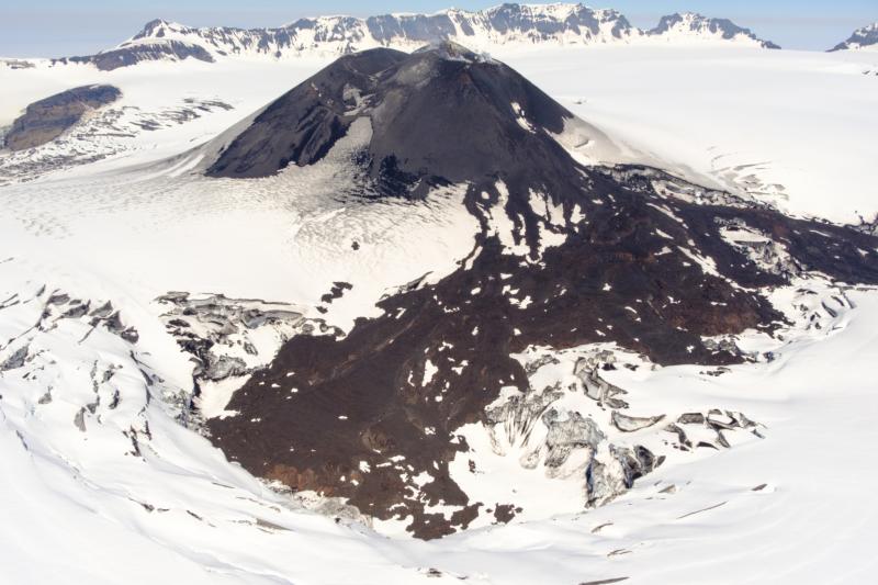
Photo : Loewen, Matt , 29 Juin 2019.
Indonesia , Anak Krakatau :
Level of activity level II (Waspada), since March 25, 2019. G. Anak Krakatau (157 m altitude) has experienced an increase in its volcanic activity since June 18, 2018, which was followed by a series of eruptions from September 2018 to February 2019. Since July 2019, eruptions have continued but their intensity is decreasing.
Since yesterday and until this morning, the volcano was covered by fog. The smoke from the crater is not observed.
The seismographs of August 15, 2019 recorded:
6 earthquake emission
1 shallow volcanic earthquake
A volcanic earthquake
1 distant tectonic earthquake
Continuous tremor with a dominant amplitude of 3 mm
Recommendation:
– The public / tourists are not allowed to approach the crater within a radius of 2 km around the crater.
VONA:
The last VONA code was sent with the color code ORANGE, published on August 6, 2019 at 23:04 WIB. The height of the smoke column was not observed.
Source : PVMBG.
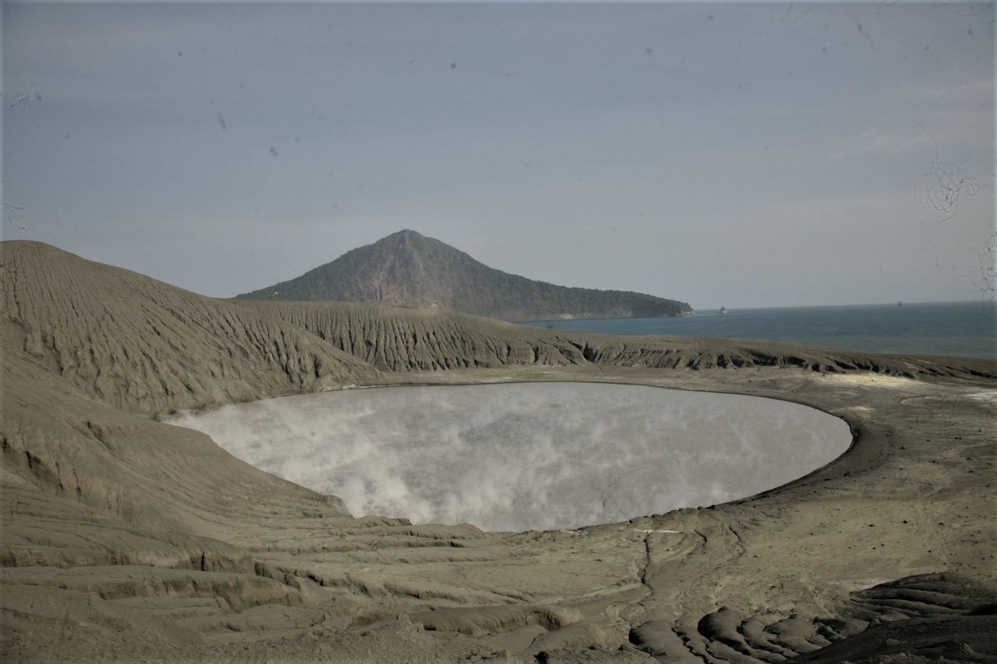
Photo : Igan S. Sutawijaya.
Mexico , Popocatepetl :
August 16, 11:00 am (August 16, 16:00 GMT)
During the last 24 hours, 188 exhalations have been identified using the monitoring systems of the Popocatepetl volcano, accompanied by water vapor, gas and small amounts of ash. In addition, five minor explosions were recorded, four yesterday at 10:28, 10:45, 11:30, 12:01 and one today at 08:00. There were also two moderate explosions today at 09:08 and 09:51, with moderate ash content and a column height of 1,200 and 1,500 meters, respectively. The two explosions dispersed in the direction West-South-West. Similarly, 790 minutes of tremor and a volcano-tectonic earthquake were recorded today at 6:28 am, with a magnitude estimated at M2.2.
Today and at the time of this report, the volcano is observed with a gas emission oriented West-South-West.
CENAPRED urges NOT to approach the volcano and in particular the crater, because of the risk of falling ballistic fragments, and in case of heavy rains, to stay far from the bottom of the ravines because of the risk of mudslides and debris.
The warning light of Popocatépetl is in YELLOW PHASE 2.
Source : Cenapred
Video : ABC News.
Philippines , Mayon :
MAYON VOLCANO BULLETIN 17 August 2019 08:00 A.M.
Mayon Volcano’s seismic monitoring network recorded one (1) rockfall event during the 24-hour observation period. Moderate emission of white steam-laden plumes that crept downslope before drifting northeast was observed. Sulfur dioxide (SO2) emission was measured at an average of 1,171 tonnes/day on 25 July 2019. Precise leveling data obtained on 16 – 25 July 2019 indicate a slight inflation of the edifice relative to 9 – 17 April 2019. This is consistent with continuous GPS data showing that the edifice is still inflated since June 2018.
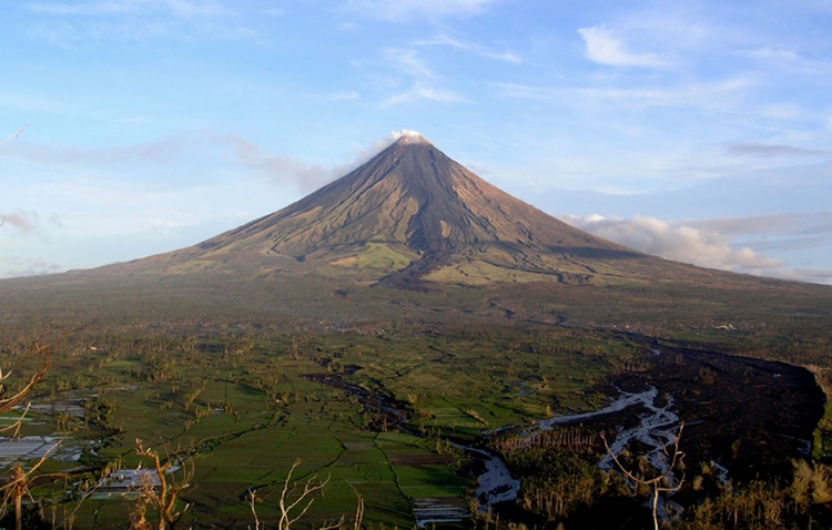
Alert Level 2 currently prevails over Mayon Volcano. This means that Mayon is at a moderate level of unrest. DOST-PHIVOLCS reminds the public that sudden explosions, lava collapses, pyroclastic density currents or PDCs and ashfall can still occur and threaten areas in the upper to middle slopes of Mayon. DOST-PHIVOLCS recommends that entry into the six kilometer-radius Permanent Danger Zone or PDZ and a precautionary seven kilometer-radius Extended Danger Zone or EDZ in the south-southwest to east-northeast sector, stretching from Anoling, Camalig to Sta. Misericordia, Sto. Domingo must be strictly prohibited. People residing close to these danger areas are also advised to observe precautions associated with rockfalls, PDCs and ashfall. Active stream/river channels and those identified as perennially lahar-prone areas on all sectors of the volcano should also be avoided especially during extreme weather conditions when there is heavy and prolonged rainfall. Civil aviation authorities must advise pilots to avoid flying close to the volcano’s summit as airborne ash and ballistic fragments from sudden explosions and PDCs may pose hazards to aircrafts.
Source : Phivolcs.
Photo : Theworldnews


No comment yet, add your voice below!