
May 03 , 2019.
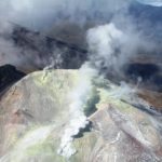
Philippines , Taal :
TAAL VOLCANO BULLETIN 03 May 2019 8:00 A.M.
Taal Volcano’s seismic monitoring network recorded five (5) volcanic earthquakes during the 24-hour observation period. Field measurements on 2 May 2019 at the western sector of the Main Crater Lake yielded a decrease in water temperature from 32.8°C to 32.2°C, a decrease in water level from 0.25 meter to 0.18 meter and decrease in pH from 2.98 to 2.87. Ground deformation measurements through precise leveling surveys from 18 – 27 March 2019 indicated slight inflation of the edifice consistent with recent results from continuous GPS data.

Alert Level 1 remains in effect over Taal Volcano. This means that hazardous eruption is not imminent. The public, however, is reminded that the Main Crater should be strictly off-limits because sudden steam explosions may occur and high concentrations of toxic gases may accumulate. The northern portion of the Main Crater rim, in the vicinity of Daang Kastila Trail, may also become hazardous when steam emission along existing fissures suddenly increases. Furthermore, the public is also reminded that the entire Volcano Island is a Permanent Danger Zone (PDZ), and permanent settlement in the island is strongly not recommended.
Source : Phivolcs.
Photo : Jhong Dizon , 27 juillet 2013 .
Colombia , Cumbal :
Weekly Activity Bulletin of the Cumbal Volcanic Complex
The level of activity of the volcano continues at the level: YELLOW LEVEL ■ (III): CHANGES IN THE BEHAVIOR OF THE VOLCANIC ACTIVITY.
Following the activity of the CUMBAL VOLCANIC COMPLEX, the COLOMBIAN GEOLOGICAL SERVICE (SGC) reports that:
For the period evaluated between April 23 and April 29, 2019, the seismic activity recorded a slight decrease compared to the previous week, when there were 309 earthquakes, while for the period evaluated, there was had 216 events. The occurrence of volcanic seismicity on the Cumbal volcano is influenced both by events associated with fluid movements in the volcanic system and by fracture processes of volcano rocks. The events associated with the fracture of a solid material were scattered in the upper part of the Cumbal volcanic complex with epicentral distances less than 2 km, depths up to 6 km from its summit (4700 m ) and magnitudes less than 1.2 on the scale. of Richter.
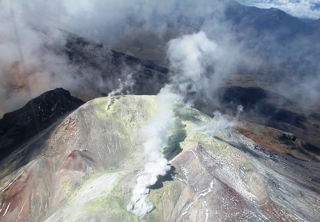
This week’s weather conditions led to the recording of gas emissions mainly from the El Verde fumarol field, north-northeast of the volcanic complex. They were white in color, of low height and of varying direction depending on the action of the winds.
The COLOMBIAN GEOLOGICAL SERVICE is attentive to the evolution of the volcanic phenomenon and will continue to inform in a timely manner of the observed changes.
Source : SGC.
Photo : Flickr ( date inconnue)
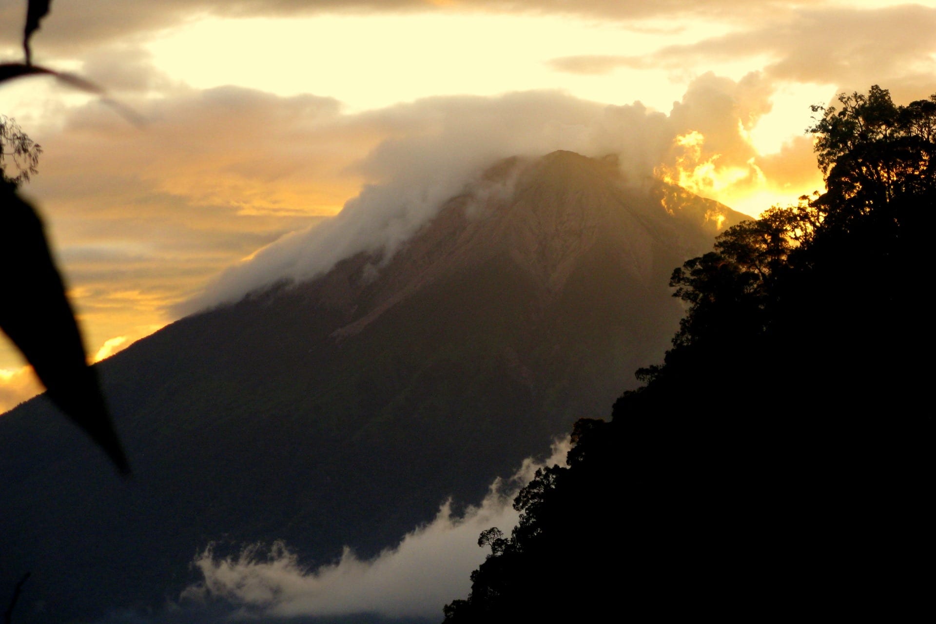
Indonesia , Kerinci :
Level II Activity Level (WASPADA). G. Kerinci (3805 m) experiences eruptions.
Since yesterday and until this morning, the volcano was clearly visible until it was covered with fog. Smoke from the main crater was observed at an altitude of 600 meters above the summit with a white color and strong intensity.
The seismographs, May 2, 2019, recorded:
315 emission earthquakes
8 shallow volcanic earthquakes
Continuous tremor with a dominant amplitude of 3 mm
Recommendation:
Communities around G. Kerinci and visitors / tourists should not have activities within a radius of 3 km around the crater.
During the rainy season, people living near rivers must be aware of the potential threat of descent from lahars.
VOLCANO OBSERVATORY NOTICE FOR AVIATION – VONA.
Issued: May 02 , 2019
Volcano: Kerinci (261170)
Current Aviation Colour Code: ORANGE
Previous Aviation Colour Code: yellow
Source: Kerinci Volcano Observatory
Notice Number: 2019KER17
Volcano Location: S 01 deg 41 min 49 sec E 101 deg 15 min 50 sec
Area: Jambi, West Sumatra, Indonesia
Summit Elevation: 12176 FT (3805 M)
Volcanic Activity Summary:
Volcanic ash fall has been reported by local resident at 02h07 UTC (21h07 local time).
Volcanic Cloud Height:
Ash-cloud is not visible
Other Volcanic Cloud Information:
Thin volcanic ash fall at south and northeast flank about 7 km from the summit.
Remarks:
Seismic activity is dominated by gas emission and tremor.
Source : PVMBG , Magma Indonésie .
Photo : Wild Sumatra ( date inconnue).
Guatemala , Pacaya :
Type of activity: Strombolian
Morphology: Composite Stratovolcano
Geographical location: 14 ° 22’50˝ Latitude N; 90 ° 36’00˝ Longitude O.
Height: 2,552msnm.
Weather conditions: partly cloudy
Wind: south
Precipitation: 0.0 mm
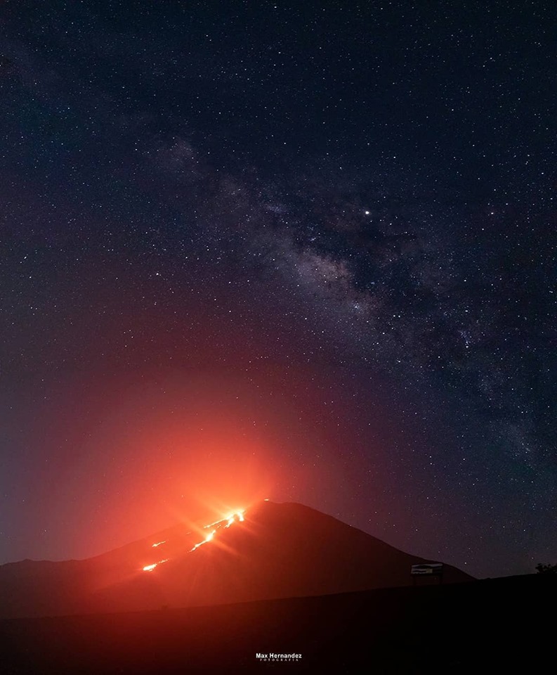
Activity:
White degassing occurs at a height of approximately 150 m above the crater scattered in a northerly direction on the slopes of the volcano. The seismic station records internal tremors associated with constant degassing and Strombolian explosions, which lift materials at a height of approximately 5 to 15 meters above the crater. There is glow in the Mackenney crater and lava flows to the north on the slopes of the volcano. There are weak avalanches in front of the lava flows.
Source : Insivumeh
Photo : Max Hernandez Fotografía , 29 Avril 2019 , via Sherine France FDB.
Kamchatka , Karymsky :
54.05 N, 159.44 E;
Elevation 4874 ft (1486 m)
Aviation Colour Code is ORANGE
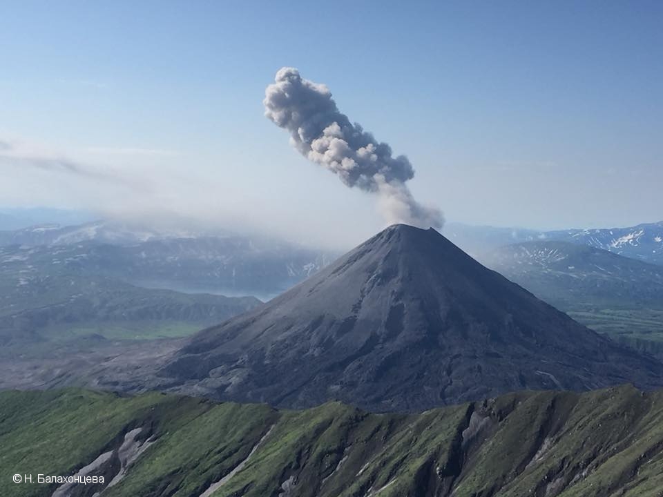
A moderate activity of the volcano continues. Ash explosions up to 13,100-19,700 ft (4-6 km) a.s.l. could occur at any time. Ongoing activity could affect low-flying aircrafts.
This moderate activity of the volcano continues. Satellite data shows a weak thermal anomaly over the volcano on 27 and 30 April, and 01 May; the volcano was quiet or obscured by clouds in the other days of week.
Source : Kvert
Photo : N. Balakhontseva , 28/7/2018 .


No comment yet, add your voice below!