
April 07 , 2019.
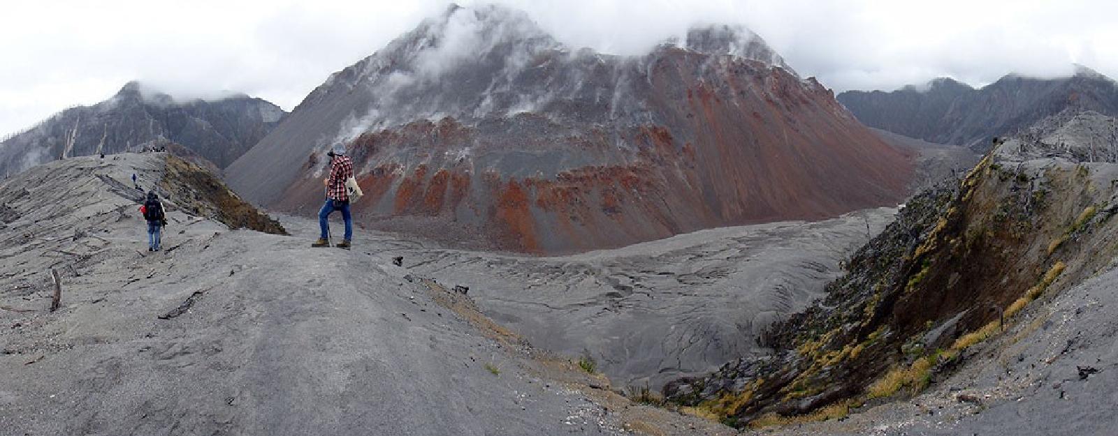
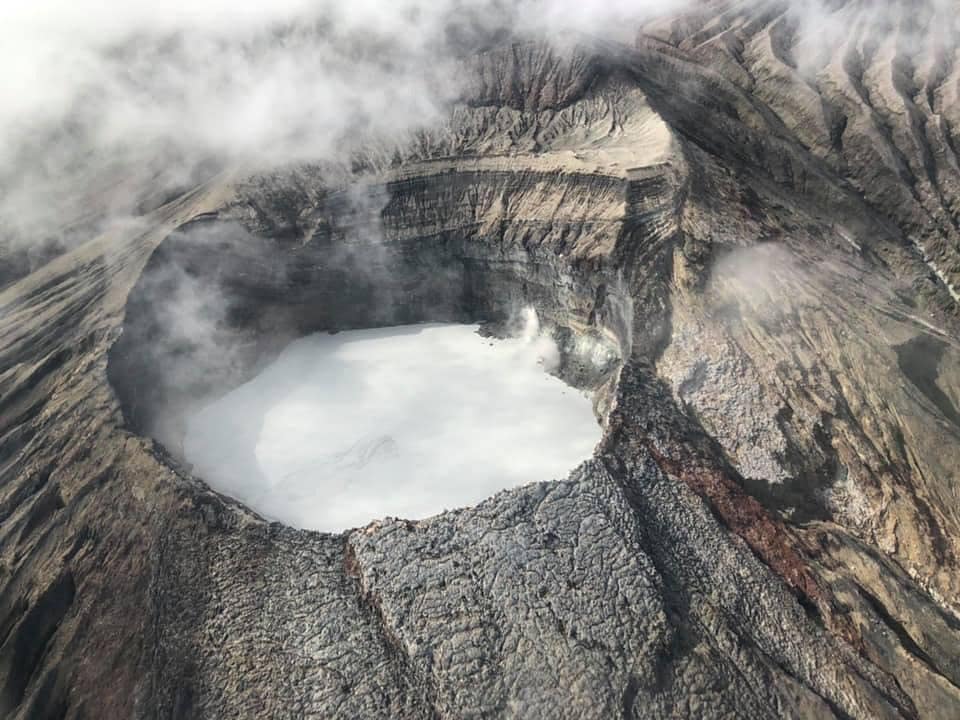
Chile , Chaiten :
During the period evaluated, a total of 34 seismic events were recorded, of which 26 were classified as being of the volcano-tectonic (VT) type, associated with rock fracturing processes. The event of greatest energy had a local magnitude (ML) equal to M 1.0, and was located 7.5 km north-east of the dome, at a depth of 4.1 km. Also, six hybrid seismic events (HB) were recorded, in relation to a complex mechanism (fracturing process of rigid material and fluid dynamics within the volcanic edifice), the most important one presenting a value reduced displacement (DRc) equal to 345 cm2 and a maximum magnitude equal to 2.2.
Finally, two long-period type earthquakes associated with the transit of fluids inside the magmatic ducts were recorded, with a maximum displacement value (DRc) of 9.8 cm2
The images provided by the IP cameras installed around the volcano, showed a superficial activity of a maximum height of 250m and an incandescence during the night.
No sulfur dioxide (S02) emissions have been reported in the area near the volcanic building, according to data published by the Ozone Observatory Sulfur Dioxide Group (http: // mon2.gsfc.nasa.gov/). ) and the National Information and Satellite Data Service on the Environment (NESDIS) (http://satepsanoine.nesdis.noaa.gov).
There have been 9 reports of thermal warnings in the area associated with the volcanic complex during the period, with a maximum of 2.8 MW radiated volcano power (PVR) as of 29 March, which is considered low, according to the data processed by the mean infrared observation of volcanic activity (MIROVA) (http://www.mirovaweb.it/) and the temporal thermal monitoring of global hot spots (MODVOLC) (http: //modis.higp.hawaii. edu /).
The activity remains at levels considered low and suggest a relative stability of the volcanic system.
Because of the above, the volcanic warning is kept at the level:
GREEN LEVEL: Changes in the behavior of volcanic activity – Probable time for an eruption: WEEKS / MONTH.
Source : Sernageomin.
Photo : Carlos09
Hawaï , Kilauea :
19°25’16 » N 155°17’13 » W,
Summit Elevation 4091 ft (1247 m)
Current Volcano Alert Level: NORMAL
Current Aviation Color Code: GREEN
Activity Summary:
Kīlauea Volcano is not erupting. Monitoring data over the past eight months have shown relatively low rates of seismicity, deformation, and gas emission at the summit and East Rift Zone (ERZ) including the area of the 2018 eruption.
As of last week, Kīlauea Volcano is at NORMAL/GREEN. For definitions of USGS Volcano Alert Levels and Aviation Color Codes, see: https://volcanoes.usgs.gov/vhp/about_alerts.html
Despite this classification, Kīlauea remains an active volcano, and it will erupt again. Although we expect clear signs prior to a return to eruption, the time frame of warning may be short. Island of Hawaiʻi residents should be familiar with the long-term hazard map for Kīlauea Volcano and how to stay informed about Kīlauea activity.
Observations:
This past week saw no significant change in monitoring data or volcanic activity. Low rates of seismicity continue across the volcano, with earthquakes occurring primarily in the summit and south flank regions. GPS stations and tiltmeters continue to show motions consistent with refilling of the deep East Rift Zone magma reservoir. Sulfur dioxide emission rates from the summit and from Puʻu ʻŌʻō remain low. These rates have been steady over the past several months.
A GPS station on the north flank of Puʻu ʻŌʻō has been showing steady slumping of the craters edge, and the motion has continued this week. This motion is not directly related to magmatic activity, but is interpreted to be sliding of the unstable edge of Puʻu ʻŌʻō cone. Small collapses at Puʻu ʻŌʻō have occurred since the eruption due to instability.

Hazards remain in the lower East Rift Zone eruption area and at the Kīlauea summit. Residents and visitors near the 2018 fissures, lava flows, and summit collapse area should heed Hawaii County Civil Defense and National Park warnings. Hawaii County Civil Defense advises that lava flows and features created by the 2018 eruption are primarily on private property and persons are asked to be respectful and not enter or park on private property.
The Hawaiian Volcano Observatory (HVO) continues to closely monitor Kīlauea’s seismicity, deformation, and gas emissions for any sign of increased activity. HVO maintains visual surveillance of the volcano with web cameras and occasional field visits. HVO will continue to issue a weekly update (every Tuesday) until further notice, and we will issue additional messages as warranted by changing activity.
Source : HVO
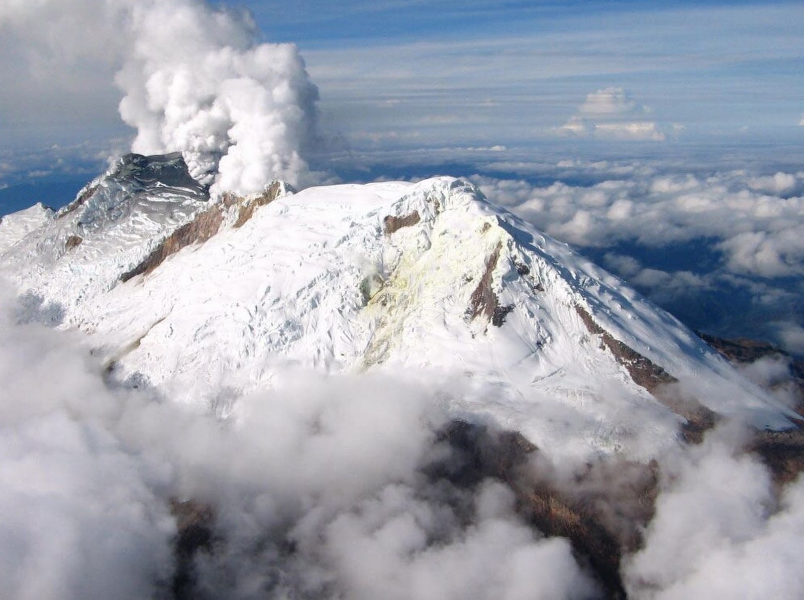
Photo et video : USGS
Colombia , Nevado del Huila :
Weekly activity bulletin of Nevado del Huila
The level of activity of the volcano continues at the level: yellow activity level or (III): changes in the behavior of volcanic activity.
Based on the analysis and evaluation of the information obtained through the surveillance network of the Nevado del Huila volcano, from 26 March to 1 April 2019, the GEOLOGICAL SERVICE OF COLOMBIA – Volcanological and Seismological Observatory of Popayán informs that:
During the evaluated period, 612 seismic events were recorded, 433 were related to rock fracturing processes (type VT) and 179 were related to fluid dynamics in volcanic canals. Of these, 164 were classified as long-period type events (LP type), 13 as low energy Tremor pulses (TR type) and two (2) events associated with fracture mechanisms and fluid transit. have been classified as hybrids (HB type).
During this period, volcano-tectonic events continued to be recorded north-east of the volcanic building, at a distance from the central peak oscillating between 9 and 22 km and with depths between 6 and 12 km.
The images obtained during the week by the web cameras of Caloto, Tafxnú, Maravillas and La Palma showed a weak degassing of the volcanic system.
Sensors for monitoring soil deformation, magnetic fields and infrasound waves have not recorded any variations associated with changes in volcanic activity.
It is repeated that, although the VT seismicity located to the northeast of the Nevado del Huila volcano is in its zone of influence, these events occur in an area
tectonically active.
Until now they have not affected the other parameters of volcanic monitoring; therefore, the level of activity of the volcano has not been changed, and continues at the Amarillo level or level III.
Source : SGC
Photo : SGC
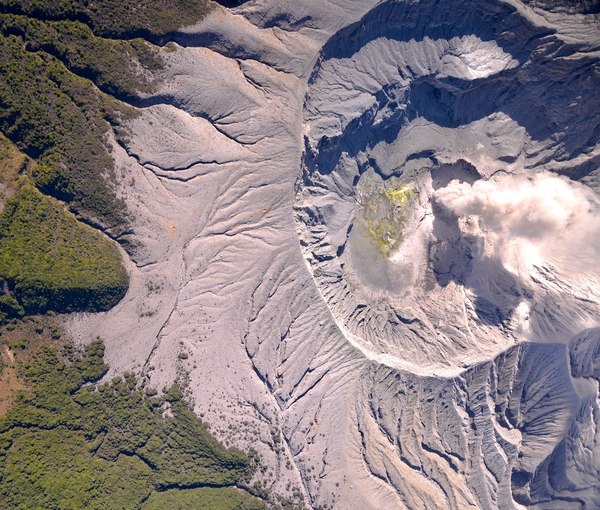
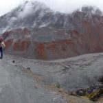
Costa Rica , Turrialba / Poas / Rincon de la Vieja :
Daily report of the state of volcanoes. OVSICORI-UNA
Turrialba Volcano: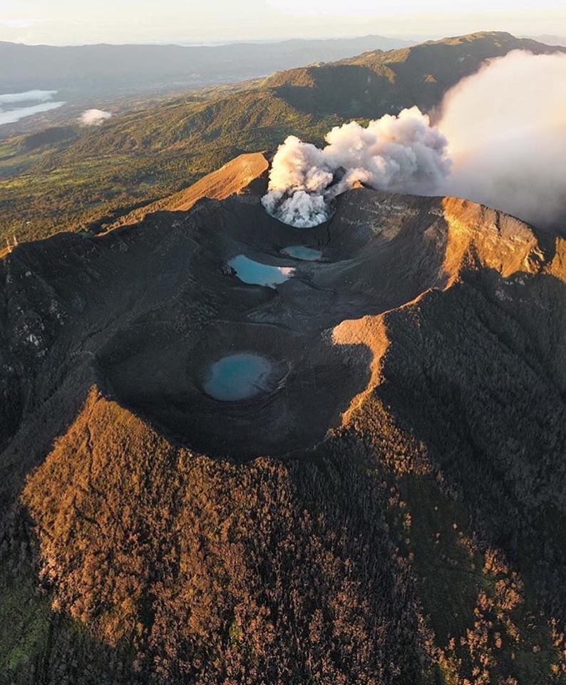
No eruption is reported.
The seismic activity is similar to that of yesterday.
At the time of this report, winds are blowing from the south.
Poas Volcano:
No eruption is reported.
The seismic activity is more important compared to the day yesterday.
At the time of this report, winds are blowing from the south.
There has been a slow downward trend in the CO2 / SO2 ratio over the last week. There is an increase in the number of LP type earthquakes today compared to yesterday.
Rincon de la Vieja Volcano:
No eruption is reported.
The seismic activity is similar to that of yesterday.
The wind direction is unknown at the moment.
No reports of additional eruptions after the small eruption of the previous days.
Source : Ovsicori
Photos : jcarvaja17 ,Federico Chavarría Kopper , Chris Allen.


No comment yet, add your voice below!