
January 15 , 2019.
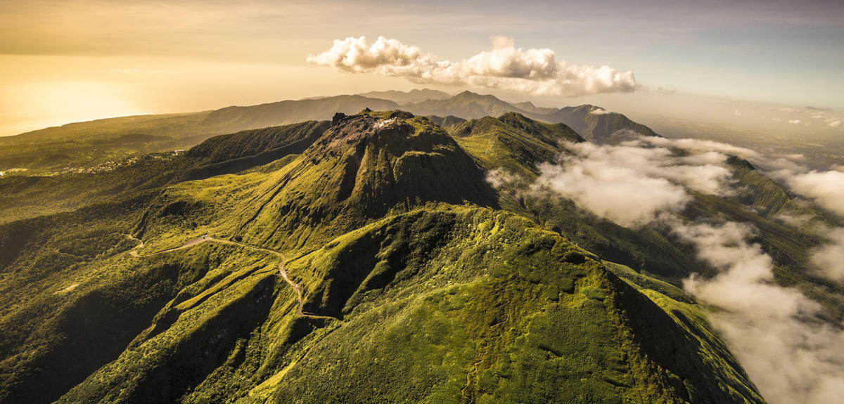
El Salvador , San Miguel ( Chaparrastique ) :
Special Report 11. The activity on the Chaparrastique volcano remains stable.
The data obtained through the monitoring with which the activity of the Chaparrastique volcano is monitored have remained stable. Occasional gas pulses continue to exit the crater and their height does not exceed 150 meters. The color of these is whitish, indicating a greater component of water vapor. However, yesterday at 18:00, a pulse was observed and the local observers network reported a smell of sulfur in the hamlet of Las Cruces, located 5.5 km northwest of the crater (Figure 1). The prevailing winds in the area dissipate the gases coming from the West.
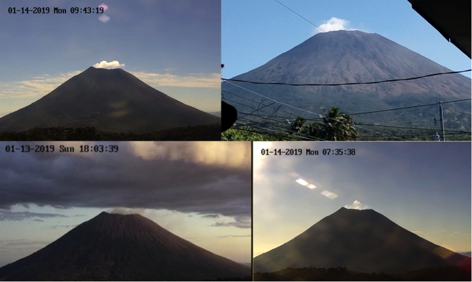
Figure 1. The emission of gas is almost imperceptible in the volcano.
As of Friday, January 11, 2019, the recorded seismic amplitude data are stable, indicating that the volcano’s internal system is relaxing and could reach equilibrium.
In the last 24 hours, seismic vibration (RSAM) values have fluctuated between 76 and 122 units in their middle (Figure 2).
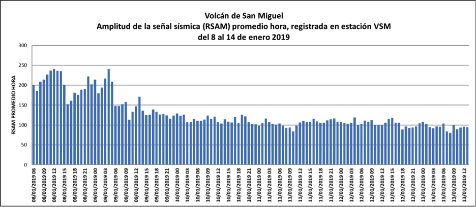
Figure 2. The behavior of the seismicity of the volcano remained stable.
The flux of sulfur dioxide emitted by the volcano fluctuated during the month of January 2019 between 210 and 388 tons per day, values considered as normal.
The analysis of the current situation suggests that the internal system of the volcano seeks its balance, so that its activity tends to fall.
MARN continues the systematic monitoring of the volcano and maintains close communication with the Directorate General of Civil Protection and local observers; also urges residents and the general public to stay away from the crater as the volcano may show sudden changes in its activity.
The next update will take place on Friday, January 18, 2019. In the event of a material change, an advance special report will be published.
Source : Marn
Photos : Marn , volcanohotspot /
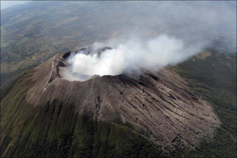
Peru , Sabancaya :
An average of 23 explosions a day was recorded. The activity associated with fluid movements (long period type) continues to predominate. Earthquakes associated with the rise of magma (hybrid types) remain very few and low energy.
The columns of gas and eruptive ash reached a maximum height of 3,500 m above the crater. The dispersion of these materials occurred within a radius of about 30 km, mainly to the southwest and northwest sectors.
The deformation of the surface of the volcanic building does not present any significant changes.
The MIROVA satellite system recorded 8 thermal anomalies, with values between 2 and 11 MW VRP (Radiated Volcano Energy).
In general, eruptive activity maintains moderate levels. No significant changes are expected in the coming days.
Source : IGP
Photo : Auteur inconnu
Guadeloupe , La Soufrière :
Monday, January 14, 2019 at 18:45
Sequence of earthquakes in the Soufrière area of Guadeloupe – Basse Terre.
The sequence of volcanic earthquakes that began on Tuesday January 8, 2019 at 00:59 local time (January 8, 2019 04h59 UTC time *) in the La Soufrière volcano area, continues with the recording of 598 earthquakes since its biginning.
Earthquakes are of very low magnitude (M <1). No earthquakes were reported. The events are located at a depth of <2.5 km under the summit of the dome of La Soufrière.
The alert level remains: yellow, vigilance.
Source : Direction de l’OVSG-IPGP
Photo : A. Brusini hemis-fr.
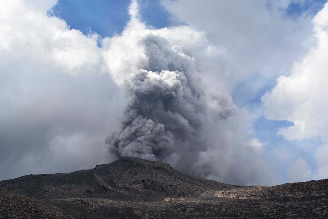
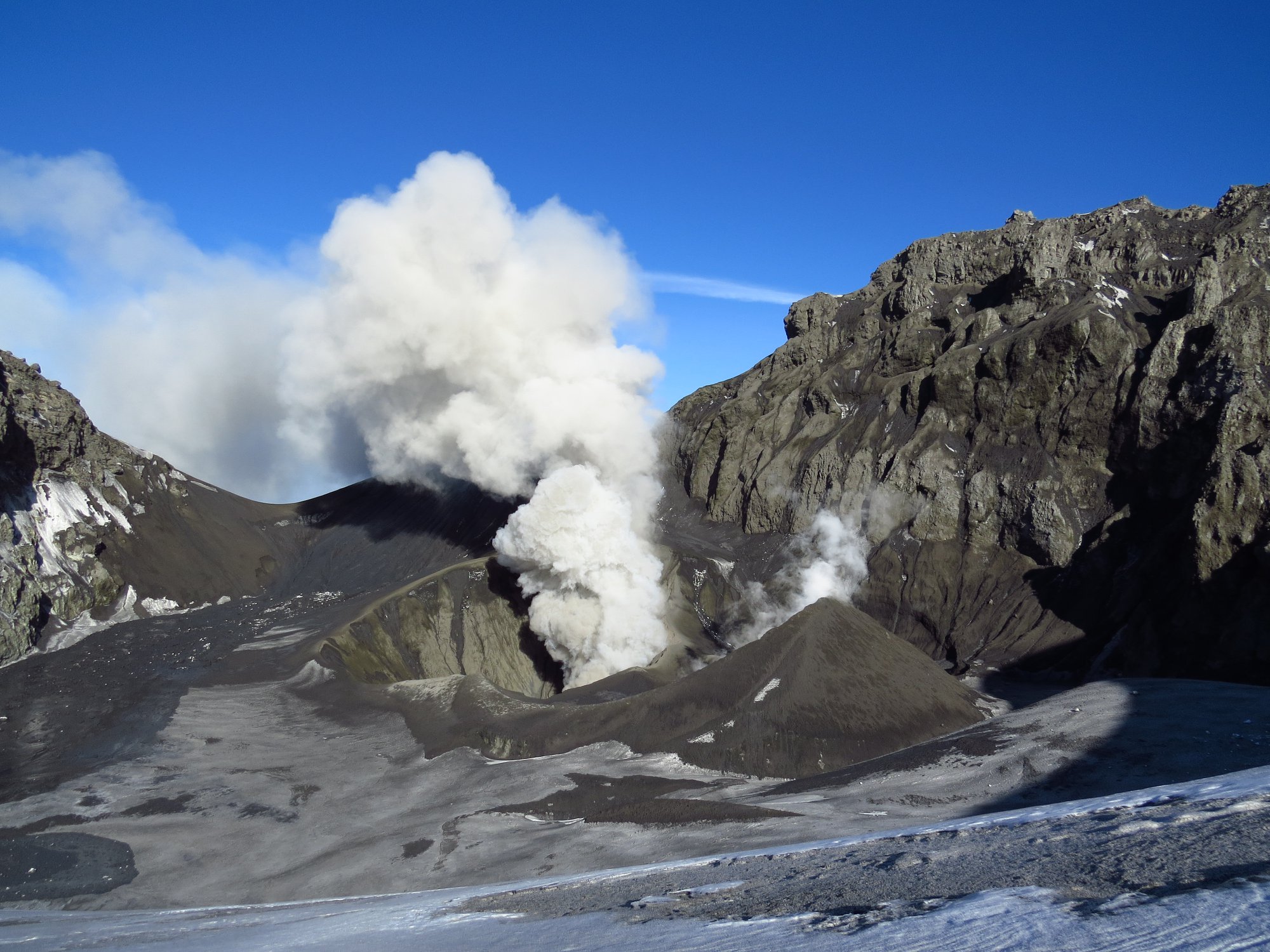
Chile , Copahue :
During this period, 145 seismic events classified as volcano-tectonic (VT) were recorded, associated with fracturing processes of rigid materials. The event with the greatest energy obtained a local magnitude equal to M 2.2 and was located 7.4 km north-northeast (NNE) of the active crater El Agrio, 2.0 km deep .
Similarly, 81 earthquakes associated with fluid dynamics were recorded under the volcanic building, classified as long-period type events (LP), with a maximum reduced displacement value (DRC) of 1.7 cm2. In addition, 12 very long period earthquakes (VLPs) were recorded, with a maximum reduced displacement value of 17 cm2.

The continuous tremor signal showed oscillations in its amplitude between low and medium intensity values with dominant frequencies between 1 and 3 Hz mainly.
IP cameras installed near the volcano recorded a constant degassing of the active crater (El Agrio) at a maximum height of 800 m with emissions of white colors, when the weather conditions allowed to observe the volcano. .
According to the analysis of the data obtained by four geodetic monitoring stations, small amplitude variations are observed, accentuated over the last 2 evaluated periods which could reflect variations inside the volcano, suggesting a small inflation. The calculated rates of change have a maximum of 0.9 cm / month in the vertical component.
Sulfur Dioxide (SO2) emissions from Differential Absorption Spectrometry (DOAS) equipment at Mellizas, located 5 km east-northeast of the active crater, had an average value of 429 + – 128 t / day, with a maximum value of 1112 t / day reported on December 22nd. SO2 emissions are considered moderate if one looks at the current state of the volcano.
No thermal warnings were reported in the area associated with the volcanic building during the reporting period, according to data processed by the mean infrared observation. volcanic activity (MIROVA) (http://www.mirovaweb.it/) and near-real-time thermal monitoring of global hot spots (MODVOLC) (http://modis.higp.hawaii.edu/) .
The monitoring parameters indicate a low activity, suggesting a balance of the system, characterized by low steam columns, no ash present, and no nighttime glow. Finally, the seismic swarm of December 6, described in a previous report, could reflect the repercussions of this trend of system stability.
Therefore, the alert level is maintained at the level:
YELLOW LEVEL: Changes in the behavior of volcanic activity – Probable time for an eruption: WEEKS / MONTH.
Observation: A zone of assignment is considered to be a radius of 1 kilometer around the crater.
Source : Sernageomin .
Photos : Sernageomin
Greece , Santorini :
Copy of the Volcanodiscovery message of January 13th.
An earthquake swarm has been occurring near the island since this morning. So far, 16 quakes of magnitudes between 2 and 3.9 and at depths ranging between about 30-6 km have been detected.
The quakes are clustered about half way between Santorini’s SW end and the Christiana Island group.
The strongest shock with magnitude 3.9 occurred at 10:27 local time and might have been felt weakly by residents of the southern part of Santorini.
Although the quakes are near the Kameni line, a tectonic lineament in SW-NE direction which has been the preferred location for magma ascent (i.e. formation of volcanic vents) in the volcano’s past few 100,000 years of history, there is currently no indication that the earthquakes are volcanic in origin. It is much more likely that they represent a normal tectonic event.
However, Santorini being both a popular tourist destination and an active volcano, the situation merits close monitoring.

Renowned Santorini (Thera), with its steep-walled caldera rim draped by whitewashed villages overlooking an active volcanic island in the center of a caldera bay, is one of the scenic highlights of the Aegean. The circular island group is composed of overlapping shield volcanoes cut by at least four partially overlapping calderas. The oldest southern caldera was formed about 180,000 years before present (BP), followed by the Skaros caldera about 70,000 years BP, and then the Cape Riva caldera about 21,000 years BP. The youngest caldera formed about 3600 years BP during the Late-Bronze-Age Minoan eruption that forced abandonment of the thriving Aegean Sea island. Post-Minoan eruptions beginning in 197 BCE constructed a series of lava domes and flows that form two islands near the center of the caldera. A submarine eruption took place in 1650 CE outside the caldera NE of Thera. The latest eruption produced a small lava dome and flow in 1950, accompanied by explosive activity.
Source : Volcanodiscovery ( https://www.volcanodiscovery.com/fr/santorini/current-activity.html ) , GVP.
Photo : wikipedia b gagnon


No comment yet, add your voice below!