
November 02 , 2018.
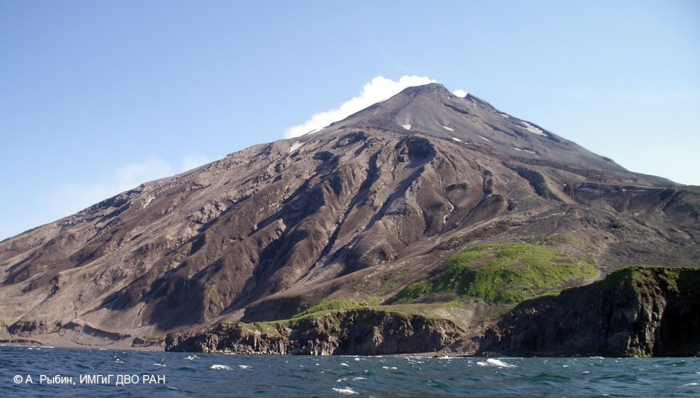
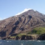
Russia / Central Kuriles , Sarychev Peak :
VOLCANO OBSERVATORY NOTICE FOR AVIATION (VONA).
Issued: November 01 , 2018
Volcano:Sarychev Peak (CAVW #290240)
Current aviation colour code:YELLOW
Previous aviation colour code:orange
Source:KVERT
Notice Number:2018-108
Volcano Location:N 48 deg 5 min E 153 deg 12 min
Area:Central Kuriles, Russia
Summit Elevation:4906.88 ft (1496 m)
Volcanic Activity Summary:
A moderate gas-steam activity of the volcano continues. According to satellite data, a thermal anomaly over the volcano was noted last time on 15 October, 2018, and ash explosions – on 10 October, 2018. The volcano was quiet or obscured by clouds on 16-31 October. KVERT continues to monitor Sarychev Peak volcano.
A moderate gas-steam activity of the volcano continues. The danger of ash explosions up to 32,800-49,200 ft (10-15 km) a.s.l. is remain. Ongoing activity could affect international and low-flying aircrafts.
Volcanic cloud height:NO ASH CLOUD PRODUSED
Other volcanic cloud information:NO ASH CLOUD PRODUSED
Source : Kvert.
Photo : A. Rybin, IMGG FEB RAS , 7/2009
Colombia , Cumbal :
Weekly Cumbal Volcano Activity Bulletin
The level of activity of the volcano is maintained at the level: LEVEL YELLOW ■ (III): CHANGES IN THE BEHAVIOR OF THE VOLCANIC ACTIVITY
Following the activity of the CUMBAL VOLCANIC COMPLEX, the COLOMBIAN GEOLOGICAL SERVICE (SGC) reports that:
Between October 23 and 29, 2018, there was an increase in seismicity associated with fluid movements and rock fracturing of the volcanic building. Despite this increase, the energy released by these earthquakes continues at levels considered low for the Cumbal volcano.
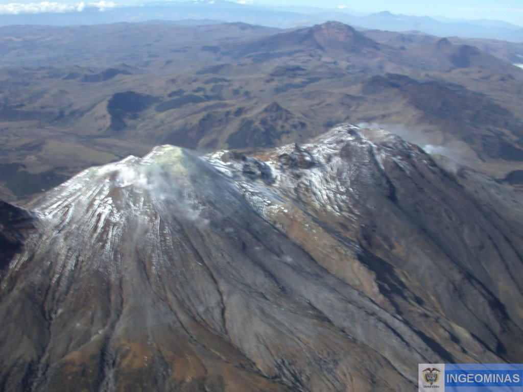
The seismicity associated with rock fracturing (volcano-tectonic earthquakes) was located near the La Plazuela crater (north-east of the Cumbal volcanic complex), at depths not exceeding 4 km from at the top (4700 m) and local magnitudes less than 0.5 on the Richter scale.
It was possible to observe gas emission columns coming from the El Verde fumarole field (North-East of the volcanic complex), white in color, at low pressure and at a low height, oriented in a dispersed manner in the direction of winds.
The COLOMBIAN GEOLOGICAL SERVICE is attentive to the evolution of the volcanic phenomenon and will continue to inform in a timely manner of the detected changes.
Source : SGC.
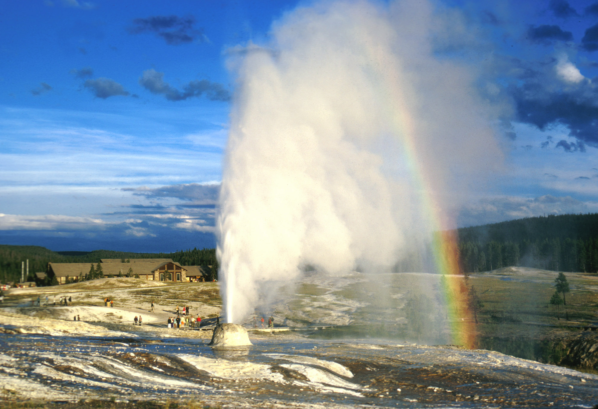
United-States , Yellowstone :
44°25’48 » N 110°40’12 » W,
Summit Elevation 9203 ft (2805 m)
Current Volcano Alert Level: NORMAL
Current Aviation Color Code: GREEN
Recent work and news
Steamboat geyser continued its pattern of near-weekly water eruptions during the month of October, with activity on October 8, 15, 23, and 31. There have now been 25 total Steamboat water eruptions in 2018. In the Upper Geyser Basin, activity at the new feature that formed on Geyser Hill in mid-September was very low throughout October. Field work during the past month was mostly aimed at preparing monitoring stations for the winter — for example, the 12-station semi-permanent GPS network was removed in early October. Those instruments will be reinstalled in May 2019.
Seismicity
During October 2018, the University of Utah Seismograph Stations, responsible for the operation and analysis of the Yellowstone Seismic Network, located 68 earthquakes in the Yellowstone National Park region. The largest event was a micro earthquake of magnitude 2.7 located about 14 miles east-southeast of West Thumb, WY, on October 21, at 03:06 PM MDT.
No swarm activity occurred during the month of October.
Yellowstone earthquake activity remains at background levels.
Ground deformation
Surface deformation recorded by GPS stations in the Yellowstone region is following the overall pattern of the past several months: uplift near the Norris Geyser Basin and subsidence of the caldera, all at rates of a few centimeters per year.
The Yellowstone Volcano Observatory (YVO) provides long-term monitoring of volcanic and earthquake activity in the Yellowstone National Park region. Yellowstone is the site of the largest and most diverse collection of natural thermal features in the world and the first National Park. YVO is one of the five USGS Volcano Observatories that monitor volcanoes within the United States for science and public safety.
Source : YVO
Guatemala , Fuego :
SPECIAL BEFGO VULCANOLOGICAL BULLETIN No. 190-2018 INCREASE ACTIVITY Guatemala October 31, 2018 at 11:30 am (local time)
Type of activity: Vulcanienne
Morphology: Composite stratovolcan
Location: 14 ° 28’54˝Latitude N; 90 ° 52’54˝Longitude W.
Height: 3,763msnm.
In the last few hours, the seismic activity recorded by the Fuego Volcano stations has increased in number and energy of explosions. The OVFGO Volcano Observatory reports moderate and some strong explosions, expelling gray ash columns of 4,400 and 4,700 meters above sea level. (14,435 to 15,419 feet) moving west and southwest over a distance of approximately 15 kilometers. Ash falls are reported on the villages of Sangre de Cristo, Morelia, Santa Sofia and San Pedro Yepocapa.
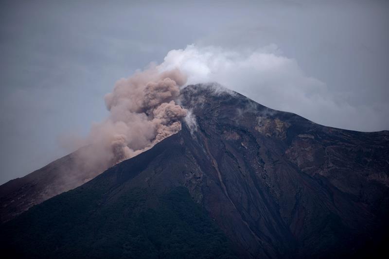
The explosions generate moderate and strong shock waves, accompanied by rumblings, sensitive to 25 km on the southwest flank, and west of the volcanic complex. The activity also causes constant avalanches of blocks along the slopes of the volcano, some of which reach the vegetation. The seismic recordings of stations around the volcano, note explosions, tremors, avalanches. There is a probability of generating lava flows in the next hours or days.
Source : Insivumeh
Photo : Archive inconnue.


No comment yet, add your voice below!