
October 16 , 2018.
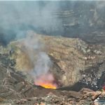
Costa Rica , Turrialba :
Turrialba Volcano Activity Report, 2018-10-15.
On October 15, 2018 at 05:42 local time, an eruption is recorded on the Turrialba volcano, with a column that rises to 1000 meters above the crater (4340 meters above sea level, 14235.2 ft).
Duration of the activity: in progress.
The winds blow towards the Northeast.
Ash falls are reported: To date, no ash fall has been reported.
Sulfur odor reported: No sulfur odor has been reported to date.
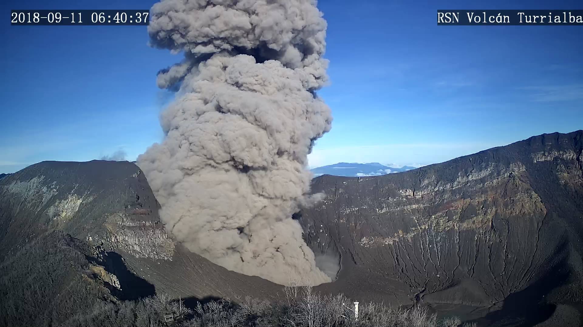
Comments: A column of ash and gas of nearly 1,000 meters is reported by the inhabitants of Paraíso de Cartago today October 15, 2018 at 05:42 hours. Then the seismographs recorded an explosion signal at 6:16.
Last night, October 14, 2018 at 17:12, the seismographs recorded a more energetic explosion than that of 6:16 today 15 October. The height of the eruption of last night is not known because of the strong clouds on the top of the volcano. Since the October 14 explosion, Turrialba has experienced a moderate eruption of ash and gas.
Since the end of August 2018, the Turrialba volcano has increased its activity and emits ashes and gases more persistently.
Source : Ovsicori.
Photo : Archive RSN , 11/09/2018.
Indonesia , Merapi :
ACTIVITY REPORT OF MONT MERAPI, from 5 to 11 October 2018.
I. RESULTS OF OBSERVATION
Visual
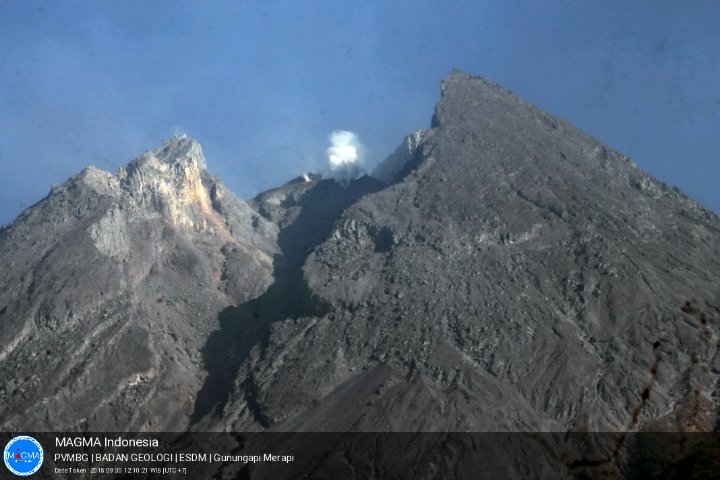
The weather is clear in the morning and in the evening, the afternoon and the foggy evening. The observed smoke from the crater is white, thick, with low gas pressure. A maximum height of 75 m was observed from the observation post of Mount Merapi Selopada on October 10, 2018.
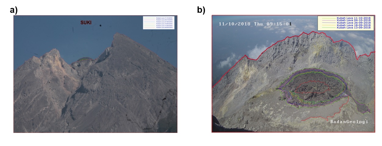
Dome of lava and morphology of the peak:
The morphological analysis based on photos of the Southeast sector shows morphological changes around the peak.
As of October 11, 2018, the volume of lava domes amounted to 160,000 m3 with an average growth rate of 3,100 m3 / day, higher than the previous week. Currently, the lava dome remains stable with a low growth rate (<20,000 m3 / day).
Seismicity:
During this week, Mount Merapi seismicity recorded 86 earthquakes, 6 volcanic earthquakes and shallow tectonics (VTB), 21 earthquakes (MP), 216 avalanche events (RF) , 41 low frequency earthquake and 10 tectonic earthquakes (TT). The high number of earthquake, avalanche and FL earthquake swarms this week showed that the lava dome continues to grow actively, even at a low rate.
Deformation
The deformation of G. Merapi which is being monitored by EDM and GPS this week has not shown any significant changes.
SO2 emissions:
During this week, the measurement of DOAS (Differential Optical Absorption Spectroscopy) gave an average value of maximum SO2 emission from Mount Merapi to 78.37 tonnes / day, still in the normal range.
Rains and Lahar:
This week, there was no rain at the observation post on Mount Merapi.
Conclusions
Based on visual and instrumental observations, it was concluded that:
1. The lava dome is currently in a stable state with a relatively low growth rate.
2. The volcanic activity of Mount Merapi is still quite high and is at the activity level « WASPADA ».
Source : BPPTKG
Photo : Magma Indonésie / Oystein Lund Andersen , 30 Septembre.
La Réunion , Piton de la Fournaise :
Activity Bulletin from Monday, October 15, 2018 at 3:00 pm (local time).
The eruption started on September 15th at 4:25 am local time continues. The intensity of the volcanic tremor (indicator of surface eruptive intensity) is still very slightly decreasing (Figure 1).
Piston gases (« gas flushes » or « tremor puffs ») at the eruptive site are always recorded by the OVPF seismometers.
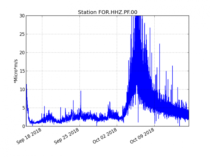
Figure 1: Evolution of RSAM (indicator of the volcanic tremor and the intensity of the eruption) between 04h00 (00h UTC) on September 15th and 14h30 (10h30 UTC) on October 15th on the FOR seismic station, located near the crater Chateau Fort (2000 m altitude on the southeast flank of the terminal cone). (© OVPF / IPGP)
– No volcano-tectonic earthquake was recorded during the day of 14 October or during the current day.
– Inflation (swelling) of the building is always recorded. This inflation reflects the pressurization of a localized source beneath the summit craters (Bory-Dolomieu) at a depth of 1-1.5 km, related to the recharge of the superficial reservoir by deeper magma.
– The surface flow rates could not be accurately estimated today because of lava flows that are too weak at the surface.
– Most of the activity is still predominantly in lava tunnels. The upstream part of the main tunnel is still rooted from the eastern base of the eruptive cone (Figure 2).
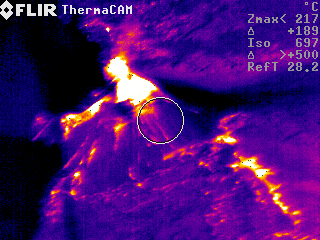
Figure 2: Thermal image of the eruptive vent on 14/10/2018 at 09:45 local time. (© OVPF / IPGP)
Alert level: Alert 2-2 – Eruption in the Enclos .
Source : OVPF . http://www.ipgp.fr/fr/ovpf/bulletin-dactivite-lundi-15-octobre-2018-a-15h00-heure-locale
Peru , Sabancaya :
An average of 17 explosions / day was recorded. The earthquakes associated with the rise of magma (hybrid type) are very few and low energy.
The columns of gas and eruptive ash reached a maximum height of about 2500 m above the crater. The dispersion of these materials occurred within a radius of about 30 km, mainly to the northeast, east, southeast and Southwest.

The volcanic gas (SO2) flow recorded on October 14 a maximum value of 3132 tons / day, a value considered important.
The deformation in the volcanic building did not show any significant variations.
Six thermal anomalies were recorded according to the MIROVA system, with values between 1 and 35 MW VRP (Radiated Volcano Energy).
In general, eruptive activity maintains moderate levels. No significant changes are expected in the coming days.
Source : IGP
Indonesia , Sangeang Api :
VOLCANO OBSERVATORY NOTICE FOR AVIATION – VONA.
Issued: October 15 , 2018 .
Volcano: Sangeangapi (264050)
Current Aviation Colour Code: ORANGE
Previous Aviation Colour Code: yellow
Source: Sangeangapi Volcano Observatory
Notice Number: 2018SAN03
Volcano Location: S 08 deg 12 min 00 sec E 119 deg 04 min 12 sec
Area: West Nusa Tenggara, Indonesia
Summit Elevation: 6237 FT (1949 M)
Volcanic Activity Summary:
Ash Emission with volcanic ash cloud at 05h38 UTC (13h38 local) and is continuing
Volcanic Cloud Height:
Best estimate of ash-cloud top is around 7037 FT (2199 M) above sea level, may be higher than what can be observed clearly. Source of height data: ground observer.
Other Volcanic Cloud Information:
Ash-cloud moving to west – northwest-southwest
Remarks:
Seismic activity is dominated with gas emissions and local tectonic earthquake
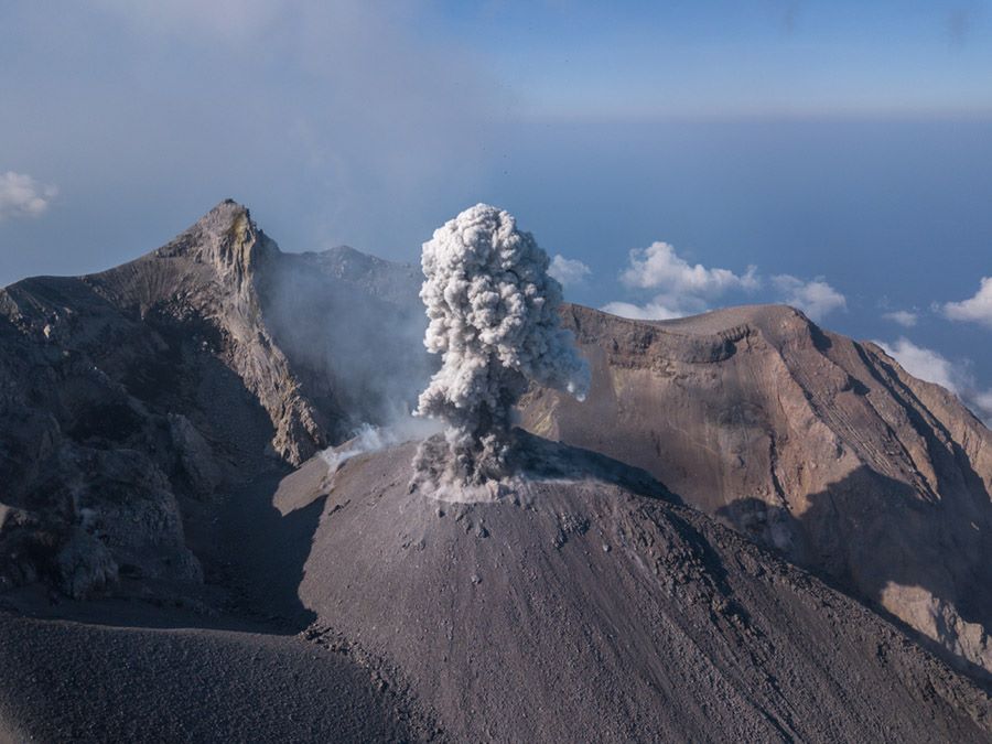
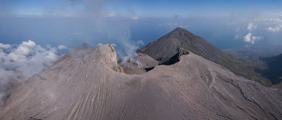
Sangeang Api volcano, one of the most active in the Lesser Sunda Islands, forms a small 13-km-wide island off the NE coast of Sumbawa Island. Two large trachybasaltic-to-tranchyandesitic volcanic cones, 1949-m-high Doro Api and 1795-m-high Doro Mantoi, were constructed in the center and on the eastern rim, respectively, of an older, largely obscured caldera. Flank vents occur on the south side of Doro Mantoi and near the northern coast. Intermittent historical eruptions have been recorded since 1512, most of them during in the 20th century.
Source : Magma Indonésie , GVP.
Photos : Martin Rietze , 30 Sept 2018. : https://www.facebook.com/groups/vulkane.net/


No comment yet, add your voice below!