
September 28 , 2018 .
Hawaï , Kilauea :
19°25’16 » N 155°17’13 » W,
Summit Elevation 4091 ft (1247 m)
Current Volcano Alert Level: WATCH
Current Aviation Color Code: ORANGE
Kīlauea summit and East Rift Zone
On Kīlauea Volcano’s lower East Rift Zone (LERZ), no significant incandescence was visible overnight in the collapse pit within the fissure 8 cone. Minor fuming has been visible during the day. Seismicity and ground deformation remain low at the summit of Kīlauea.
Rates of tilting throughout the East Rift Zone are much lower than those observed during the recent period of major eruptive activity. There has been no change in seismicity during the past week. Small aftershocks from the magnitude-6.9 earthquake in early May are still being generated along faults located on Kīlauea’s south flank.
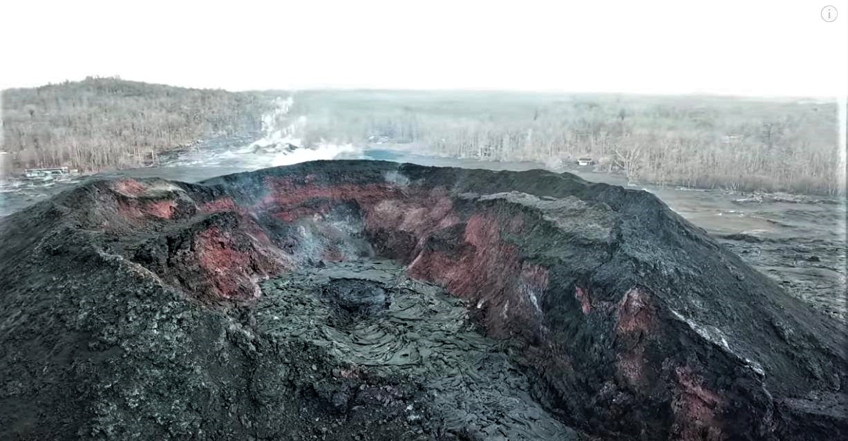
Sulfur dioxide (SO2) emission rates at the summit, Puʻu ʻŌʻō, and LERZ are drastically reduced; the combined rate is less than 1,000 tonnes/day, which is lower than at any time since late 2007. SO2 emission rates from LERZ vents were below the detection threshold of the measurement technique when last measured on September 11. Minor amounts of hydrogen sulfide (H2S) are being emitted at the summit, at Puʻu ʻŌʻō, and in the LERZ.
The Hawaiian Volcano Observatory (HVO) continues to closely monitor Kīlauea’s seismicity, deformation, and gas emissions for any sign of reactivation, and maintains visual surveillance of the summit and East Rift Zone. HVO will continue to issue daily updates and additional messages as needed.
Source : HVO
Photo : Dane DuPont
La Réunion : Piton de la Fournaise ,
Activity Bulletin of Thursday, September 27, 2018 at 17:00 (local time).
The eruption started on September 15th at 4:25 am local time continues. The intensity of the volcanic tremor (indicator of surface eruptive intensity) has remained relatively stable over the last 24 hours (Figure 1).
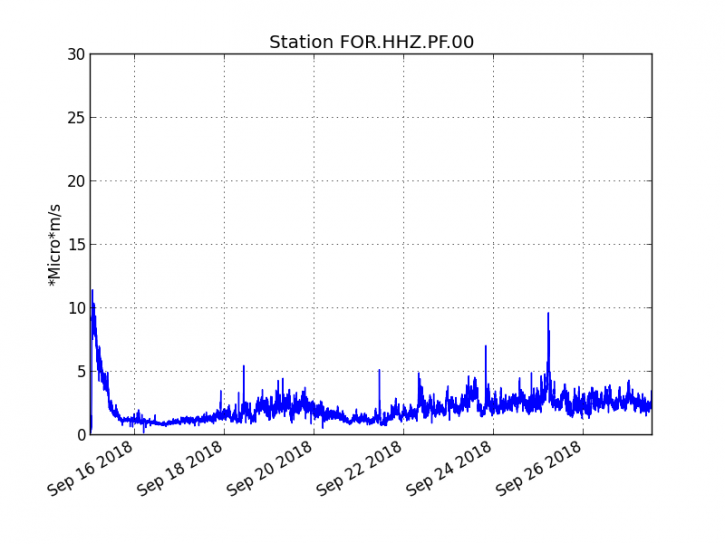
Figure 1: Evolution of the RSAM (indicator of the volcanic tremor and the intensity of the eruption) between 04h00 (00h UTC) on September 15th and 16h30 (12h30 UTC) on September 27th on the FOR seismic station, located near the crater Chateau Fort (2000 m altitude on the southeast flank of the terminal cone).
-No volcano-tectonic earthquake was recorded during the day of September 26 or during the current day.
– No significant deformation is noticeable.
– The surface flows estimated from the satellite data, via the HOTVOLC platform (OPGC – Clermont Auvergne University) are maintained and are always between 1 m3 / s and 3 m3 / s over the last 24 hours.
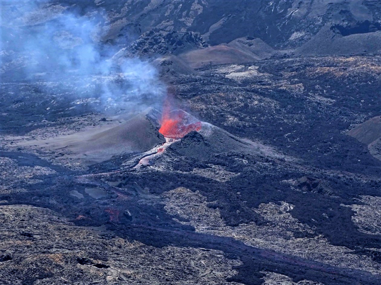
– The cone continues its construction, it is now completely closed for two days and surmounted by a summit mouth from which lava projections escape.
Observations made today in the field show that activity in lava tunnels is now dominant. The flows escape south of the cone through a main tunnel and emerge by resurgences located about 150-200m downstream south of the cone.
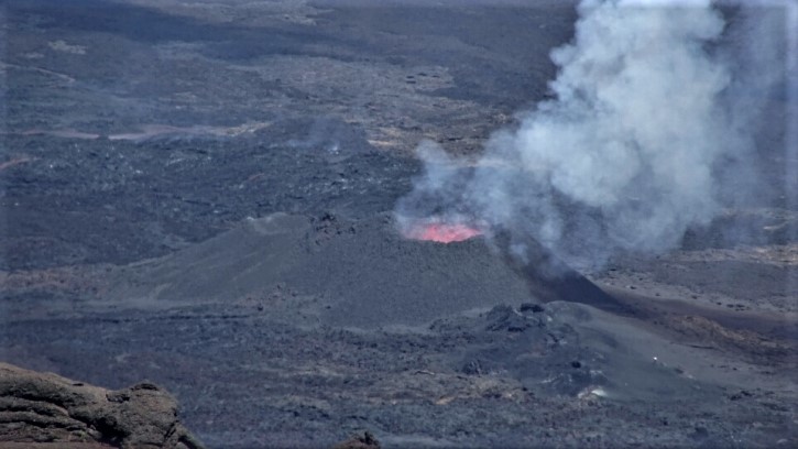
Figure 2: Shooting of the eruptive site on September 27, 2018 at 12:00 local time. (OVPF / IPGP)
Alert level: Alert 2-2 – Eruption in the Enclos.
Source : OVPF.
Alaska , Veniaminof :
56°11’52 » N 159°23’35 » W,
Summit Elevation 8225 ft (2507 m)
Current Volcano Alert Level: WATCH
Current Aviation Color Code: ORANGE
The eruption from Veniaminof volcano’s summit cone continues. Recent satellite images indicate the active lava flow has reached 0.9 km (0.56 miles) from the vent to the south. Seismicity remains elevated with continuous tremor. Webcam images showed intermittent incandescence overnight, but daytime views of the volcano have been largely obscured by clouds. Recent satellite data do not show elevated surface temperatures, likely due to cloud cover. No significant ash emissions have been observed or reported.

Photo of Veniaminof’s active vents and lava flow on 26 September 2018.
Veniaminof Volcano is monitored with a local real-time seismic network, which will typically allow AVO to detect changes in unrest that may lead to an explosive eruption. Rapid detection of an ash-producing eruption would be accomplished using a combination of seismic, infrasound, lightning, and satellite data.
Source : AVO
Photo : Lyons, John.
Kamchatka , Karymsky :
54.05 N, 159.44 E;
Elevation 4874 ft (1486 m)
Aviation Colour Code is ORANGE
A moderate eruptive activity of the volcano continues. Ash explosions up to 13,100-19,700 ft (4-6 km) a.s.l. could occur at any time. Ongoing activity could affect low-flying aircrafts.
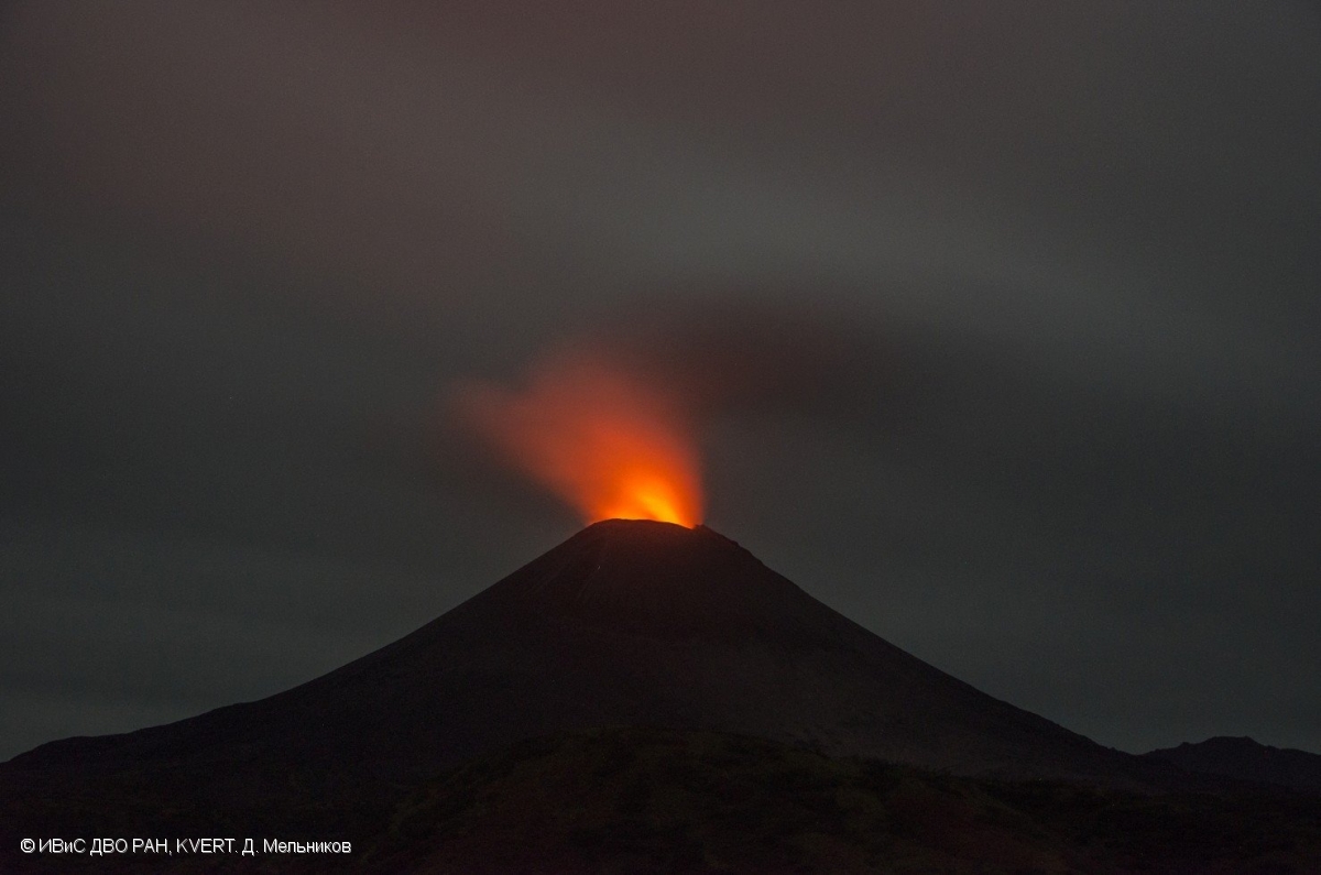
Fumarole activity of Karymsky volcano on 12 September, 2018.
A moderate eruptive activity of the volcano continues. Satellite data by KVERT showed ash plumes extended up to 365 km to the east from the volcano on September 22-23; and a thermal anomaly over the volcano on September 22-24; the volcano was obscured by clouds during other days of the Week.
Source : Kvert .
Photo : D. Melnikov, IVS FEB RAS, KVERT.


No comment yet, add your voice below!