
September 06 , 2018.
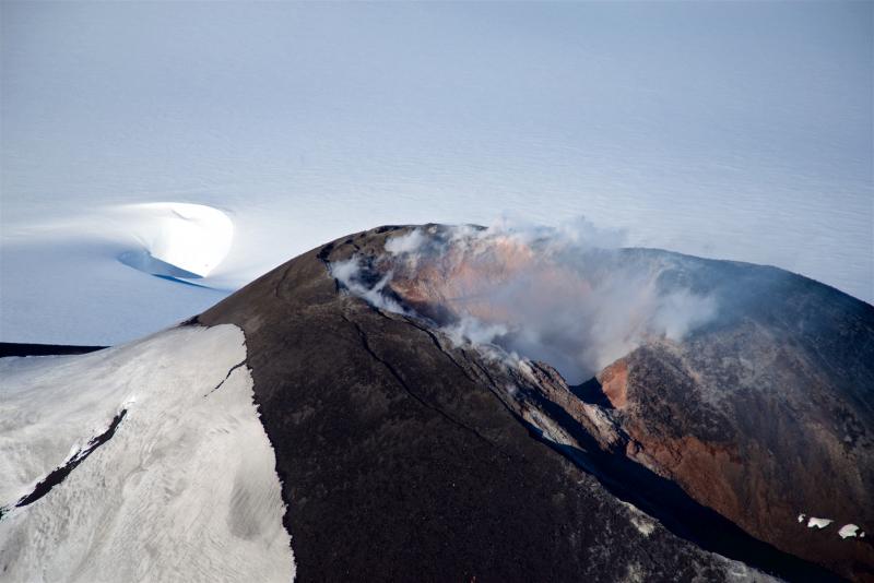
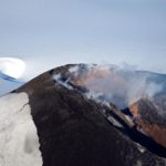
Alaska , Veniaminof :
56°11’52 » N 159°23’35 » W,
Summit Elevation 8225 ft (2507 m)
Current Volcano Alert Level: WATCH
Current Aviation Color Code: ORANGE
Unrest continues at Veniaminof. Seismic activity remains elevated. The FAA Perryville web camera showed frequent pulsatory low altitude ash plumes throughout the day yesterday and continuing this morning. A pilot report from this morning indicated a volcanic cloud from Veniaminof at an altitude less than10,000 ft asl and a small amount of ash deposited on the ice field. Small thermal features consistent with a hot vent area were observed in satellite data from the past day.
Veniaminof Volcano is monitored with a local real-time seismic network, which will typically allow AVO to detect changes in unrest that may lead to an explosive eruption. Rapid detection of an ash-producing eruption would be accomplished using a combination of seismic, infrasound, lightning, and satellite data.
Source : AVO.
Photo : Read, Cyrus.
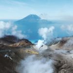
Colombia , Chiles / Cerro Negro :
The level of activity of volcanoes remains at the level : ■ YELLOW LEVEL (III): changes in the behavior of volcanic activity.
Following the activity of the CHILE volcanoes and CERRO NEGRO, the COLOMBIAN GEOLOGICAL SERVICE (SGC) reports that:
During the period from 28 August to 3 September 2018, seismicity in the Chiles – Cerro Negro volcanoes region increased in number and power from 527 to 905 events, mostly associated with rock fracturing. inside the volcano.
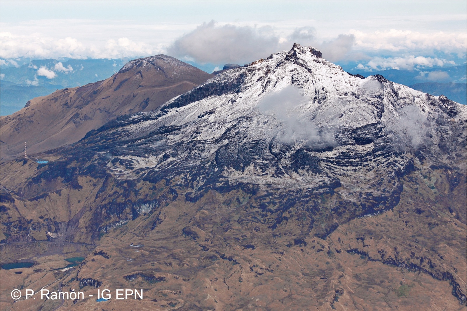
Figure 1. Southeast side of Chiles volcano. In the background you can see Mayasquer’s Cerro Negro (Photo: P. Ramón, IG EPN).
The earthquakes were located and located in 4 zones differentiated from the height of the upper Chiles volcano (4700 m). The first south Chiles volcano, at distances between 0.1 and 2.0 km, with depths between 3 and 4 km, the second zone in the southwest, at distances between 2.3 and 3 , 7 km, with depths between 4.5 and 6.0 km; the third zone to the southeast at distances of between 4.5 and 11.3 km with depths greater than 6 km and less than 15 km; and the fourth zone also to the southeast, at distances of 12.5 to 16 km with depths between 3 and 9 km from the summit (4700 m). The recording of 4 earthquakes of magnitude greater than 2.5 is highlighted, the largest of them with an ML of 3.0 on the Richter scale, recorded on 1 September at 9:44, located at 7.7 km southwest of Chiles volcano with a depth of 9.6 km, which would have been felt in the city of Chiles.
The Colombian Geological Survey and the Institute of Geophysics of the National Polytechnic School of Ecuador closely monitor the evolution of this seismic and volcanic activity and will report immediately on the changes detected.
Source : SGC
Indonesia , Anak Krakatau :
6.102°S, 105.423°E
Elevation 813 m
Based on satellite data, the Darwin VAAC reported that during 29-30 August and during 3-4 September ash plumes from Anak Krakatau rose to altitudes of 1.2-1.5 km (4,000-5,000 ft) a.s.l. and drifted SW, W, NW, and N. The Alert Level remained at 2 (on a scale of 1-4); residents and visitors were warned not to approach the volcano within 2 km of the crater.
Level of activity at Level II (WASPADA). ANAK. Krakatau (305 m above sea level) has experienced an increase in volcanic activity since 18 June 2018.
Since yesterday and until this morning, the volcano was visually covered with fog until it was clear. The winds were weak and oriented north and east. The smoke from the crater was white / gray, rising up to 200 m above the peak.
Thanks to the seismographs of September 5th, 2018, it was recorded:
Continuous tremor with a maximum amplitude of 3-45 mm (dominant value 35 mm)
Recommendations:
The community / tourists are not allowed to approach the volcano within a radius of 1 km around the crater.
VONA:
The last VONA received the color code ORANGE, published August 23, 2018 at 18:07 WIB, related to the eruption recorded with a seismogram of maximum amplitude of 27 mm for a duration of about 31 seconds. The height of the eruption column was about 1005 m above sea level or 700 m above the peak. The column of ashes was moving north-east.
Source : GVP , PVMBG .
Video : EVis Ka
United – States , Yellowstone :
44°25’48 » N 110°40’12 » W,
Summit Elevation 9203 ft (2805 m)
Current Volcano Alert Level: NORMAL
Current Aviation Color Code: GREEN
Recent work and news
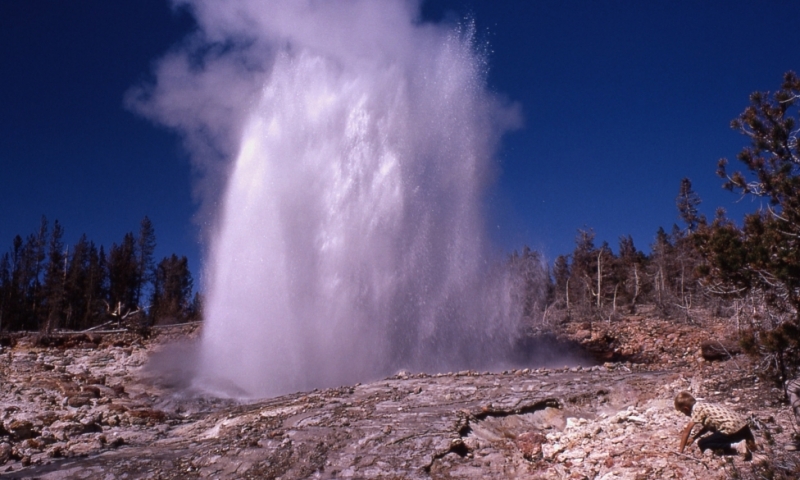
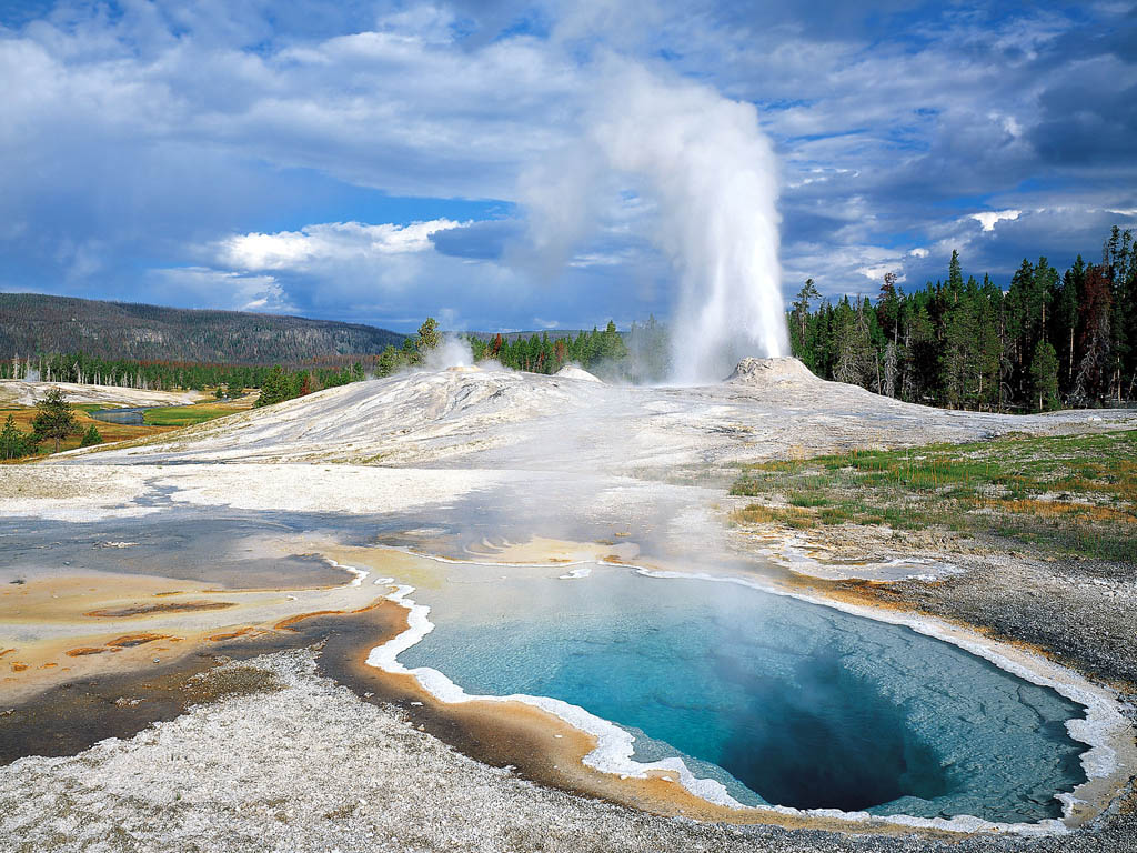
Steamboat geyser, in the Norris Geyser Basin, erupted three more times in August, on August 4, 22, and 27. Field work in the caldera area included geologic investigations to better understand the ages and characteristics of the numerous lava flows that erupted since the last caldera-forming event 631,000 years ago. In addition, the Hydrothermal Dynamics of Yellowstone Lake (HD-YLAKE; https://hdylake.org/) project, which involves a team of scientists from several institutions with major funding from the National Science Foundation, completed two weeks of field work that focused on the hydrothermal system that lies on the floor of Yellowstone Lake.
Seismicity
During August 2018, the University of Utah Seismograph Stations, responsible for the operation and analysis of the Yellowstone Seismic Network, located 102 earthquakes in the Yellowstone National Park region. The largest event was a micro earthquake of magnitude 2.5 located about 13 miles north-northwest of Pahaska Tepee, WY, on August 7, at 4:19 AM MDT.
A sequence of 13 earthquakes occurred about 8 miles north of West Yellowstone, MT, on August 2-3. The largest event was a micro earthquake of magnitude 2.2.
A sequence of 14 earthquakes occurred about 4 miles north of West Thumb, WY, on August 26. The largest event was a micro earthquake of magnitude 2.0.
A sequence of 12 earthquakes occurred about 14 miles south-southeast of Mammoth Hot Springs, WY, on August 29-30. The largest event was a micro earthquake of magnitude 2.4.
Earthquake sequences like these are common and account for roughly 50% of the total seismicity in the Yellowstone region.
Yellowstone earthquake activity remains at background levels.
Ground deformation
After showing little or no change in July, surface deformation recorded by GPS stations in Yellowstone resumed the trends that have been persistent since 2015. Stations in the caldera are subsiding by a few centimeters per year, while the station near the Norris Geyser Basin returned to uplifting by a few centimeters per year. The lack of measurable surface motion in July was probably an aberration caused by seasonal changes, perhaps due to surface and subsurface water conditions.
The Yellowstone Volcano Observatory (YVO) provides long-term monitoring of volcanic and earthquake activity in the Yellowstone National Park region. Yellowstone is the site of the largest and most diverse collection of natural thermal features in the world and the first National Park. YVO is one of the five USGS Volcano Observatories that monitor volcanoes within the United States for science and public safety.
Source : YVO


No comment yet, add your voice below!