
May 30 , 2018.
Pu’u ‘Ō’ō / Kilauea , Hawai :
Monday, May 28, 2018, 10:59 PM HST (Tuesday, May 29, 2018, 08:59 UTC)
19°25’16 » N 155°17’13 » W,
Summit Elevation 4091 ft (1247 m)
Current Volcano Alert Level: WARNING
Current Aviation Color Code: RED
Kīlauea Volcano Lower East Rift Zone
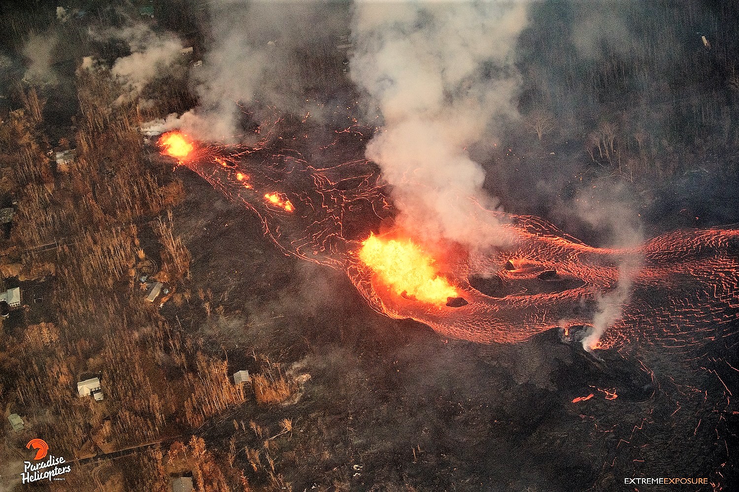
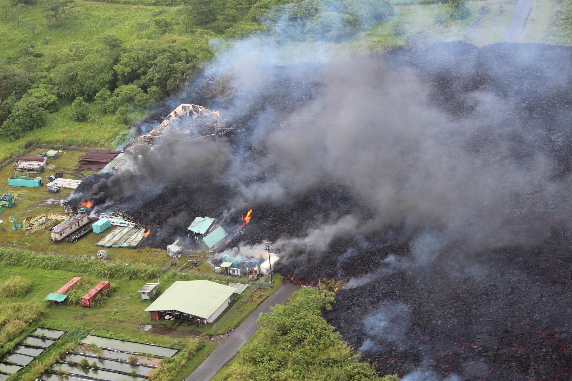
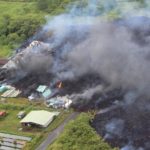
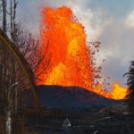
Vigorous eruption of lava continues from the lower East Rift Zone (LERZ) fissure system in the area of Leilani Estates and Lanipuna Gardens.
Late this afternoon, vigorous fountaining resumed at Fissure 8, spawning a fast moving flow that moved north along Luana Street. As of 10:00 PM HST the flow front had reached within 300 yards of Kahukai street. The flow is traveling an estimated 20 yards per hour to the northeast. An overflight early this evening showed that Fissures 16, 18, 22,13, and 20 were active, with a flow moving south from Fissures 16/18.
Pele’s hair from vigorous fountaining of Fissure 8 is being transported downwind, and there are reports of some strands falling in Pahoa. Residents are urged to minimize exposure to Pele’s hair (volcanic glass), which can cause skin and eye irritation similar to volcanic ash.
HVO field crews are on site tracking the fountains, lava flows, and spattering from multiple fissures as conditions allow and reporting information to Hawaii County Civil Defense. Crews are also checking on the status of ground cracks on Highway 130.
Volcanic gas emissions remain very high from the fissure eruptions. Trade winds are forecast to return in the coming days, meaning vog will impact the southern and western sides of the island.
Magma continues to be supplied to the lower East Rift Zone. Earthquake locations have not moved farther downrift in the past few days and the number of located earthquakes remains low.
Additional ground cracking and outbreaks of lava in the area of the active fissures are possible. Residents downslope of the region of fissures should heed all Hawaii County Civil Defense messages and warnings.
USGS/HVO continues to monitor the lower East Rift Zone activity 24/7 in coordination with Hawaii County Civil Defense.
Kīlauea Volcano Summit
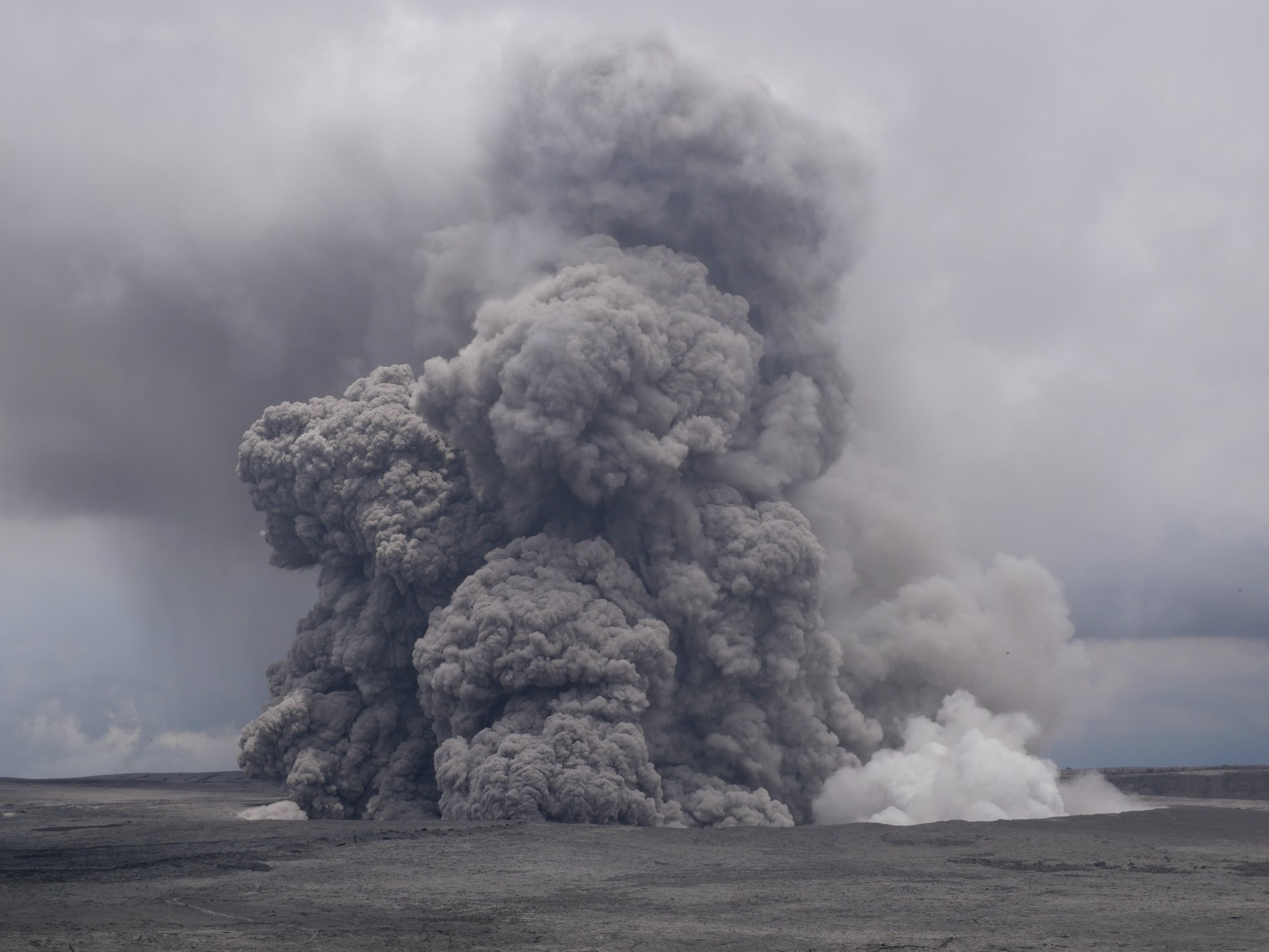
Ash continued to erupt intermittently from the vent within Halemaʻumaʻu crater, at Kīlauea’s summit. Winds have weakened and shifted in direction so that ash fall could occur in communities around the summit area.
A magnitude 4.1 earthquake occurred at 5:39 PM HST on the Koa’e fault zone south of the caldera. Earthquakes in the summit region continue as the summit area subsides and adjusts to the withdrawal of magma.
Additional explosive events that could produce minor amounts of ash fall downwind are possible at any time. Volcanic gas emissions at the summit remain high.
052918 County of Hawaii Civil Defense, 132 closed:
A message from COUNTY OF HAWAII
This is a Civil Defense Message for Tuesday, May 29 at 6:30 in the morning.
Highway 132 is being shut down between Lava Tree State Park to Four Corners, due to a fast moving lava flow approaching the highway. Everyone is advised to avoid the area. Beach Road is the only access into lower Puna. You are advised to make necessary plans and monitor your radio or phone for Civil Defense alerts.
Tuesday, May 29, 2018, 7:45 AM HST (Tuesday, May 29, 2018, 17:45 UTC)
Kīlauea Volcano Lower East Rift Zone
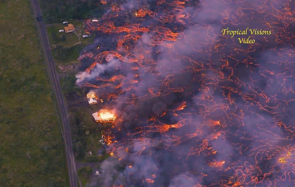
Fissure 8 reactivated yesterday afternoon and, overnight, was fountaining to heights of 200 feet at times and feeding a lava flow that was traveling to the northeast. That flow was moving atop the Fissure 8 flow that was active the previous night, passing on to open ground and crossing Pohoiki road at about 5 AM HST. As of 7 AM Tuesday morning, lava is advancing along the north margin of an earlier lava flow from Fissure 7 toward the PGV access road.
Visual observations early Tuesday morning also confirmed continued weak activity at Fissures 18, 19, and 20. Fissure 18 has produced channelized flows which have advanced about one-third of the way (1.2 mi) toward the coast.
Pele’s hair and and other lightweight volcanic glass from high fountaining of Fissure 8 are being transported downwind and falling to the west of the fissure. On Monday night, there were reports of Pele’s hair falling in Pāhoa. Residents are urged to minimize exposure to these volcanic particles, which can cause skin and eye irritation similar to volcanic ash.
Kīlauea Volcano Summit.
Ash continued to erupt intermittently from the vent within Halemaʻumaʻu crater, at Kīlauea’s summit. At 1:56 AM HST, there was a small explosion that sent ash to 15,000′ above sea level. The ash cloud rose vertically above the summit and drifted only slightly to the northwest owing to calm winds. The explosion was reported felt by a number of residents in the Volcano area, and it resulted in the emplacement of some incandescent blocks on the east floor/wall of Halemaʻumaʻu crater.
Tuesday, May 29, 2018, 4:51 PM HST (Wednesday, May 30, 2018, 02:51 UTC)
Kīlauea Volcano Lower East Rift Zone
Vigorous eruption of lava continues from the lower East Rift Zone (LERZ) fissure system in the area of Leilani Estates and Lanipuna Gardens.
Fissure 8 remained very active today fountaining to heights of 200 feet at times and feeding a lava flow that advanced atop the Fissure 8 ʻaʻā flow that was active Sunday night/Monday morning. The first lobe of this flow crossed highway 132 just before 2 pm HST Tuesday. Lava continues to advance toward the northeast
Visual observations early Tuesday afternoon also confirmed continued weak activity at Fissures 18 and 19. Fissure 18 has produced channelized flows which have advanced 1.6 mi toward the coast.
Source : HVO , Comté d’Hawaii.
Video : Ryan Finlay.
Photos : Bruce Omori , Kaiali’i Kahele , Mick Kalber , USGS
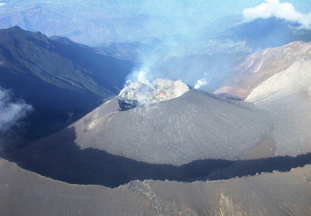
Galeras , Colombia :
Subject: Weekly activity bulletin of Galeras volcano
The level of activity of the volcano continues at the level:
YELLOW LEVEL ■ (III): CHANGES IN THE BEHAVIOR OF VOLCANIC ACTIVITY.
Following the activity of GALERAS VOLCAN, the COLOMBIAN GEOLOGICAL SERVICE informs that:
For the period between May 22 and May 28, 2018, seismic activity levels remained low in occurrence and released seismic energy, recording mainly the events associated with fracturing the rock within the volcanic building. The said seismicity was scattered around the volcano, at distances of less than 14 km from the main crater, with depths between 2.4 and 8 km from the summit (reference level at 4200 m) and local quantities up to 14 km. at M1.6 on the Richter Scale. During the evaluated period, when the climatic conditions in the volcano region were adequate, it was possible to observe the gas emissions of the main fumarolic volcanic cone fields, with a low outlet pressure, a white color, a low height and a variable dispersion according to the predominant direction of the winds in the area of the volcanic peak.
It should be noted that, on the morning of May 29, 2018, at 9:15, an earthquake associated with the fracturing processes of rocks inside the volcano, was reported as felt by the inhabitants of the town of Pasture . The magnitude was M4 on the Richter scale, a depth of about 5.3 km from the summit (reference level at 4200 meters) and it was located about 5.3 km northeast of the volcano. Until the publication of this bulletin, five other events were recorded in the same area, whose magnitudes were calculated between M0.7 and M2.1 on the Richter scale.
The COLOMBIAN GEOLOGICAL SERVICE remains attentive to the evolution of the volcanic phenomenon and will continue to inform in a timely manner of the observed changes.
Source : SGC.
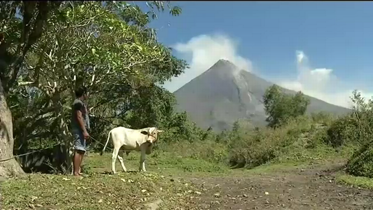
Mayon , Philippines :
MAYON VOLCANO BULLETIN 30 May 2018 08:00 A.M.
Mayon Volcano’s seismic monitoring network recorded three (3) volcanic earthquakes during the past 24 hours. Moderate emission of white steam-laden plumes from the summit that drifted southwest was observed throughout the day. Fair crater glow from the summit could be observed at night. Sulfur dioxide (SO2) emission was measured at an average of 1160 tonnes/day on 27 May 2018. Precise leveling data obtained on 02-14 April 2018 indicate inflation of the edifice relative to 22-29 March 2018, while electronic tilt data show sudden slight inflation of the mid-slopes beginning 05 May 2018. Medium-term ground deformation data, however, show that the edifice is still deflating consistent with the decline in unrest but is still inflated relative to 2010 baselines.
Alert Level 2 currently prevails over Mayon Volcano. This means that Mayon is at a moderate level of unrest. DOST-PHIVOLCS reminds the public that sudden explosions, lava collapses, pyroclastic density currents or PDCs and ashfall can still occur and threaten areas in the upper to middle slopes of Mayon. DOST-PHIVOLCS recommends that entry into the six kilometer-radius Permanent Danger Zone or PDZ and a precautionary seven kilometer-radius Extended Danger Zone or EDZ in the south-southwest to east-northeast sector, stretching from Anoling, Camalig to Sta. Misericordia, Sto. Domingo must be strictly prohibited. People residing close to these danger areas are also advised to observe precautions associated with rockfalls, PDCs and ashfall. Active river channels and those perennially identified as lahar prone areas in the southern and eastern sectors should also be avoided especially during bad weather conditions or when there is heavy and prolonged rainfall. Civil aviation authorities must advise pilots to avoid flying close to the volcano’s summit as airborne ash and ballistic fragments from sudden explosions and PDCs may pose hazards to aircrafts.
DOST-PHIVOLCS is closely monitoring Mayon Volcano’s activity and any new significant development will be immediately communicated to all stakeholders.
Source : Phivolcs.
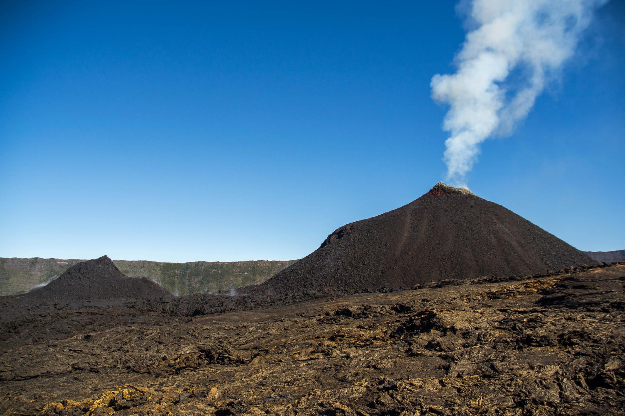
Piton de la Fournaise , La Réunion :
Activity Bulletin from Tuesday, May 29, 2018 at 3:00 pm (local time).
The eruption started on April 27, 2018 at 23:50 local time continues.
The intensity of the volcanic tremor (indicator of eruptive intensity on the surface) continues its progressive decline.
– An overview conducted this morning confirms that the lava flows occur almost exclusively in tunnel, a large degassing continues at the top of the main vent, and that very rare small arms of lava can be observed in the lava field. On the other hand, although the influence of the flow has changed over the last 15 days, the lava front has not progressed towards the east.
– The inflation of the building continues.
– Surface flow rates have become too low to be estimated from satellite data.
– No volcano-tectonic earthquake has been recorded during the last 24 hours under the Piton de la Fournaise volcano .
Source : OVPF
Photo : Frédérick LEVENEUR


No comment yet, add your voice below!