
April 26 , 2018.
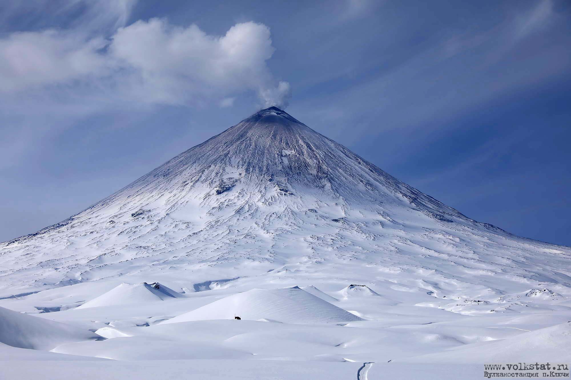
Klyuchevskoy , Kamchatka :
VOLCANO OBSERVATORY NOTICE FOR AVIATION (VONA).
Issued: April 25 , 2018.
Volcano:Klyuchevskoy (CAVW #300260)
Current aviation colour code:YELLOW
Previous aviation colour code:green
Source:KVERT
Notice Number:2018-38
Volcano Location:N 56 deg 3 min E 160 deg 38 min
Area:Kamchatka, Russia
Summit Elevation:15580 ft (4750 m)
The spring fieldwork on the Klyuchevskoy geodynamic chain was carried out by the Kamchatka Volcanic Station and the Remote Methods and Geodesy Laboratory. Time did not help us. It was snowing constantly with the wind, which greatly complicated the installation of the instruments at the points of the geodetic network. And instead of 10 days allocated for this work, they spent more than a month. As a result, all the planned measures have been carried out. Now the results of field measurements are being processed.
Volcanic Activity Summary:
A gas-steam activity of the volcano continues. According to visual data by volcanologists from the fly of Klyuchevskaya group of volcanoes on 25 April, sometimes an ash was noting in gas-steam bursts from the Klyuchevskoy volcano. Activity of the volcano is increasing.
Activity of the volcano continues. Ash explosions up to 16,400-19,700 ft (5-6 km) a.s.l. could occur at any time. Ongoing activity could affect low-flying aircraft.
Volcanic cloud height: NO ASH CLOUD PRODUSED
Other volcanic cloud information: NO ASH CLOUD PRODUSED
Source : Kvert.
Photo : Volkstat ru. ( Yu Demyanchuck)
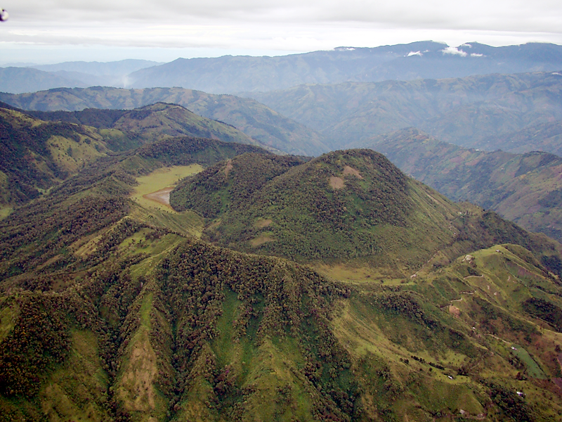
Cerro Machin , Colombia :
Subject: Cerro Machín Volcano Activity Bulletin.
The level of activity continues at the level: Yellow activity level or (III): changes in the behavior of volcanic activity.
With regard to monitoring the activity of the Cerro Machín volcano, the COLOMBIAN GEOLOGICAL SERVICE informs that:
During the last week, the Cerro Machín volcano recorded a seismic activity associated with the fracturing of the rocks that make up the volcano. This seismic activity was located on the west, southwest and southeast flanks of the main dome, at depths between 2.6 and 9.0 km.
The maximum magnitude recorded during the week was 0.3 ML (Local Magnitude) corresponding to two earthquakes recorded on March 20 and 23 at 10:58 and 12:58 (local time), located to the west and south of the main dome, at 4 , 8 and 2.6 km deep, respectively. The other monitored parameters did not show significant changes from previous records.
The COLOMBIAN GEOLOGICAL SERVICE is attentive to the evolution of the volcanic phenomenon and will continue to inform in a timely manner of the changes that may occur.
Source : SGC
Kirishimayama , Kyushu , Japan :
31.934°N, 130.862°E
Elevation 1700 m
An explosive eruption at Iwo-yama (also called Ioyama, NW flank of Karakuni-dake), a stratovolcano of the Kirishimayama volcano group, occurred at 15h55 on 19 April prompting JMA to raise the Alert Level to 3 (on a scale of 1-5). This was the first eruption in that area since 1768; frequent and recent activity has occurred from Shinmoedake (Shinmoe peak).
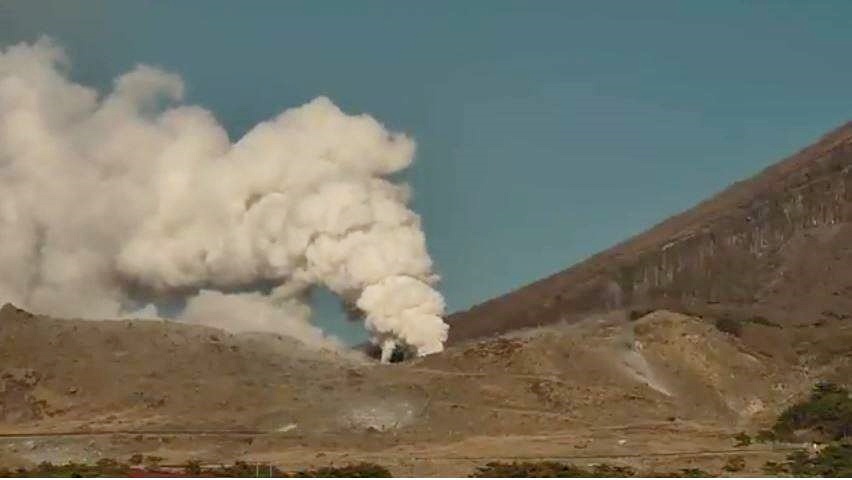
Ash plumes rose as high as 500 m above new vents in the SE part of the crater, and a large amount of ejected tephra including boulders were deposited around the crater area. Webcams showed expansion of vents by 21h00. A new fumarole was observed at 16h30 on 20 April in the vicinity of the highway, on the W side of Iwo-yama.

During overflights on 20 and 21 April scientists observed multiple vents with fumarolic emissions, and intermittent ejections of black-gray muddy water. The activity continued through 23 April.
Source: Agence météorologique japonaise (JMA)
Photo : Hayakawa Yukio
Popocatépetl , Mexico:
In the last 24 hours, through monitoring systems of the Popocatepetl volcano, 86 low intensity exhalations have been identified, accompanied by water vapor, gas and light amounts of ash. There were 4 explosions, two yesterday at 19:03 and 19:21, and two today at 4:38, 06:18, these explosions had eruptive columns of less than 1 km. In addition, yesterday there was a volcano-tectonic earthquake at 13:47 and three today at 02:05, 02:23 and 07:23, with amplitudes of M1,6, M2,0, M1,9 and M3,1 respectively . In addition to five minutes of harmonic tremor of low amplitude.
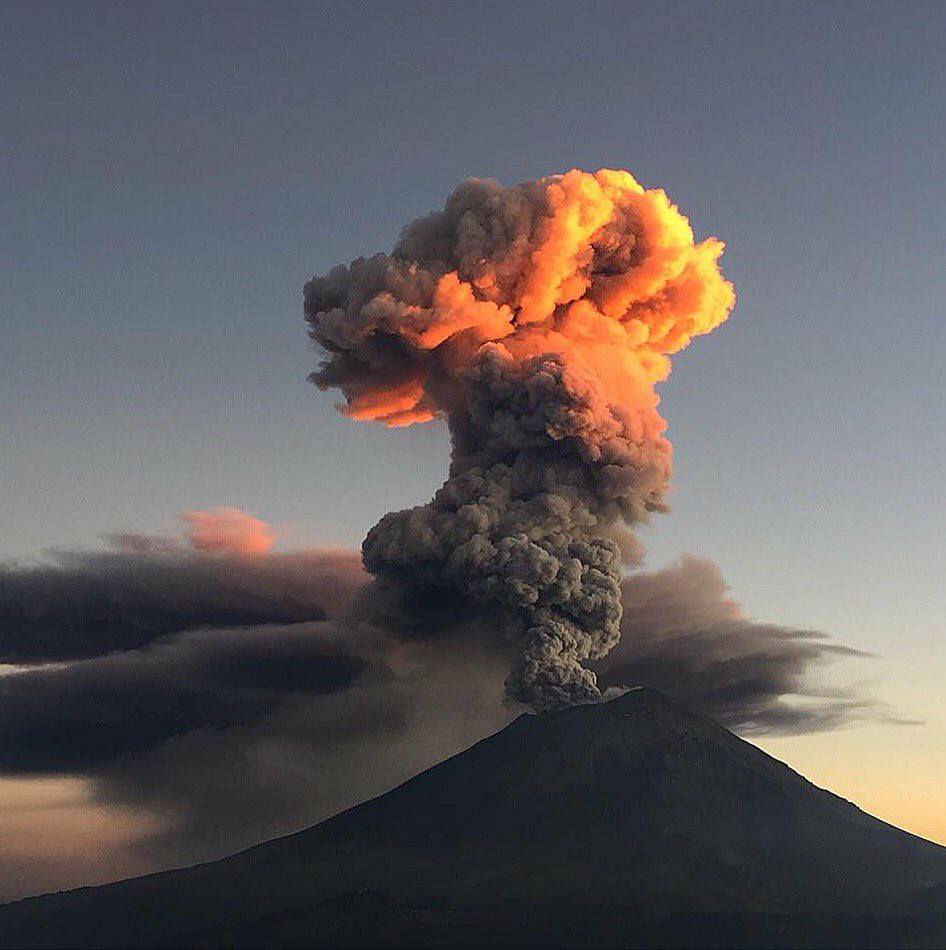
During the night there was mist on the crater of the volcano, however it was sometimes observed an incandescence which increased at the time of some exhalations.
From today morning and at the time of this report we observe that the wind disperses the emissions to the Southeast.
The volcanic warning light of the Popocatepetl volcano is located at Amarillo Phase 2.
Source : Cenapred
Nevados de Chillan , Chile:
36.868 ° S, 71.378 ° W
Elevation 3180 m
The Servicio Nacional de Geología and Minería (SERNAGEOMIN) Observatorio Volcanológico de Los Andes del Sur (OVDAS) reported a continuous activity from 17 to 18 April associated with the growth of the lava dome Gil-Cruz in the crater Nicanor of Nevados de Chillán. Seismicity consisted of long-term events and tremors associated with explosions. The webcam recorded pulsed white gas emissions with a probability of possible ash, night glow, and intermittent rock ejection from explosions. The alert level remained in Orange, the second highest level on a four-color scale. ONEMI has maintained a yellow alert level (the average level on a tricolor scale) for the communities of Pinto, Coihueco and San Fabián.
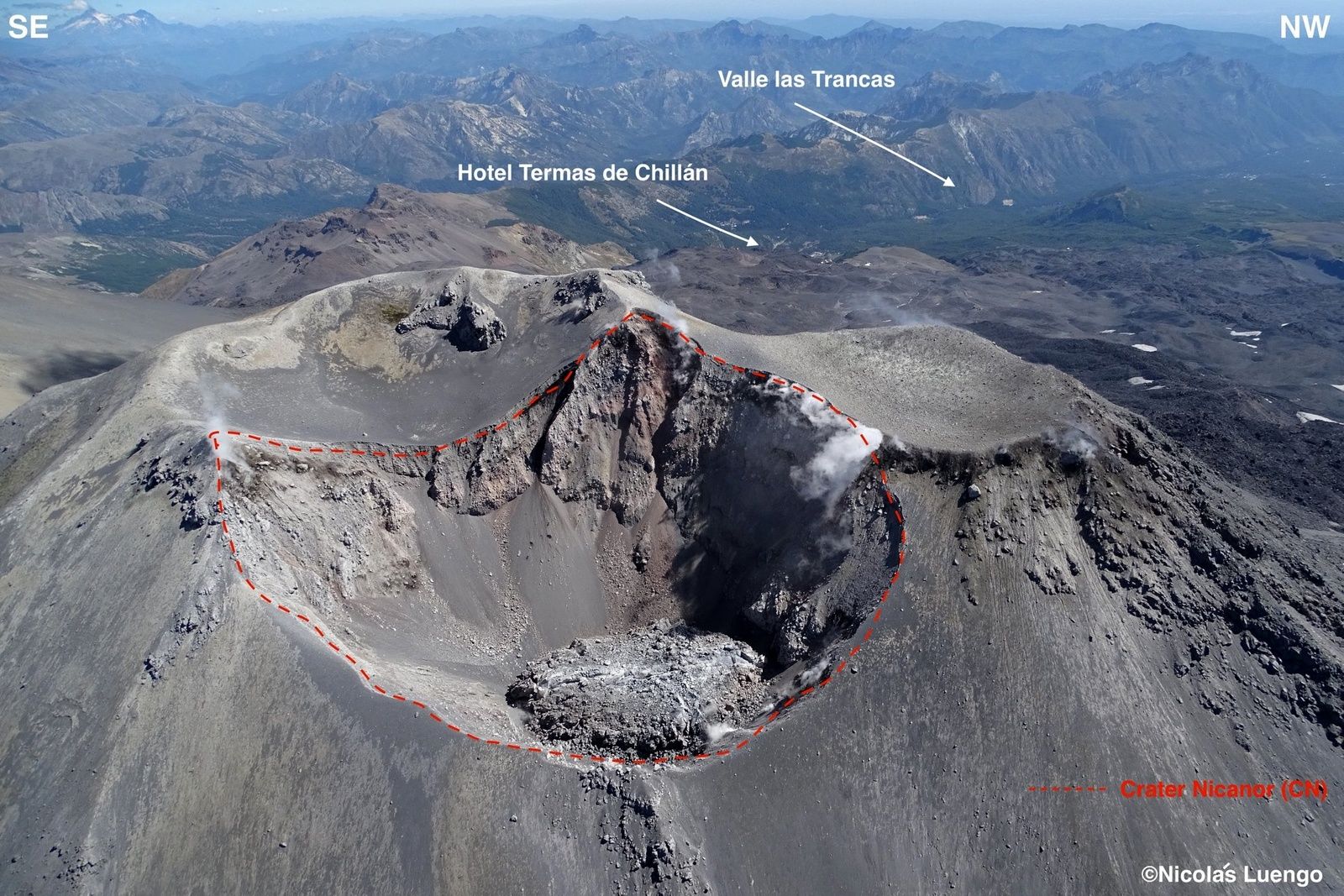
During the past 24 hours, the seismic monitoring network of the Nevados volcanic complex in Chillan has recorded the occurrence of long-period seismicity (LP) and tremor episodes (TR) as present in recent days, these two seismic signals associated with the appearance of explosions at the surface of the active crater and the extrusion dome located in the crater. Most of them were associated with moderate level energies. On the other hand, three (3) very low energy volcano-tectonic events were recorded (ML = 1.1).
Observations
The active degassing column of this process, observed from Ovdas IP cameras, showed essentially pulsatile behavior, with little vertical development and mainly whitish coloration, with preferential dispersion in the south direction (S). Intermittent nighttime glow was observed with incandescent projections reaching a maximum height of 100 m above the edge of the active crater.
Sources: Centre consultatif sur les cendres volcaniques de Buenos Aires (VAAC), Office national d’urgence-ministère de l’intérieur (ONEMI), Servicio Nacional de Geología y Minería (SERNAGEOMIN) , GVP.
Photo : Nicolas Luengo.