
April 20 , 2018.
Ioyama , Japan :
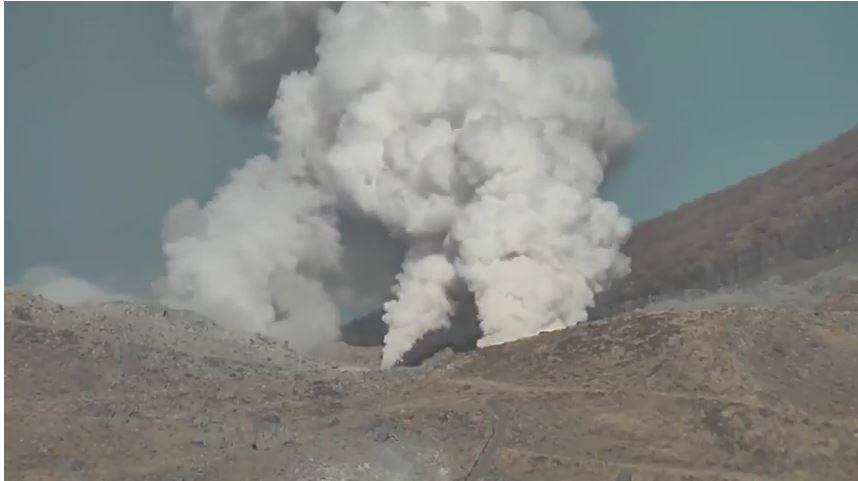
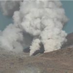
EBINO, Miyazaki Prefecture – Mount Ioyama, a volcano in the Kirishima mountain range, erupted at 15:39. April 19 for the first time in 250 years, emitting a greyish smoke in the air.
The Japanese Meteorological Agency has raised the Level 3 alert level on all 5 steps of the ladder, to prevent mountain access of 1,317 meters, warning against falling rocks and pyroclastic flows from volcano within a radius of 2 kilometers.
The alert level before the recent eruption was level 2, in which access to the area around volcanic craters was prohibited.
The Kirishima Range straddles the Miyazaki and Kagoshima prefectures on the main island of Kyushu.
The eruption of Mount Ioyama is the latest in a series of volcanic eruptions in this mountain range.
The last time the Mount Ioyama eruption was recorded was in 1768, according to the agency’s Fukuoka regional headquarters.
The agency raised the alert level to 2 in February, citing volcanic activity.
This is the first time the agency has raised the alert level to 3 for the mountain.
Mount Shinmoedake, also part of the volcanic zone, erupted in October for the first time in six years and has been active since then with occasional eruptions.
Source : Asahi Simbun
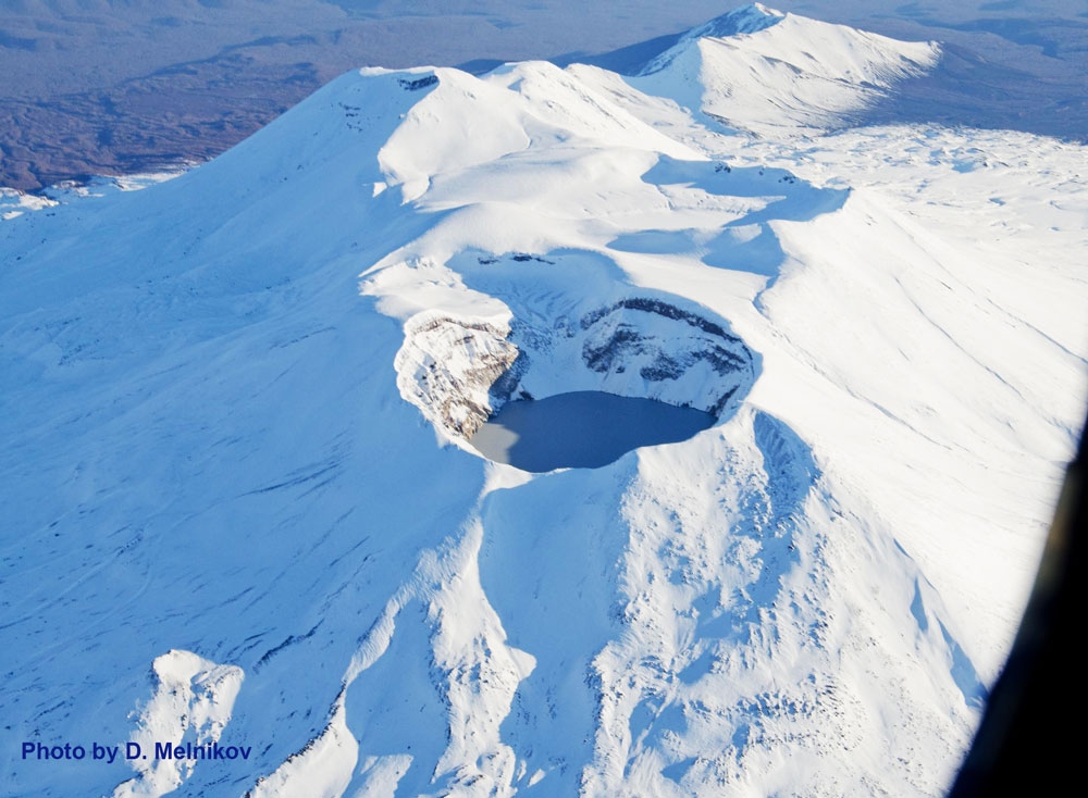
Maly Semyachik, Kamchatka :
VOLCANO OBSERVATORY NOTICE FOR AVIATION (VONA).
Issued: April 20 , 2018 .
Volcano:Maly Semyachik (CAVW #300140)
Current aviation colour code:GREEN
Previous aviation colour code:yellow
Source:KVERT
Notice Number:2018-36
Volcano Location:N 54 deg 8 min E 159 deg 40 min
Area:Kamchatka, Russia
Summit Elevation:5116.8 ft (1560 m)
Volcanic Activity Summary:
An activity of the volcano increased in the second half of March, 2018. The ice that covered the lake into the volcano crater melted within 5-6 days, but an explosive activity of the volcano was not registered. Satellite data by KVERT shows a weak thermal anomaly over the volcano from 20 March till now. KVERT continues to monitor Maly Semyachik volcano.
An activity of the volcano continues. Gas-steam plumes could affect low-flying aircraft.
Volcanic cloud height:NO ASH CLOUD PRODUSED
Other volcanic cloud information: NO ASH CLOUD PRODUSED
Source : Kvert
Photo : D. Melnikov, IVS FEB RAS , 15/10/2012 .
Ibu , Indonesia :
VOLCANO OBSERVATORY NOTICE FOR AVIATION – VONA
Issued: April 19 , 2018.
Volcano: Ibu (268030)
Current Aviation Colour Code: ORANGE
Previous Aviation Colour Code: unassigned
Source: Ibu Volcano Observatory
Notice Number: 2018IBU01
Volcano Location: N 01 deg 29 min 17 sec E 127 deg 37 min 48 sec
Area: North Maluku, Indonesia
Summit Elevation: 4240 FT (1325 M)
Volcanic Activity Summary:
Eruption produced white-grey volcanic ash column at 21h37 UTC (06h37 local).
Volcanic Cloud Height:
Best estimate of ash-cloud top is around 6160 FT (1925 M) above sea level, may be higher than what can be observed clearly. Source of height data: ground observer.
Other Volcanic Cloud Information:
Ash cloud moving to south.
Remarks:
Seismic activity is characterized by explosion and rockfall earthquake.
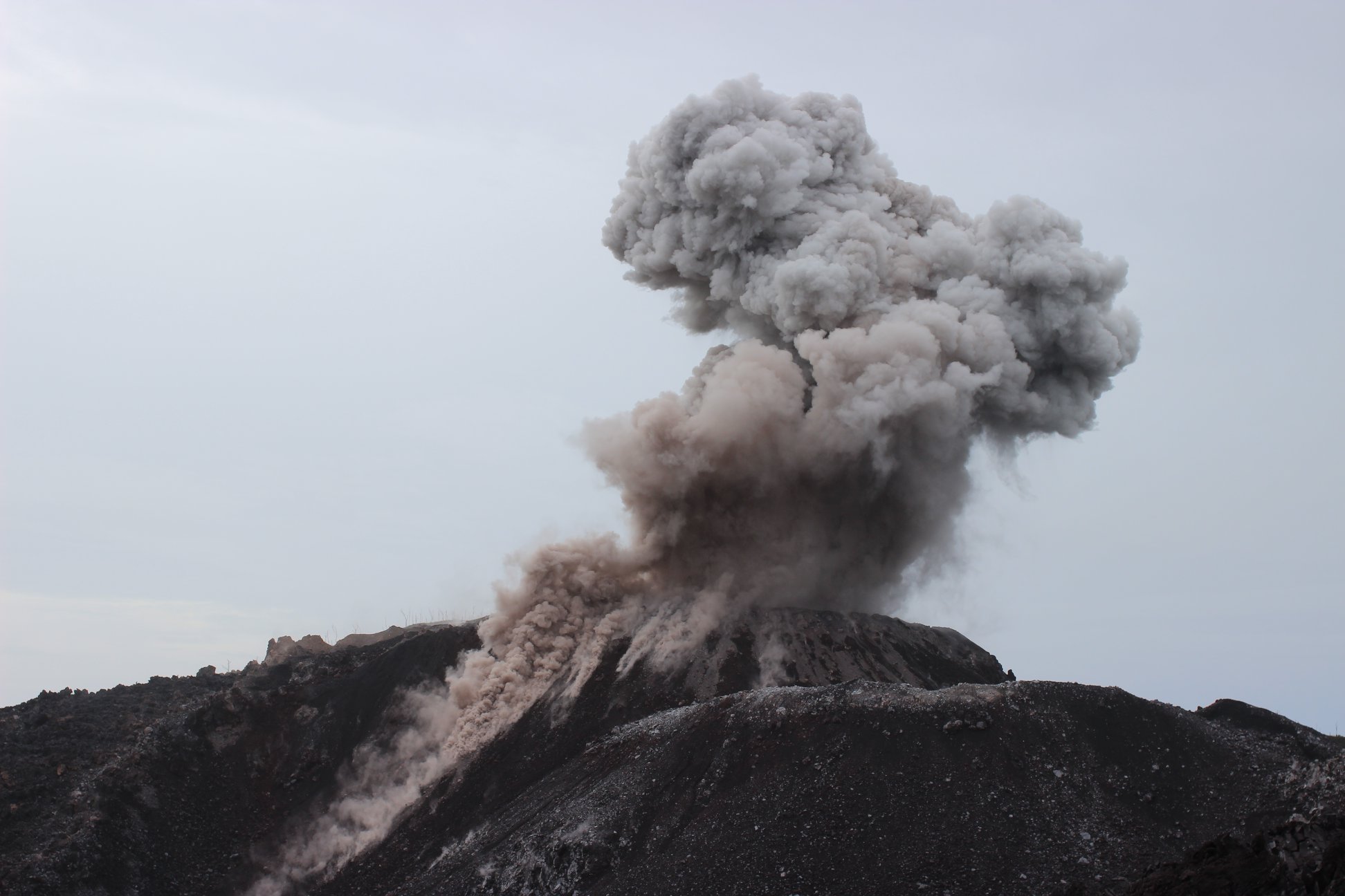
Activity Level at Level II (WASPADA). G. Ibu (1340 m above sea level) has been erupting since 2008.
Since yesterday until this morning visually the peak of the volcano can be observed until it is covered with fog. The explosion / emission column is observed from white to gray, with moderate intensity, and medium to low pressure, rising 300 to 600 m above the peak. The wind is blowing weakly to moderately to the south and west.
Through the seismographs dated April 19, 2018, it was recorded:
79 times earthquakes of eruption.
52 times Earthquake emission.
5 times Tremor Harmonic type events.
1 time Tectonic Earthquake
Recommendations:
Communities around G. Ibu and visitors / tourists should not climb and approach within 2 km, with a 3.5 km sectoral expansion towards the opening in the northern part of the active crater of G. Ibu.
Source : Magma , VSI .
Photo : Photovolcanica
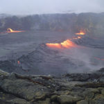
Pacaya , Guatemala :
SPECIAL VOLCANOLOGICAL BULLETIN BEPAC # 16-2018, Guatemala 19 April 2018, 10:00 hours (local time).
VOLCAN PACAYA, effusive activity (1402-11)
Type of activity: Strombolian
Morphology: Composite Stratovolcan
Location: 14 ° 22’50˝Latitude N; 90 ° 36’00˝Longitude W.
Altitude: 2,552msnm.
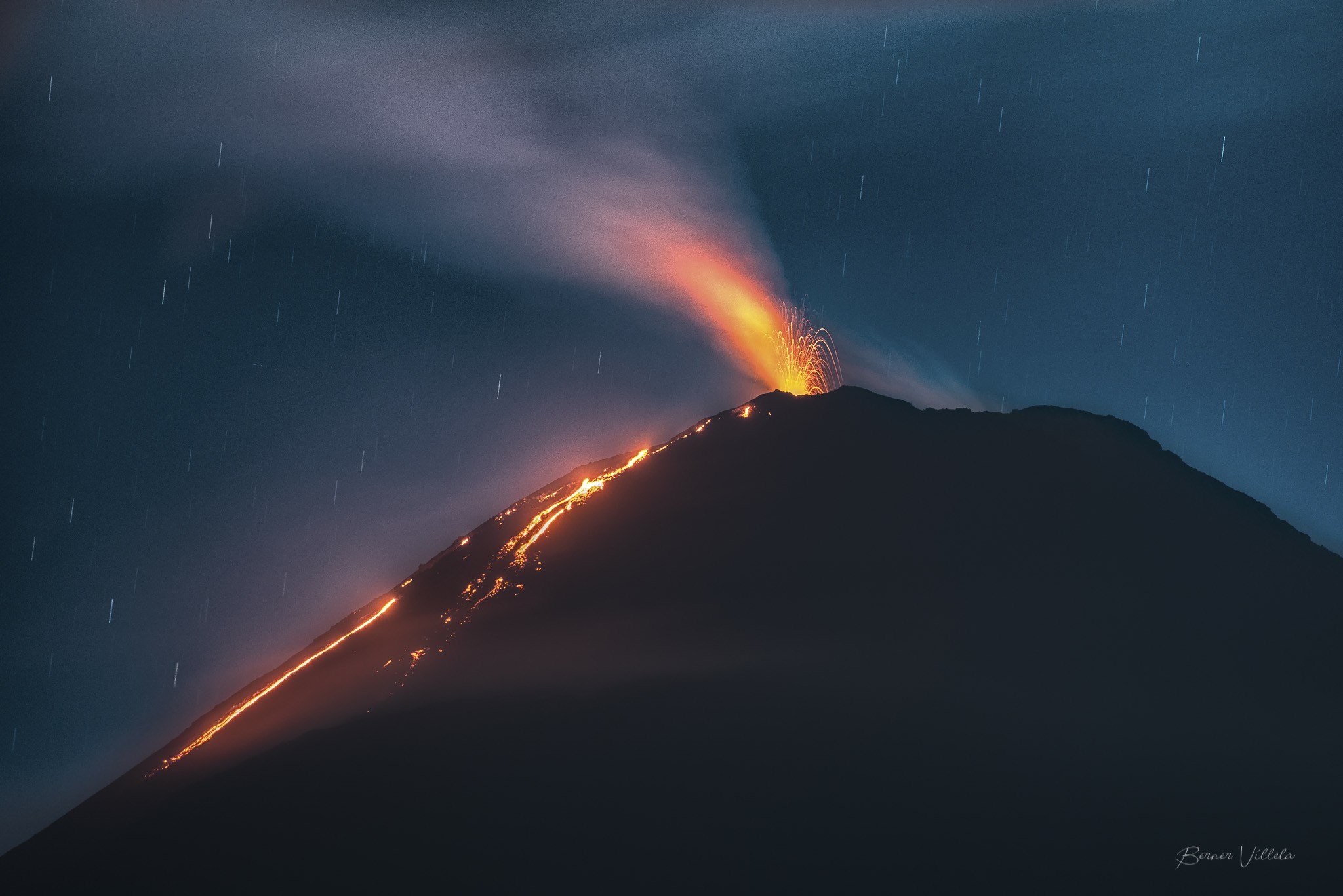
In recent days, the activity of the Pacaya volcano, presented a state with more and more lava effusions, which yesterday generated four lava flows on the southwest, west and northwest flanks with lengths from 200 to 500 meters, accompanied by constant avalanches of blocks. This activity is also accompanied by explosions in the Mackenney crater, 40 to 50 meters, with no ash emissions, but this expulsion of volcanic material, continues the construction of the cone of slag inside the crater.
This Strombolian activity is normal on a volcano such as the Pacaya, however there is a probability of generating more lava flows, from the crater or cracks on the cone. It is therefore recommended not to stay in areas near the cone, because of constant avalanches of blocks, which descend from the crater, which reach the base of it. Do not allow people to ascend to the crater, as this activity can cause explosions and high altitude rock throwing.
Source : Insivumeh
Photo : B Villela.


No comment yet, add your voice below!