
April 06 , 2018.
Piton de la Fournaise , La Réunion :
Activity Bulletin from Thursday, April 5, 2018 at 3:15 pm (local time)
Seismicity
The seismicity recorded under the Piton de la Fournaise has decreased in the last 24 hours with:
12 superficial volcano-tectonic earthquakes recorded on 05 April between 00h and 15h (local time),
No deep earthquake has been recorded today,
No earthquakes under north-northeast flank have been recorded today,
Landslides at the Nez Coupe de Sainte Rose are always saved (11 events between 00h and 15h local time).
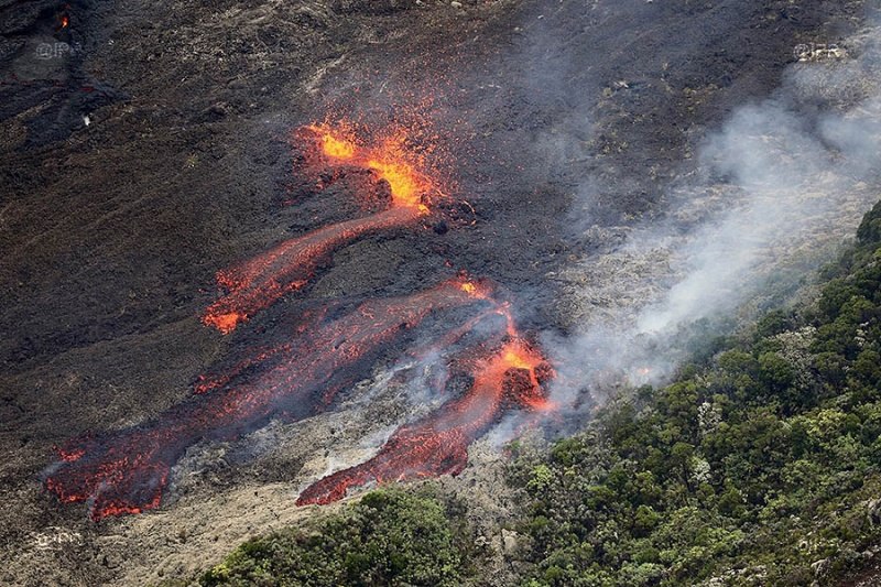
Deformation
No major deformation of the building is recorded.
Geochemistry of gases
The levels of H2S and SO2 in the atmosphere at the level of the summit zone are below the detection limit.
Source : OVPF
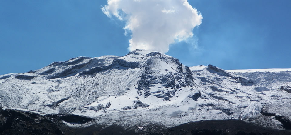
Nevado del Ruiz , Colombiea :
Subject: Bulletin of activity of the Nevado del Ruiz volcano.
The level of activity continues at the level: Yellow activity level or (III): changes in the behavior of volcanic activity.
With regard to monitoring the activity of the Nevado del Ruiz volcano, the COLOMBIAN GEOLOGICAL SERVICE informs that:
The seismicity caused by the fracturing of the rocks that make up the volcano, has shown a significant increase in the number of events and similar levels in the released seismic energy, compared with the previous week. This highlights a seismic increase recorded on April 2, located in the southwest sector of the volcano (about 5.2 km from the crater Arenas), at depths between 3.5 and 5.3 km. The maximum magnitude recorded during the week was 1.6 ML (Local Magnitude) corresponding to the earthquake recorded at 05:19 (local time) on April 2, located southwest of Arenas Crater, at a depth of 4, 1 km. The other active sources during the week were the Southwest, Northeast, South and Southeast sources of the volcanic structure, and to a lesser extent in the Arenas crater, at depths between 0.9 and 8.0 km.
The seismic activity associated with the dynamics of the fluids within the channels of the volcanic structure showed similar levels in the number of registered earthquakes and in the released seismic energy, compared to the previous week. This type of activity is characterized mainly by the occurrence of multiple fluid earthquakes, long periods and very long periods, as well as tremor impulses. The earthquakes were located mainly in the vicinity of the crater of Arenas.
Volcanic deformation measured from electronic inclinometers, Global Navigation Satellite System (GNSS) stations and radar images shows stability behavior without recording significant deformation processes of the volcanic structure.
The volcano continues to emit water vapor and gases into the atmosphere, among which the sulfur dioxide (SO2) is distinguished, as evidenced by the values obtained by the SCANDOAS stations installed on the volcano and the analysis satellite images. In tracking the information provided by the MIROVA and NASA FIRMS portals, several thermal anomalies have been identified near the Arenas crater.
The column of gas and steam reached a maximum height of 1650 m measured on the summit of the volcano, April 2. The direction of column dispersion was governed by the direction of the wind in the area, which had a predominant direction to the northwest, from the Arenas crater.
The Nevado del Ruiz volcano continues at the level of yellow activity.
Source : SGC.
Cleveland , Aleutian Islands :
52°49’20 » N 169°56’42 » W,
Summit Elevation 5676 ft (1730 m)
Current Volcano Alert Level: WATCH
Current Aviation Color Code: ORANGE
Following the explosion yesterday, a small ash emission was detected in local seismic data and in satellite data at 19:06 UTC / 11:06 AKST. Strongly elevated surface temperatures at the summit of the volcano have also been observed in multiple satellite images.
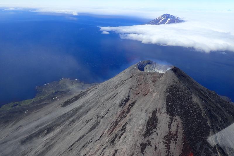
Cleveland volcano is monitored by only two seismic stations, which restricts AVO’s ability to detect precursory unrest that may lead to an explosive eruption. Rapid detection of an ash-producing eruption may be possible using a combination of seismic, infrasound, lightning, and satellite data.
Source : AVO
Photo : July 25, 2016 12:00 AM , Werner, Cindy
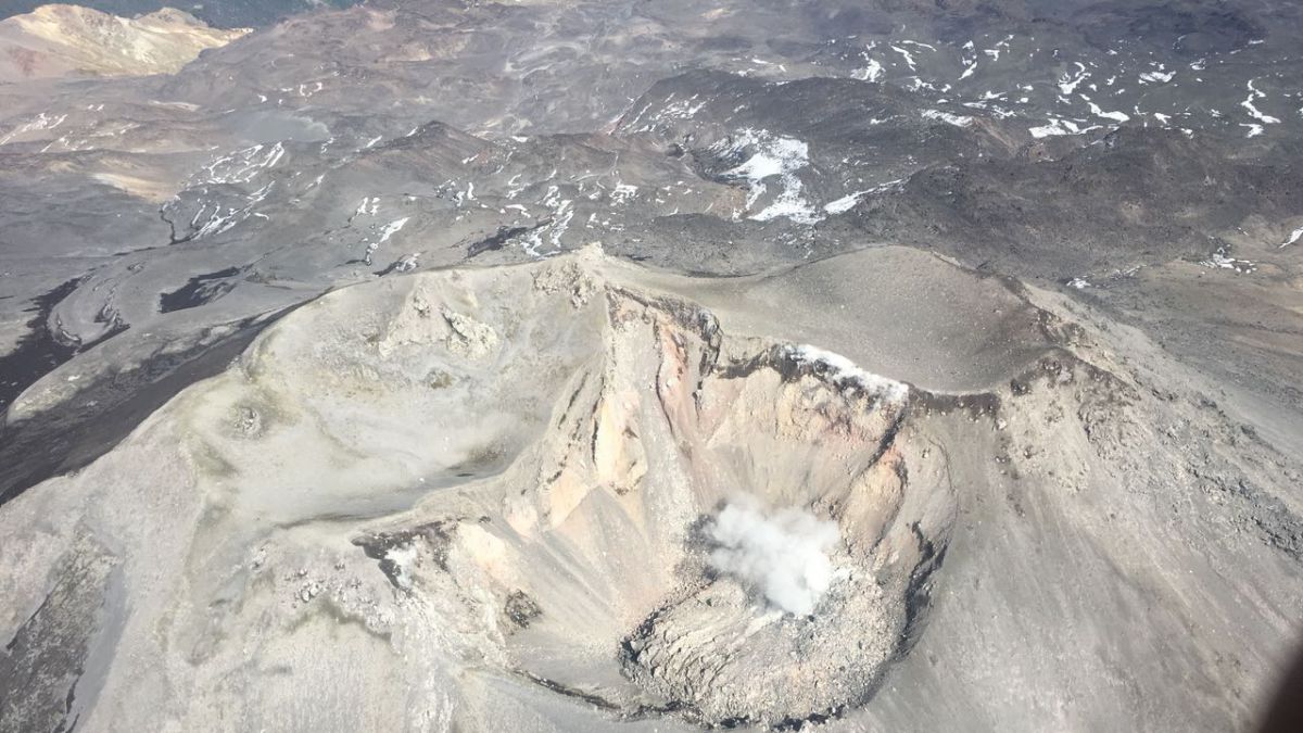
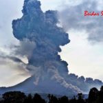
Maly Semyachik , Kamchatka :
54.14 N, 159.67 E;
Elevation 5117 ft (1560 m)
Aviation Colour Code is YELLOW
An activity of the volcano increased. Ash explosions up to 16,400-23,000 ft (5-7 km) a.s.l. could occur at any time. Ongoing activity could affect low-flying aircraft.
An activity of the volcano continues. Satellite data by KVERT showed a thermal anomaly over the volcano on 29 March and 01-02 April, the volcano was obscured by clouds in the other days of week.

Maly Semyachik is a compound stratovolcano located in a 10-km-wide caldera within the 15 x 20 km mid-Pleistocene Stena-Soboliny caldera. Following construction during the late Pleistocene of the Paleo-Semiachik volcano beginning about 20,000 years before present (BP), activity migrated to the SW, forming Meso-Semiachik (about 11,000-9000 BP) and Ceno-Semiachik (about 8000 BP to the present). An initial stage lasting about 3500 years was dominantly explosive, constructing the present cone. A second stage beginning about 4400 years ago was marked by alternating constructive and destructive processes during which the volcano was destroyed by major explosions and then reconstructed. A crater lake fills the historically active Troitsky Crater, which formed during a large explosive eruption about 400 years ago.
Source : Kvert.
Photo : 15/10/2012 , D. Melnikov, IVS FEB RAS
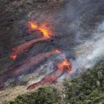
Nevados de Chillan , Chile :
During this period, 44 events classified as volcano-tectonic events (VT), processes related to the fracturing of rigid materials, with local maximum amplitudes (ML) of M2.6, were recorded. The strongest earthquake was located 4.7 km southeast (SE) of the active crater at a depth of 4.0 km.
Similarly, 3874 earthquakes associated with fluid dynamics within the volcano were recorded, of which 2645 were classified as long period type (LP) events with a reduced maximum displacement value ( DRC) of 570 cm2 associated with an explosive event whose column reached 2000 m. altitude. This earthquake is the one that released the most seismic energy according to our historical records since the beginning of this eruptive process. Finally, 1229 tremor type earthquakes (TR) were recorded with harmonic characteristics in the frequency spectrum, the largest with a reduced displacement of 80 cm, considered as high intensity values.
Between March 16 and 31, there were a total of 765 explosions associated mainly with magmatic gases. From the 24th, a reduction of the deployed seismic energy was initiated, which culminated with the explosion of 30 and 31, recording a maximum acoustic pressure of 14 Pa reduced to 1 km distance. This explosion recorded the highest sound pressure since the appearance of the dome.
The images obtained through the cameras installed on the volcanic complex showed mainly gas emissions associated with the explosions, coming from the craters currently active with column heights lower than 2000 m compared to the level of the crater. In addition, at night, the cameras recorded sporadic glow associated with some explosions and / or increased gas emissions from the active crater.
On April 03, an overflight was made during which white and gray energy pulses, mainly water vapor and low pyroclast contents were observed, through the central crack, as well as a constant degassing of other sectors. Comparatively, the Gil Cruz dome has increased in volume since the last sighting (March 11th). A subsidence of its central part was observed. The maximum temperature recorded on the dome was 670 ° C.
From the geodetic data, no significant deformation of the volcanic building was observed.
Sulfur dioxide (SO2) emissions from the Differential Absorption Spectrometry (DOAS) equipment at the Chillán station, located 2.6 km southeast of the active crater, showed an average monthly value of 164. ± 31 t / d and a maximum daily value of 831 t / d on March 23rd. S02 emissions are at low levels for this volcano, consistent with the presence of degassed magma.
A thermal warning in the zone associated with the volcanic complex with a 1 MW volcanic power (VRP), according to the data processed by mean infrared observation of volcanic activity (Mirova), on 31 March has been reported (http: //www.mirovaweb.it/).
In this context, it is possible that the development of volcanic seismicity and its characteristics as well as other monitoring parameters do not present precursor signals or that these occur only a few minutes before the destruction of the dome. In all cases, 24/7 permanent monitoring is continued with permanent aerial visual observations to monitor the growth and evolution of the dome, paying attention to any changes indicating its possible destruction and subsequent development. a major eruption.
For the above, the volcanic technical alert is maintained at:
LEVEL Orange: Probable major eruption in days or weeks
Source : Sernageomin


No comment yet, add your voice below!