January 12 , 2018 .
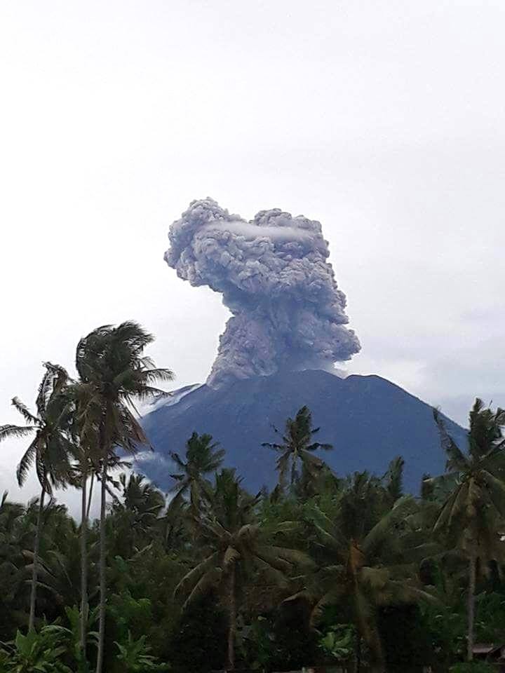
Agung , Indonesia :
VOLCANO OBSERVATORY NOTICE FOR AVIATION – VONA.
Issued: January 11 , 2018.
Volcano: Agung (264020)
Current Aviation Colour Code: ORANGE
Previous Aviation Colour Code: orange
Source: Agung Volcano Observatory
Notice Number: 2018AGU05
Volcano Location: S 08 deg 20 min 31 sec E 115 deg 30 min 29 sec
Area: Bali, Indonesia
Summit Elevation: 10054 FT (3142 M)
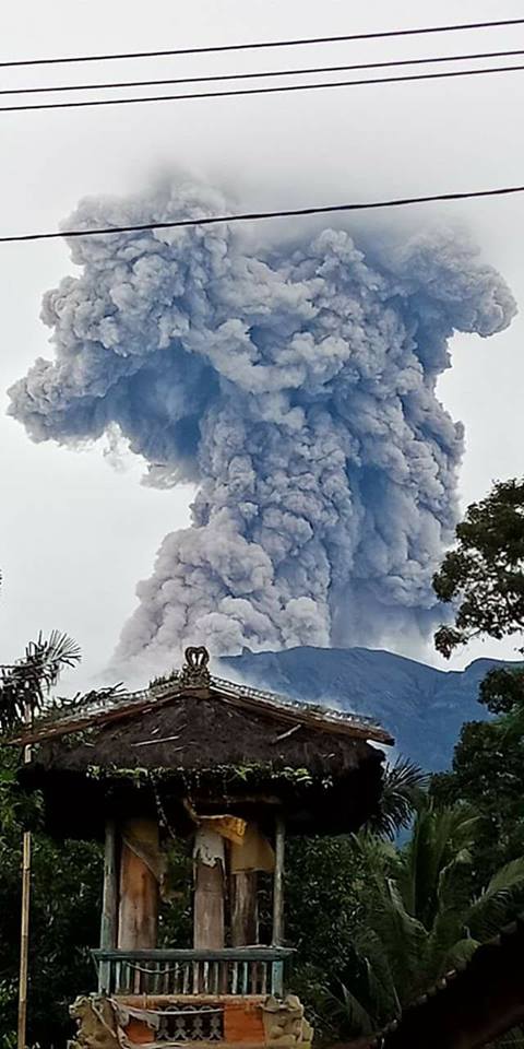
Volcanic Activity Summary:
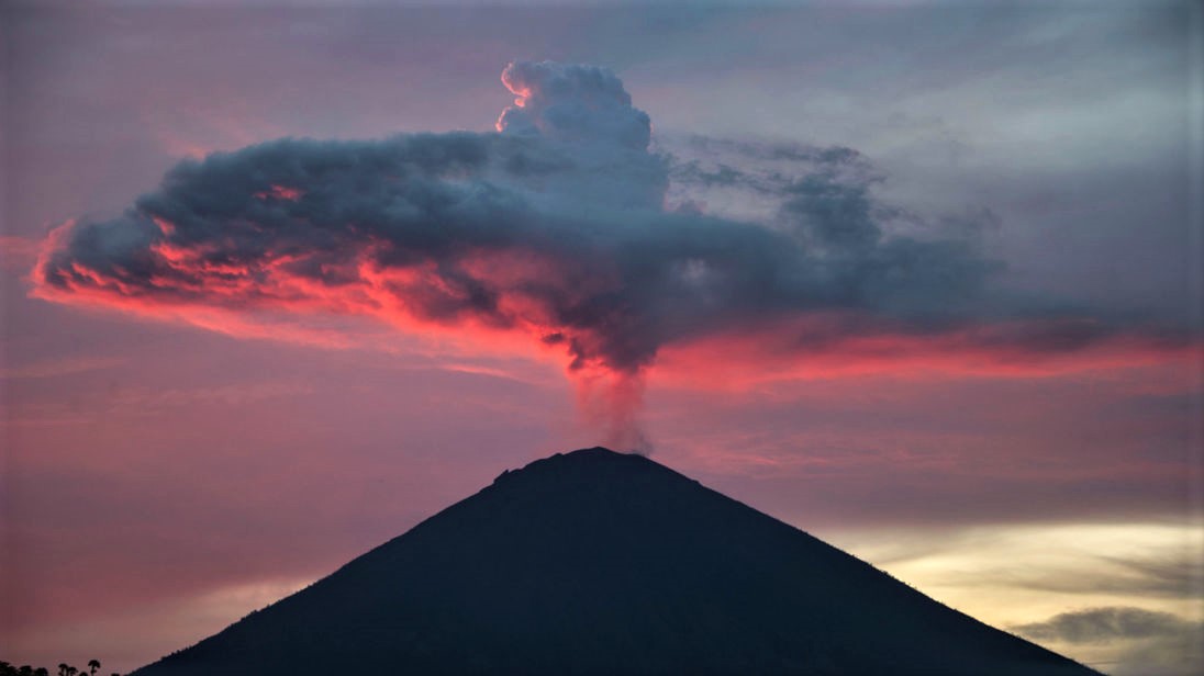
Eruption with volcanic ash cloud at 09h54 UTC ( 17h54 local). Eruption and ash emission is not continuing
Volcanic Cloud Height:
Best estimate of ash-cloud top is around 18054 FT (5642 M) above sea level, may be higher than what can be observed clearly. Source of height data: ground observer.
Other Volcanic Cloud Information:
Ash-cloud moving to North – Northeast
Remarks:
Seismic activity is dominated by shallow volcanic earthquake events
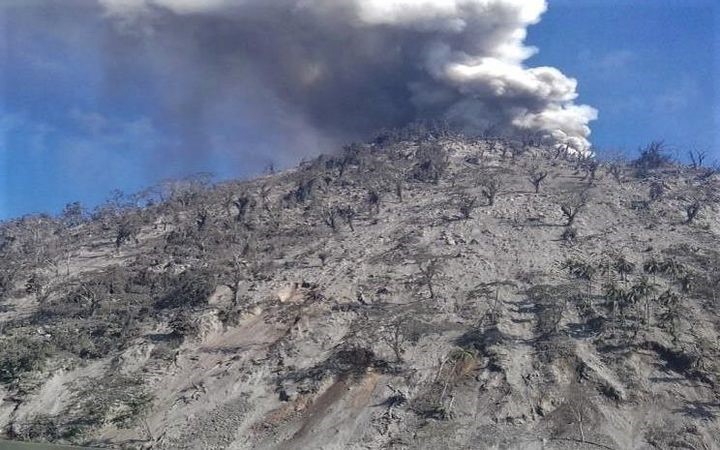
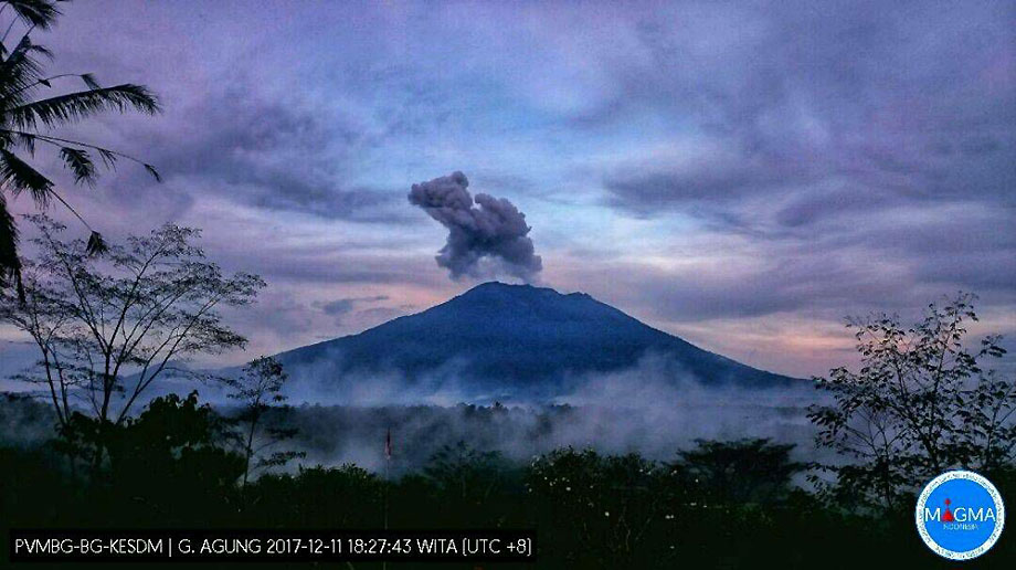
On the basis of the results of the visual and instrumental data analysis and considering the potential threats of danger, on November 27, 2017 at 06:00, the status of G. Agung was raised from Level III (SIAGA) to Level IV (AWAS) . Since yesterday and until today visually the volcano is usually covered with fog. Gray, white, medium-pressure gray ash has a height of about 100 to 2000 mm above the summit and slopes to the south and southwest. At night, the glow of the incandescent lava is not observed.
Seismograph records as of January 11, 2018 noted:
1 shallow volcanic earthquakes (VB)
10 deep volcanic earthquakes (VA)
19 earthquakes emission.
No distant tectonic earthquake (TL).
No low frequency earthquake (LF)
A continuous tremor with an amplitude of 1 to 27 mm and a dominant value of 1 mm.
As of January 12, 2018 (00:00 to 18:00) it has been registered:
3 emission earthquakes
2 shallow volcanic earthquakes (VB)
2 deep volcanic earthquakes (VA)
1 local tectonic earthquake (TL)
1 Low frequency earthquake (LF)
A continuous tremor with an amplitude of 1 to 3 mm and a dominant value of 1 mm.
Recommendations:
The communities around G. Agung and mountaineers / visitors / tourists should not climb, climb or do any activity in the danger zone around the G. Agung crater area and in all areas within 6 km from the crater of G. Agung. The estimated area risks are dynamic and continuously assessed and can be modified at any time based on the most recent observational data from G. Agung.
Level IV (AWAS) is only valid for a 6 km radius as mentioned above. Outside the activity area, everything can work like NORMAL and always SAFE.
Source : Magma , VSI.
Photo : Peter Rendez Vous , BNPB.
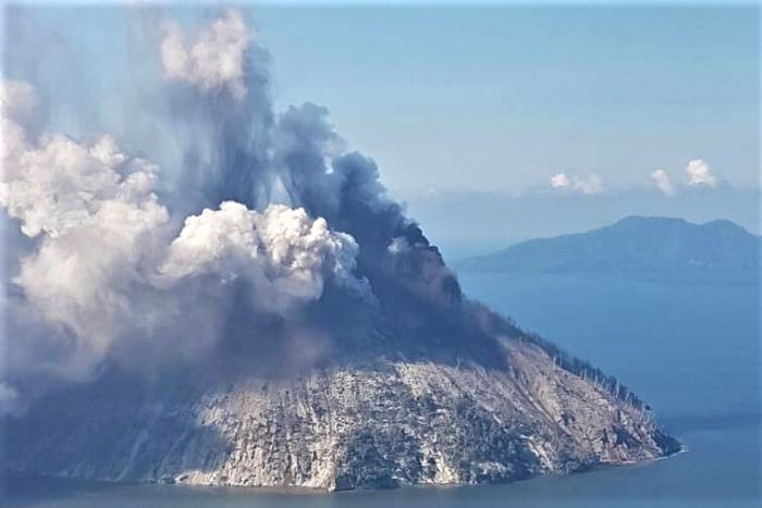
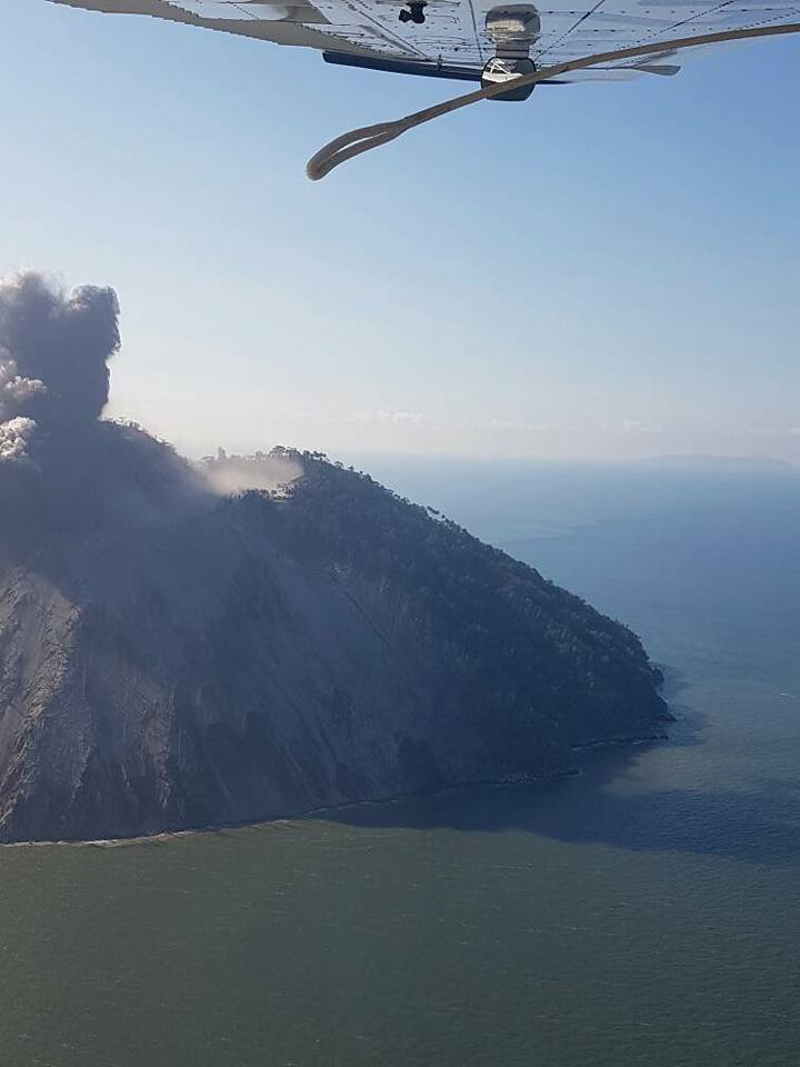
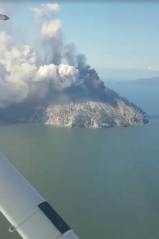
Kadovar , Papua New Guinea :
Sulfur Dioxide observed on Kadovar.
There is now a significant Sulphur Dioxide gas being observed on Kadovar.
Visual observations from a Rabaul Volcano Observatory (RVO) observer on a boat, indicates the whole island is still receiving significant ash fall.
In a situational update from RVO say the fracture running down the summit dome to the coast has apparently widened, with vigorous steaming occurring from it.
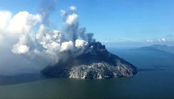
While there is currently no ground based monitoring, it is anticipated that seismometers will be deployed by Sunday.
RVO said that the evacuated population currently on Ruprup Island is to be moved to the mainland, due both the risk from eruption and the logistics of supplying them.
Ruprup is also another volcanic island, there are hot springs on the island that continues to heat up, and the sulfur of neighboring Kadovar has contaminated the western part of Ruprup Island.
Source : Postcourrier.com.pg
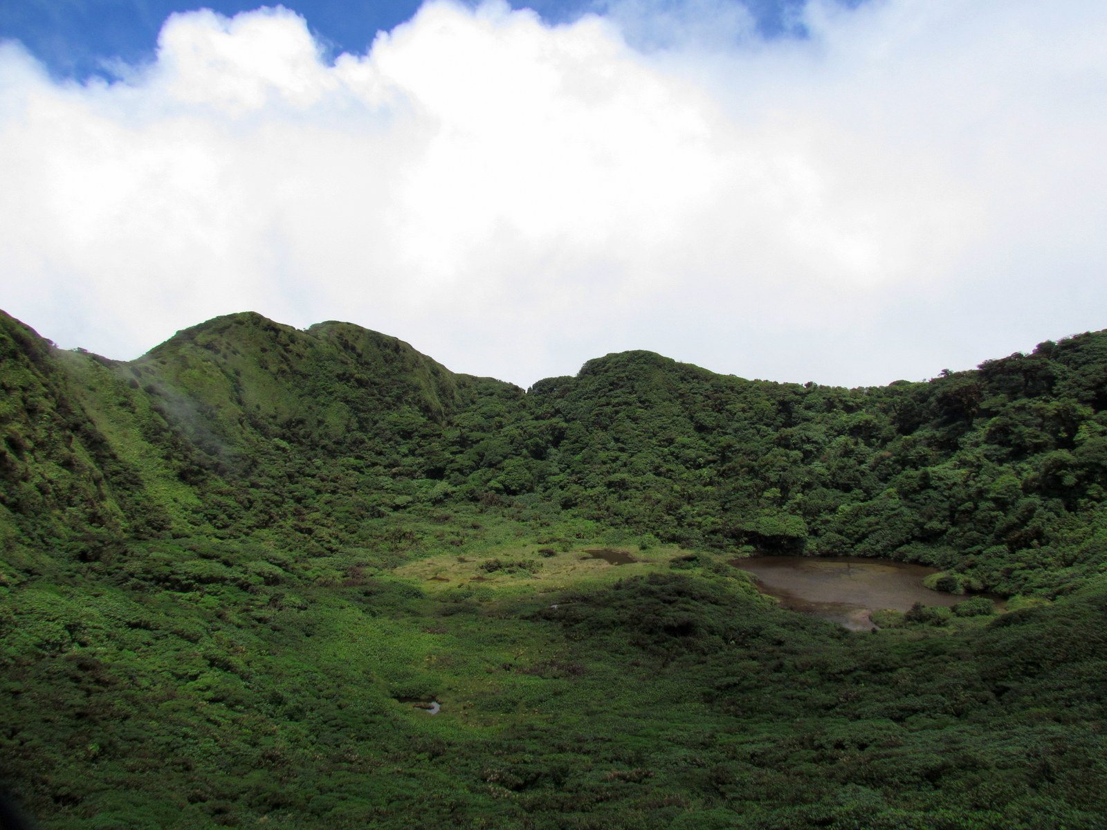
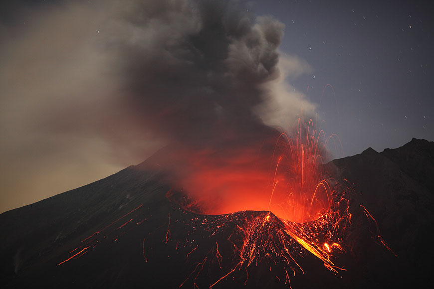
Tenorio , Costa Rica :
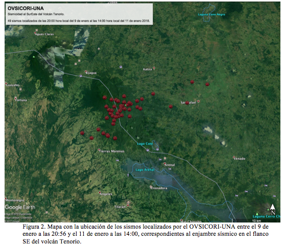
Preliminary report on the seismic swarm on the south-east flank of Tenorio volcano. OVSICORI-UNA · Friday, January 12, 2018.
With the arrival of the surface waves of the earthquake of January 9, 2018, magnitude Mw = 7.6, which occurred at 8:51 pm in the Swan Fault, in northern Honduras, a seismic swarm has soared on the southern flank. East of Tenorio Volcano (Figure 1). Two strong events of more than 4 degrees of magnitude occurred at 20:56 and 20:58 and since then, until 14:00 on January 11, there have been about 100 earthquakes in this region. A total of 50 earthquakes have been possible to locate, by the seismological network of the Volcanological and Seismological Observatory of Costa Rica (OVSICORI) of the National University, of which more than 10 have been felt by the population. The villagers of Tierras Morenas, Bijagua Katira and San Rafael de Guatuso are the ones who felt most of the events. The greatest magnitude greater than 4 degrees, was felt in Tilarán, Cañas, Bagaces, Monteverde, San Carlos Fortuna and even in the central valley.
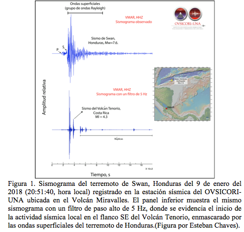
Figure 2 shows a map with the location of the 50 events occurring from 9 January at 20:54 until 11 January at 14:00. This swarm has earthquakes with depths less than 25 km and amplitudes up to 5 degrees. The 5 most important events in terms of size are those that took place on January 9 at 20:56 and 20:58 and on January 11 at 10:00, 11:03 and 13:57.
OVSICORI-UNA will continue to monitor this seismic activity for the study of its evolution. Seismic swarms decrease in number and magnitude of earthquakes with the passage of time. It is not known how long this activity can last in the region of Tenorio volcano, but as always it is necessary to keep calm.
Source : Marino Protti et Floribeth Vega. OVSICORI-UNA
Photo : Costa Rica Guide.
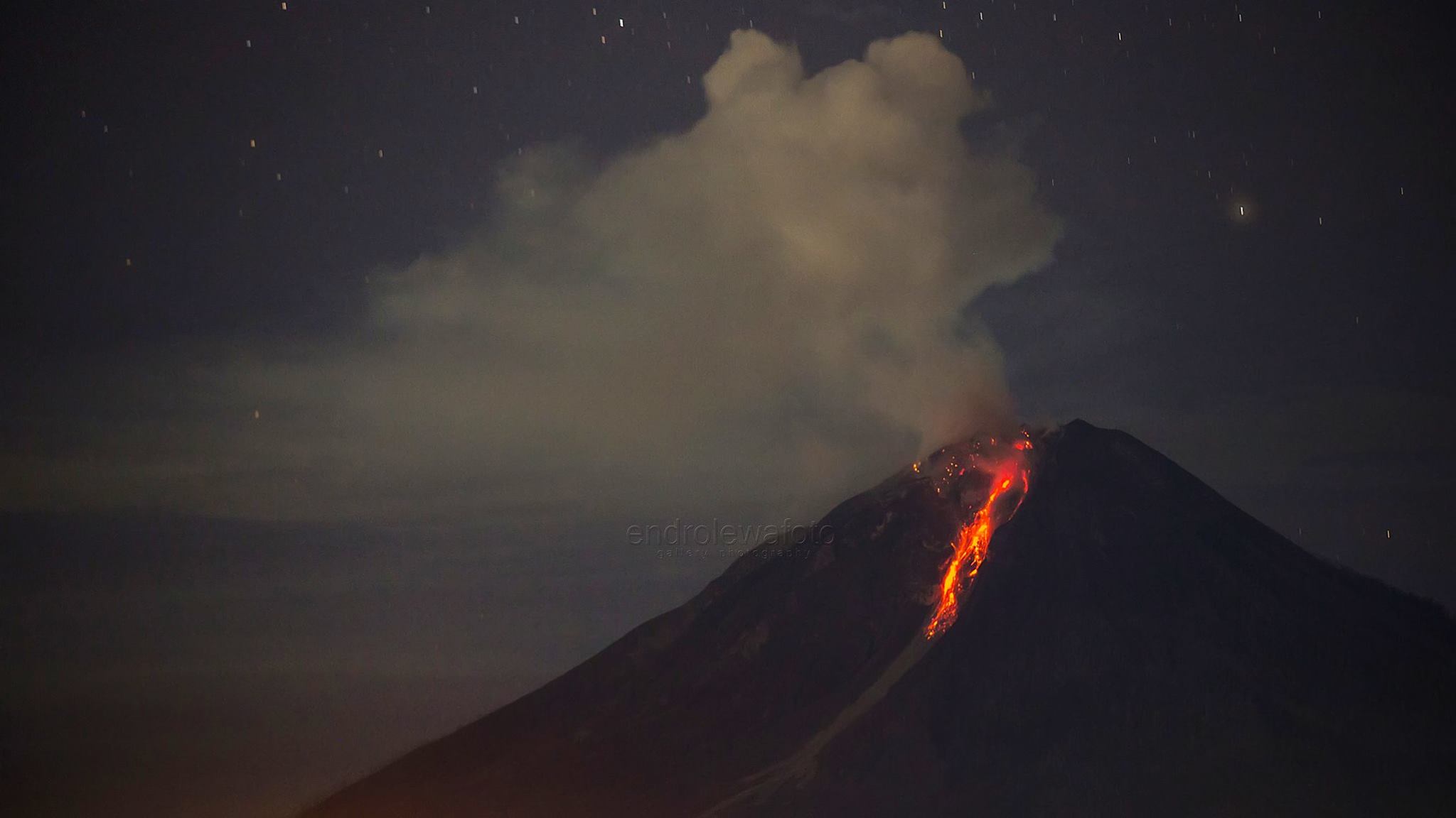
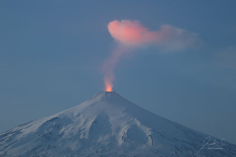
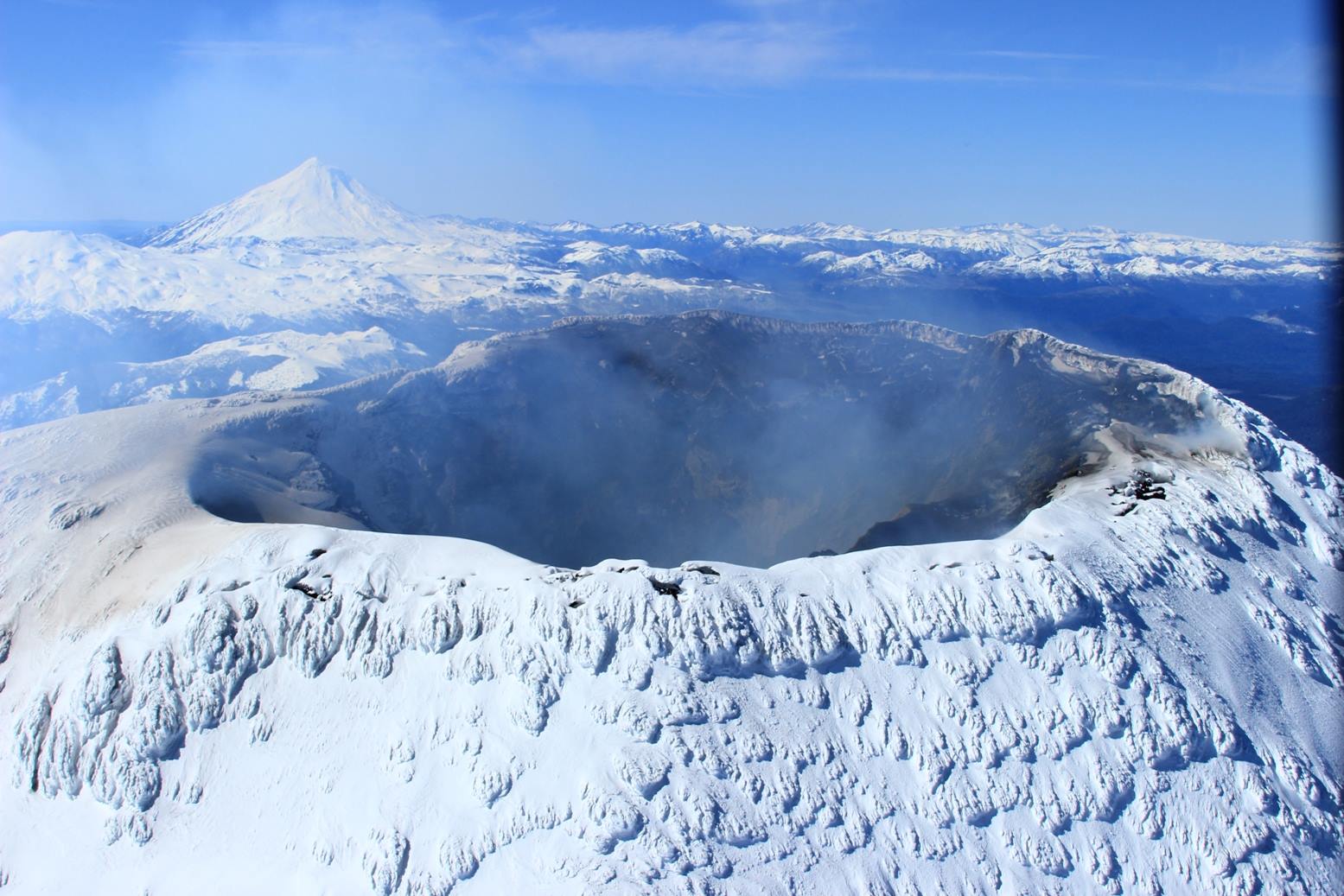
Aira ( Sakurajima ) , Kyushu , Japan :
31.593°N, 130.657°E
Elevation 1117 m
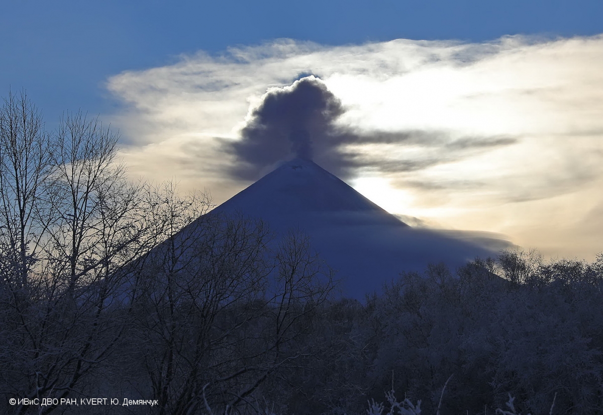
JMA reported that very small events occurred at Minamidake crater (at Aira Caldera’s Sakurajima volcano) during 28 December 2017-4 January 2018. An event at 17h44 on 6 January ejected material from Minamidake Crater as far as 900 m from the crater. An event at Showa Crater on 8 January at 03h59 ejected material as far as 800 m. The Alert Level remained at 3 (on a 5-level scale).
The Aira caldera in the northern half of Kagoshima Bay contains the post-caldera Sakurajima volcano, one of Japan’s most active. Eruption of the voluminous Ito pyroclastic flow accompanied formation of the 17 x 23 km caldera about 22,000 years ago. The smaller Wakamiko caldera was formed during the early Holocene in the NE corner of the Aira caldera, along with several post-caldera cones. The construction of Sakurajima began about 13,000 years ago on the southern rim of Aira caldera and built an island that was finally joined to the Osumi Peninsula during the major explosive and effusive eruption of 1914. Activity at the Kitadake summit cone ended about 4850 years ago, after which eruptions took place at Minamidake. Frequent historical eruptions, recorded since the 8th century, have deposited ash on Kagoshima, one of Kyushu’s largest cities, located across Kagoshima Bay only 8 km from the summit. The largest historical eruption took place during 1471-76.
Source: Agence météorologique japonaise (JMA) , GVP.
Photo : M Rietze.